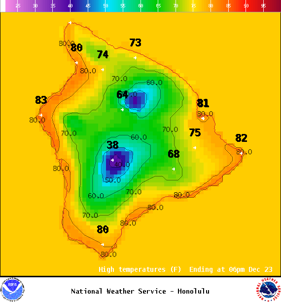
**Click directly on the images below to make them larger. Charts include: Big Island high/low forecasted temperatures, projected winds, chance of cloud cover, projected localized weather conditions, vog/SO2 forecast and expected wave heights.**
+
SWIPE LEFT OR RIGHT
ARTICLE CONTINUES BELOW AD
ARTICLE CONTINUES BELOW AD
Looking Ahead
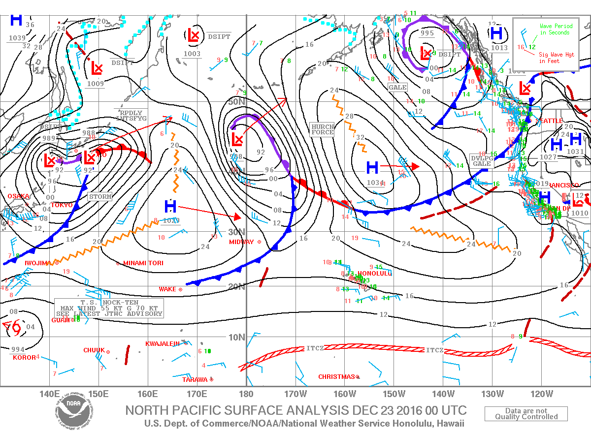
Trade winds will continue over Christmas weekend and into next week, with showers favoring windward and mauka areas, especially overnights and into the early morning. Wind speeds could drop off a bit on Friday but will strengthen again over the weekend.
ARTICLE CONTINUES BELOW AD
Today
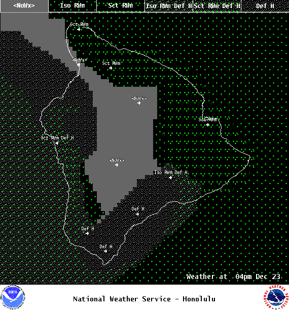
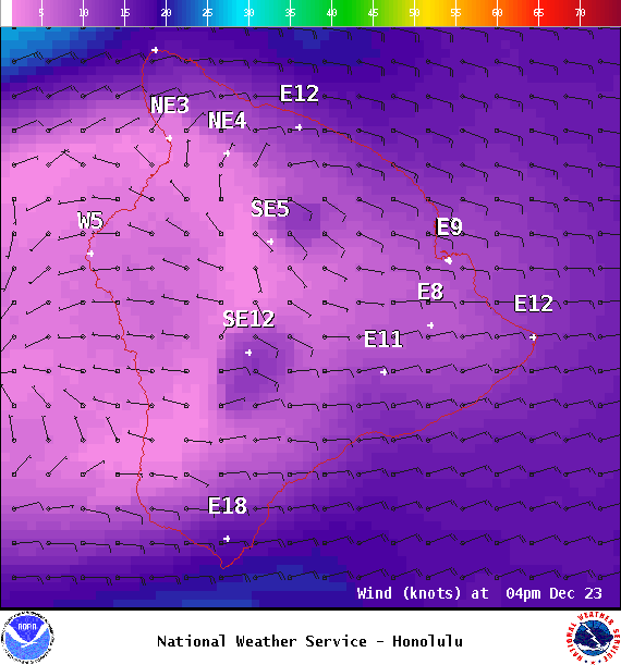
Partly sunny skies are expected today with scattered showers for windward and mauka spots along the Hilo side. Hazy for the Kona side with mostly clear skies in the morning and isolated showers in the afternoon. High temperatures from 79° to 84°. Winds will be east around 15 to 20 mph.
UV index at 6 (“high” exposure level)
ARTICLE CONTINUES BELOW AD
Tonight
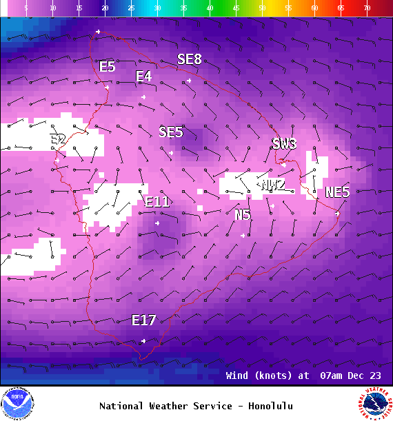
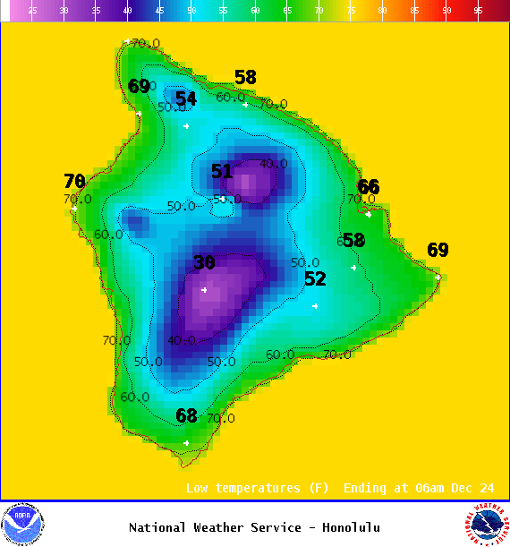
East winds are forecast 10 to 20 mph. Mostly cloudy skies for windward spots with showers likely and isolated evening showers for the Kona side with clearing as the night goes on. Low temperatures from 67° to 72°.
This comments section is a public community forum for the purpose of free expression. Although Big Island Now encourages respectful communication only, some content may be considered offensive. Please view at your own discretion. View Comments