**A breakdown of expected conditions specific to the Big Island is presented below in graphical form. High and low temperatures, swell, percent chance of clouds / rain and wind conditions are each depicted. All graphics are provided by the National Weather Service in Honolulu.**
Alerts
There are no alerts posted for Hawai’i County at this time.
Map of expected high temperatures for Friday, October 24, 2014 / Image: NOAA / NWS
Today
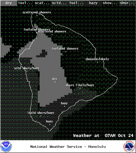
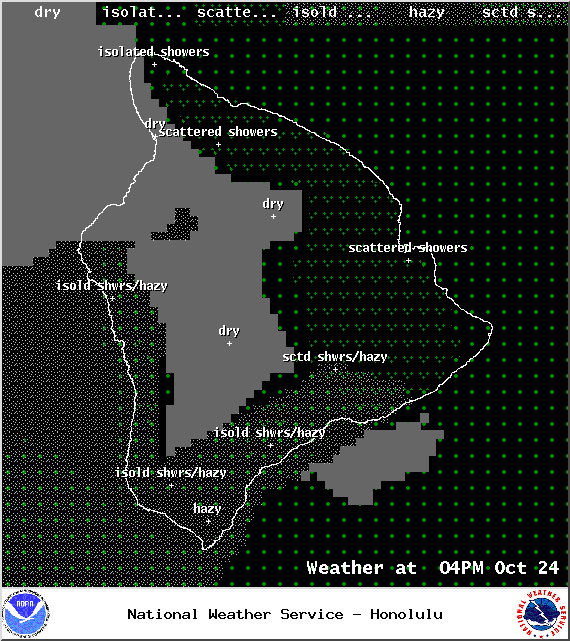
We expect cloudy skies and scattered showers in the morning for windward and mauka areas. Some of those showers could push into leeward spots every now and then. In the afternoon, daytime heating is expected to bring some cloud cover and the possibility of isolated showers to the Kona side. High temperatures should fall in the range of 82° to 87° with cooler temperatures at higher elevations. Trade winds from 10 to 20 mph are expected.
Sunrise: 6:18 a.m.
Sunset: 5:50 p.m.
UV index at 8 (“very high” exposure level)
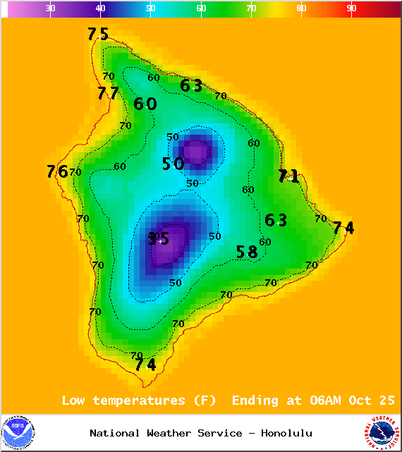
Map of expected overnight low temperatures for Friday, October 24, 2014 / Image: NOAA / NWS
ARTICLE CONTINUES BELOW AD
ARTICLE CONTINUES BELOW AD
Tonight
Mostly cloudy skies are expected for windward and mauka areas tonight. Leeward spots are forecasted to clear out as the evening land breeze take holds and pushes the cloud cover back out to sea. Low temperatures should fall in the range of 72° to 77° and winds are expected out of the east from 10 to 15 mph.
Looking Ahead
Ana is expected to merge with a north Pacific low on Saturday which will push our trade wind producing high farther away. That means we expect lighter east-southeast winds by Saturday afternoon and through early next week. Late each day, showers are likely to be more active than usual as a deep pocket of moisture comes into the area. It’s still far out, so confidence in this scenario is not high, but trade winds could make a return to the Aloha State by Wednesday or Thursday.
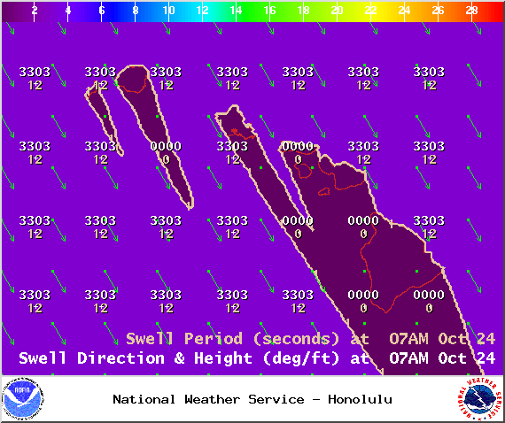
Swell map for Friday, October 24, 2014 / Image: NOAA / NWS
Surf and Seas
Our current north-northwest swell (320-360°) peaks and is expected to fade through the weekend. We expect surf heights in the knee to possibly head high range at the best northerly exposures. The west side should get ankle to possibly waist high waves on the sets. A small to moderate reinforcing north swell should arrive late Saturday, bringing shoulder to head high waves on the sets by sundown.
Our small south-southwest (200-190°) swell is lingering, offering knee to possibly waist high waves at our best exposed shores. This swell is expected to start fading Saturday, dropping down to trace amounts by the weekend. Another small boost is expected by mid-week, offering knee to waist high surf at best exposures.
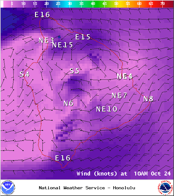
Map of expected wind conditions at 10am on Friday, October 24, 2014 / Image: NOAA / NWS
ARTICLE CONTINUES BELOW AD
If Ana continues on its current forecast track, its remnants are expected to merge with a storm to our north. If that happens we may see a swell generated from it early next week. Otherwise, Ana is not looking to be a big swell producer.
All shores will be below advisory levels with surf heights.
Keep in mind, surf heights are measured on the face of the wave from trough to crest. Heights vary from beach to beach, and at the same beach, from break to break.
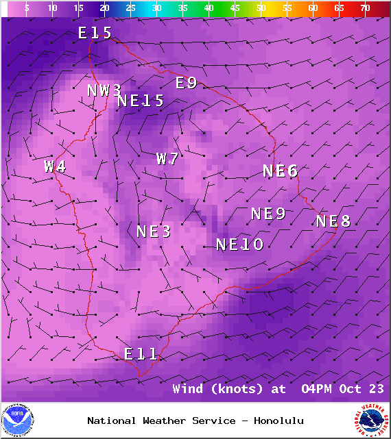
Map of expected weather conditions at 4pm on Friday, October 24, 2014 / Image: NOAA / NWS
ARTICLE CONTINUES BELOW AD
Almanac for Hilo Airport Maximum Temperature for today:
Normal 82°
Record 86° / Set in 1993 and tied in 1994 & 2003
Minimum Temperature for today:
Normal 68°
Record 62° / Set in 1980
Map of expected weather conditions at 7am on Friday, October 24, 2014 / Image: NOAA / NWS
Map of expected weather conditions at 4pm on Friday, October 24, 2014 / Image: NOAA / NWS
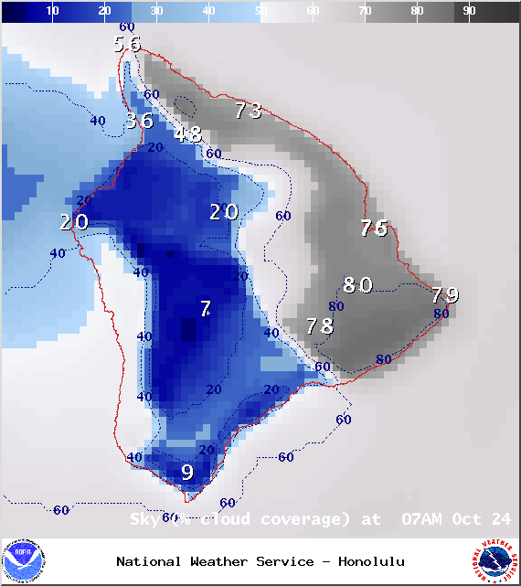
Map of expected cloud cover at 7am on Friday, October 24, 2014 / Image: NOAA / NWS
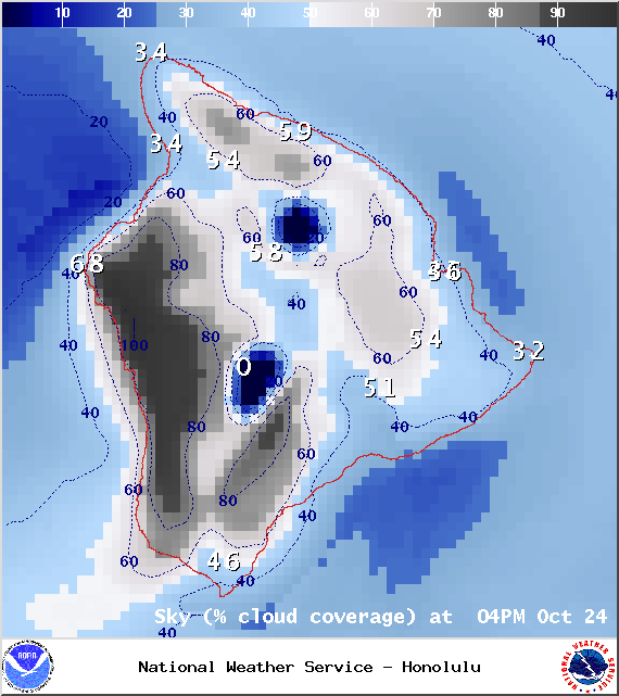
Map of expected cloud cover at 4pm on Friday, October 24, 2014 / Image: NOAA / NWS
This comments section is a public community forum for the purpose of free expression. Although Big Island Now encourages respectful communication only, some content may be considered offensive. Please view at your own discretion. View Comments