Outlook through Friday January 18: A large northwest swell is on its way here. The current moderate northwest swell will hold through tonight, then rise to warning levels along the north and west facing shores on Saturday. Expect a High Surf Warning to be issued later today. This swell will peak Saturday night, then lower through Sunday with the surf falling to advisory levels by Sunday night. Advisory level surf will continue through the middle of next week for the north and west facing shores as a series of low pressure areas passes north of the islands. The east swell will continue to get smaller through the weekend, but bump up again the second half of next week as a front ushers in some breezy northeast winds. A small background south swell will persist through most of the period.
Surf heights are forecast heights of the face, or front, of waves. The surf forecast is based on the significant wave height, the average height of the one third largest waves, at the locations of the largest breakers. Some waves may be more than twice as high as the significant wave height. Expect to encounter rip currents in or near any surf zone.
North East
ampm
ARTICLE CONTINUES BELOW AD
ARTICLE CONTINUES BELOW AD
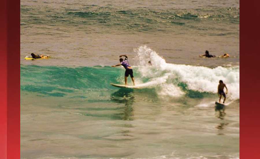
Surf: Shoulder to head high NNW ground swell for the morning with occasional 1-2′ overhead high sets. This drops in the afternoon with occasional head high sets.
Conditions: Sideshore texture/chop with SSE winds 10-15mph in the morning shifting SE 15-20mph in the afternoon.
North West
ampm
Surf: Knee to waist high WNW ground swell in the morning with occasional stomach high sets. This drops into the knee to thigh range for the afternoon.
ARTICLE CONTINUES BELOW AD
Conditions: Glassy in the early morning with S winds less than 5mph. Sideshore texture/chop conditions move in during the morning hours with the winds shifting SW 10-15mph.
West
ampm
Surf: Waist to stomach high WNW ground swell for the morning with occasional chest high sets. This drops a bit in the afternoon.
Conditions: Glassy in the morning with ESE winds less than 5mph. Semi glassy/semi bumpy conditions for the afternoon with the winds shifting to the WSW.
ARTICLE CONTINUES BELOW AD
South East
ampm
Surf: Waist high ESE short period wind swell.
Conditions: Semi glassy/semi bumpy in the morning with ENE winds less than 5mph. Bumpy/semi bumpy conditions for the afternoon with the winds shifting E 5-10mph.
Image: NOAA
Image: NOAA
Image: NOAA
Image: NOAA
Image: NOAA
Image: NOAA
**Click directly on the images below to make them larger. Charts include: Hawaii County projected winds, tides, swell direction & period and expected wave heights.**
This comments section is a public community forum for the purpose of free expression. Although Big Island Now encourages respectful communication only, some content may be considered offensive. Please view at your own discretion. View Comments