The U.S. Geological Survey released these photos and video of the East Rift Zone on Monday, Aug. 6, 2018.
Kīlauea lower East Rift Zone
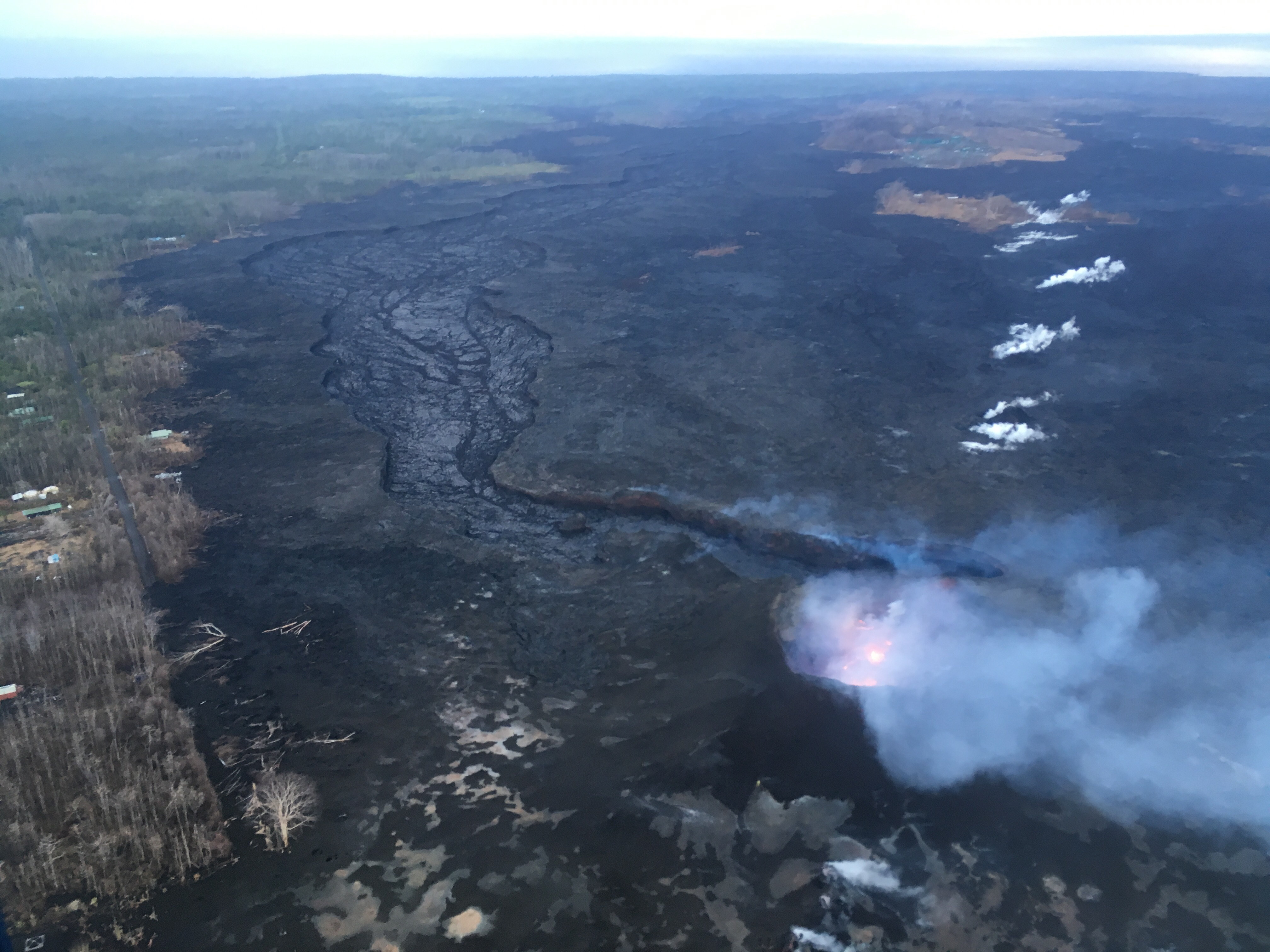
This morning’s overflight revealed a weak to moderately active pond of lava bubbling within the Fissure 8 cone, but no visible supply of lava from Fissure 8 into the channel.
Active flow in the channel was observed immeidately west Kapoho Crater. Click to enlarge. PC: USGS
The perched channel and braided sections downstream were essentially crusted over with some incandescence noted.
ARTICLE CONTINUES BELOW AD
ARTICLE CONTINUES BELOW AD
During this morning’s overflight, HVO geologists observed low levels of lava fountaining within the Fissure 8 spatter cone and crusted lava in the spillway and channel downstream.
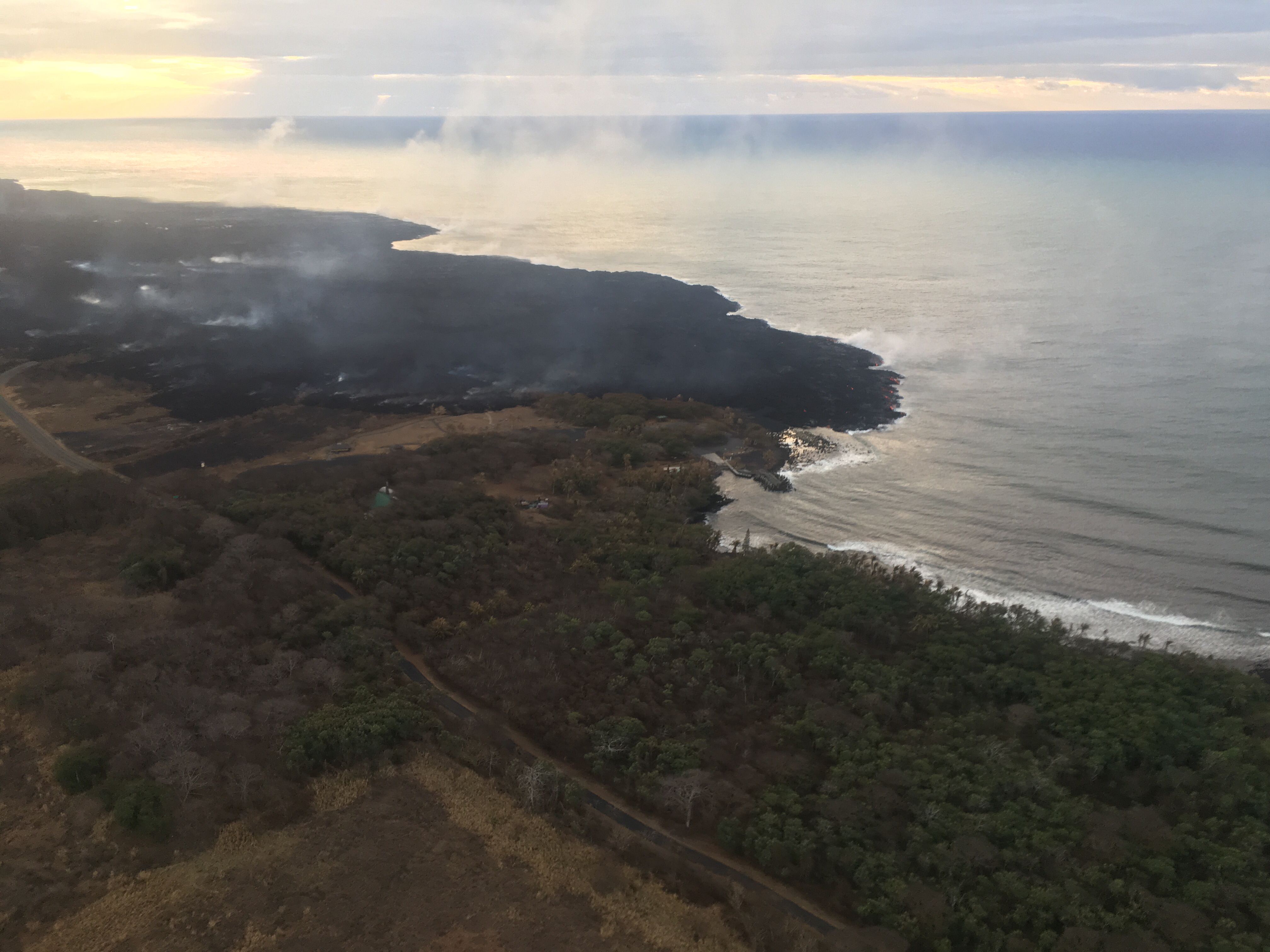
There were small active lava ooze outs at the coast in the vicinity of the former Kapoho Bay and Ahalanui, and the laze plume was greatly diminished. Active lava is close to the Pohoiki boat ramp but did not advanced significantly toward it over the weekend. Click to enlarge. PC: USGS
The significance of this change is not yet clear. Eruptions can wax and wane or pause for days to weeks before returning to high levels of lava discharge. New outbreaks in the area of the active fissures could also occur in the near future.
Kīlauea summit
ARTICLE CONTINUES BELOW AD
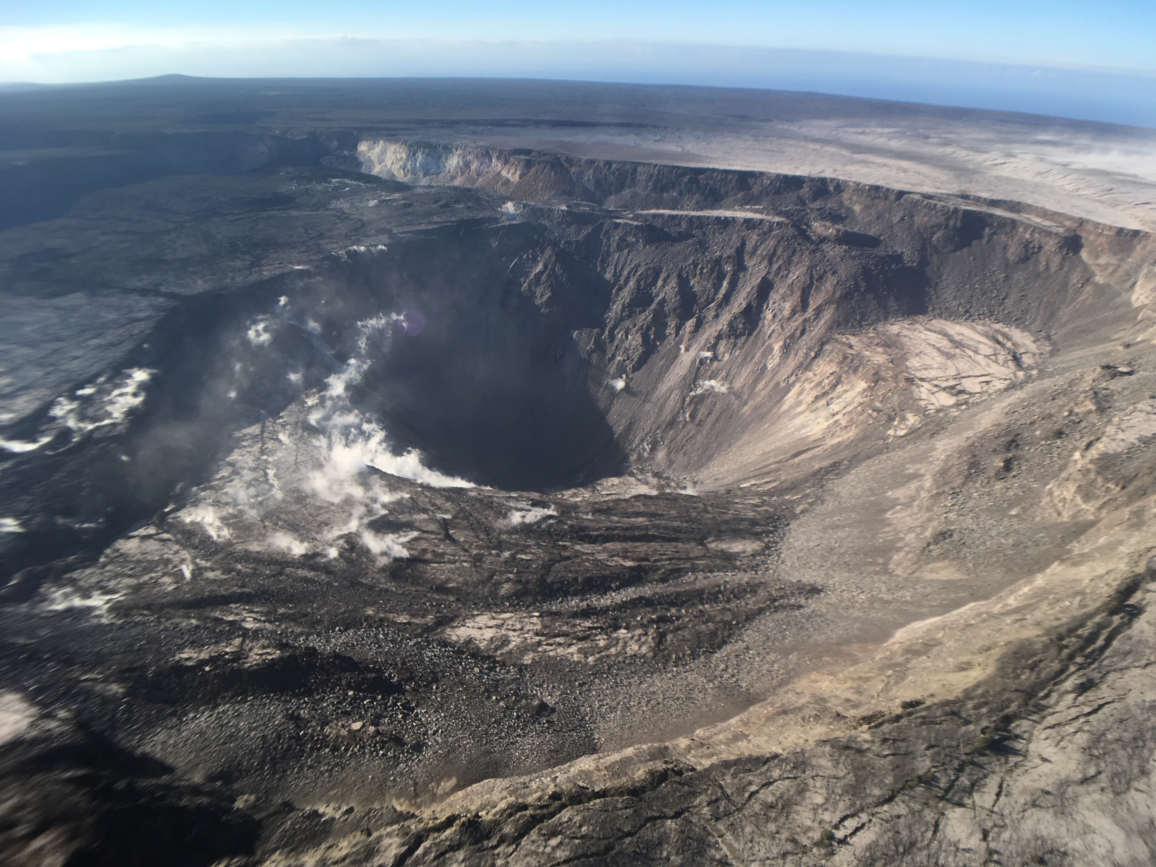
Kīlauea’s summit remains quiet following the most recent collapse event on Aug. 2, at 11:55 a.m.
Kīlauea summit on Aug. 2, 2018, at 11:55 a.m. This view of Halema‘uma‘u is toward the southeast. Click to enlarge. PC: USGS
This quiet is a significant departure from the pattern of episodic seismicity and continuous deformation over the past several months, with very low rates of seismicity continuing today. Deformation at the summit as measured by tiltmeter and GPS instruments slowed and virtually stopped between Aug. 4 and 5.
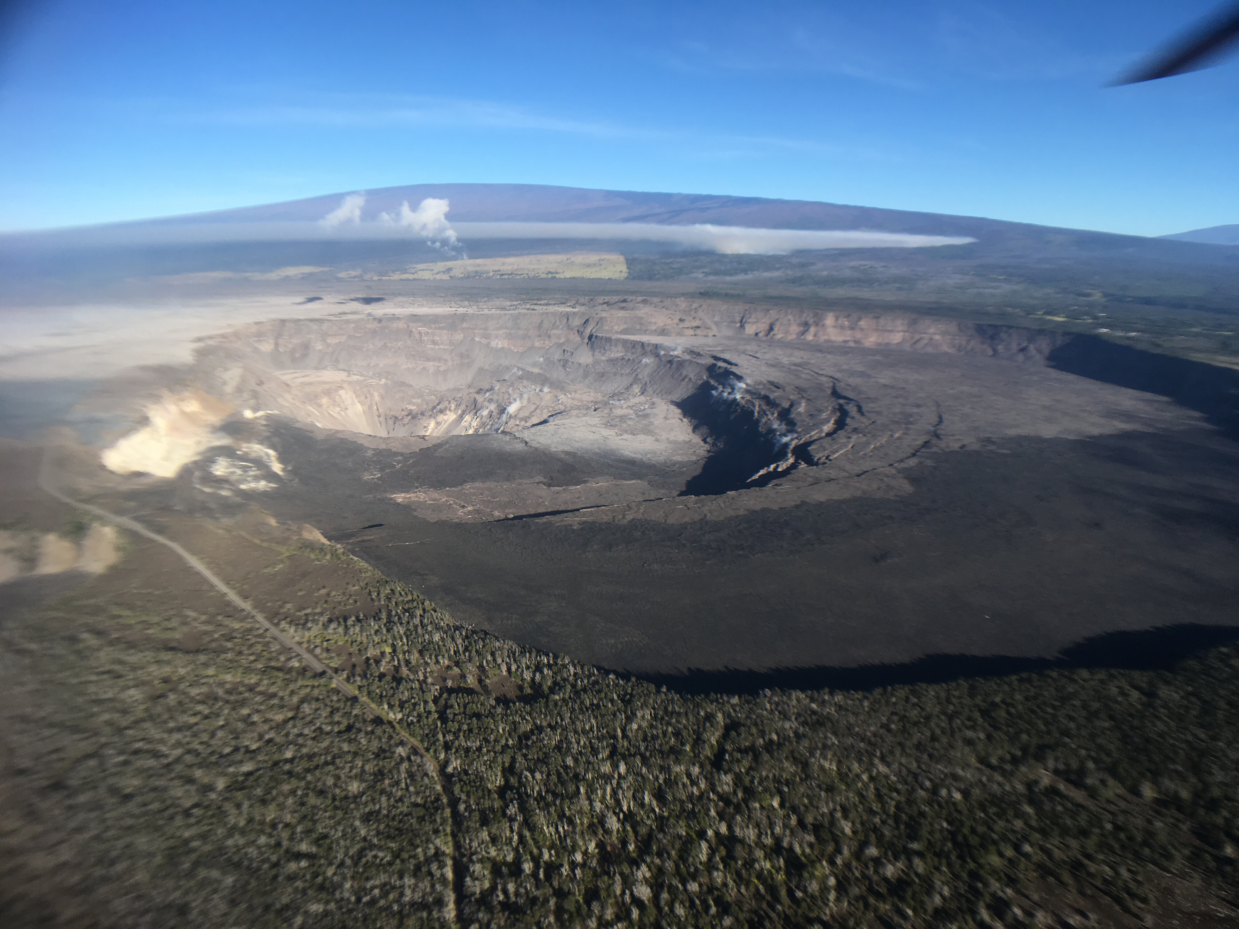
High-elevation view of Halema‘uma‘u and the larger Kīlauea Crater from this morning’s overflight, with Mauna Loa in the background.
Kīlauea summit on Aug. 2, 2018. Click to enlarge. PC: USGS
ARTICLE CONTINUES BELOW AD
HVO and NPS Jaggar Museum are located on bluffs at the far side of the crater in the center of the view. Note the smoke plume from a still-burning brushfire on the lower flank of Mauna Loa.
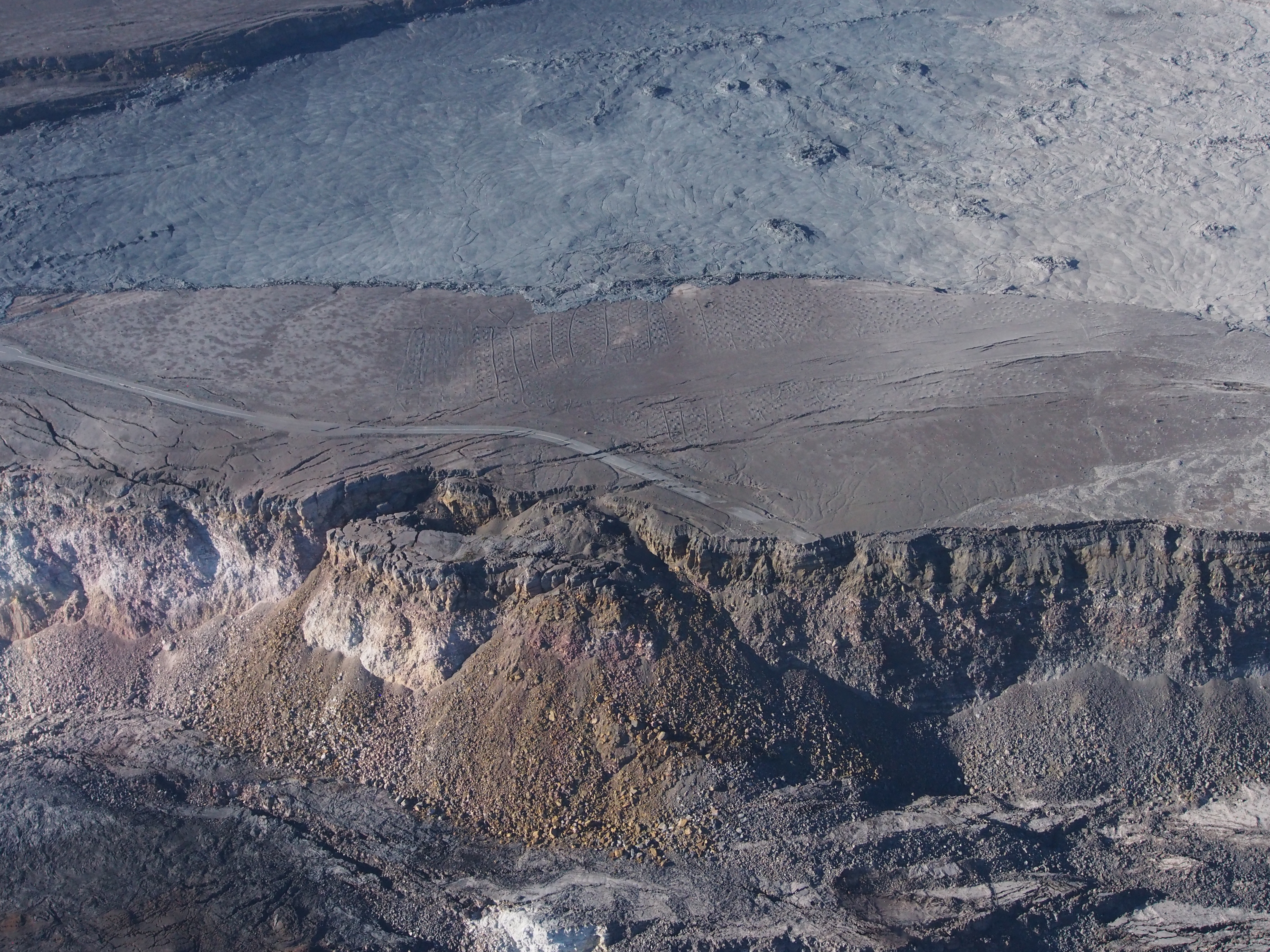
This photo shows a portion of the Crater Rim Drive that led from the east to the Halema‘uma‘u parking area, which slid into the growing crater weeks ago.
Crater Rim Drive on Aug. 6, 2018. Click to enlarge. PC: USGS
Note a slump block located below and near where the road ends at Halema‘uma‘u. The September 1982 lava flow can be seen in the top of the photograph.
This comments section is a public community forum for the purpose of free expression. Although Big Island Now encourages respectful communication only, some content may be considered offensive. Please view at your own discretion. View Comments