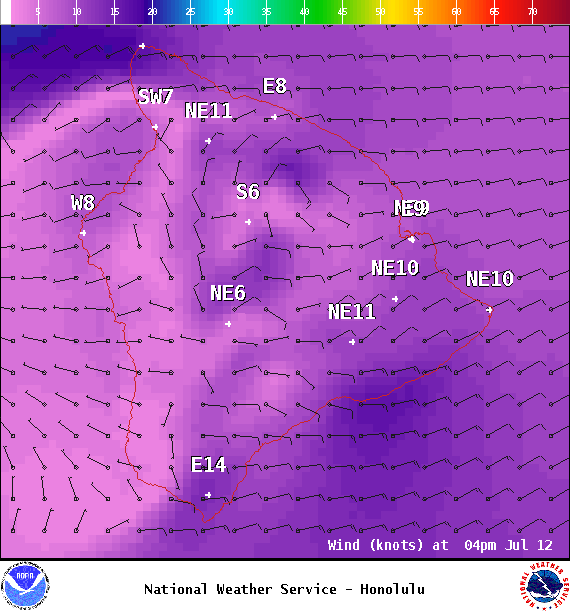
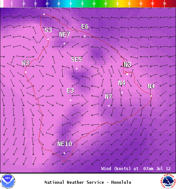
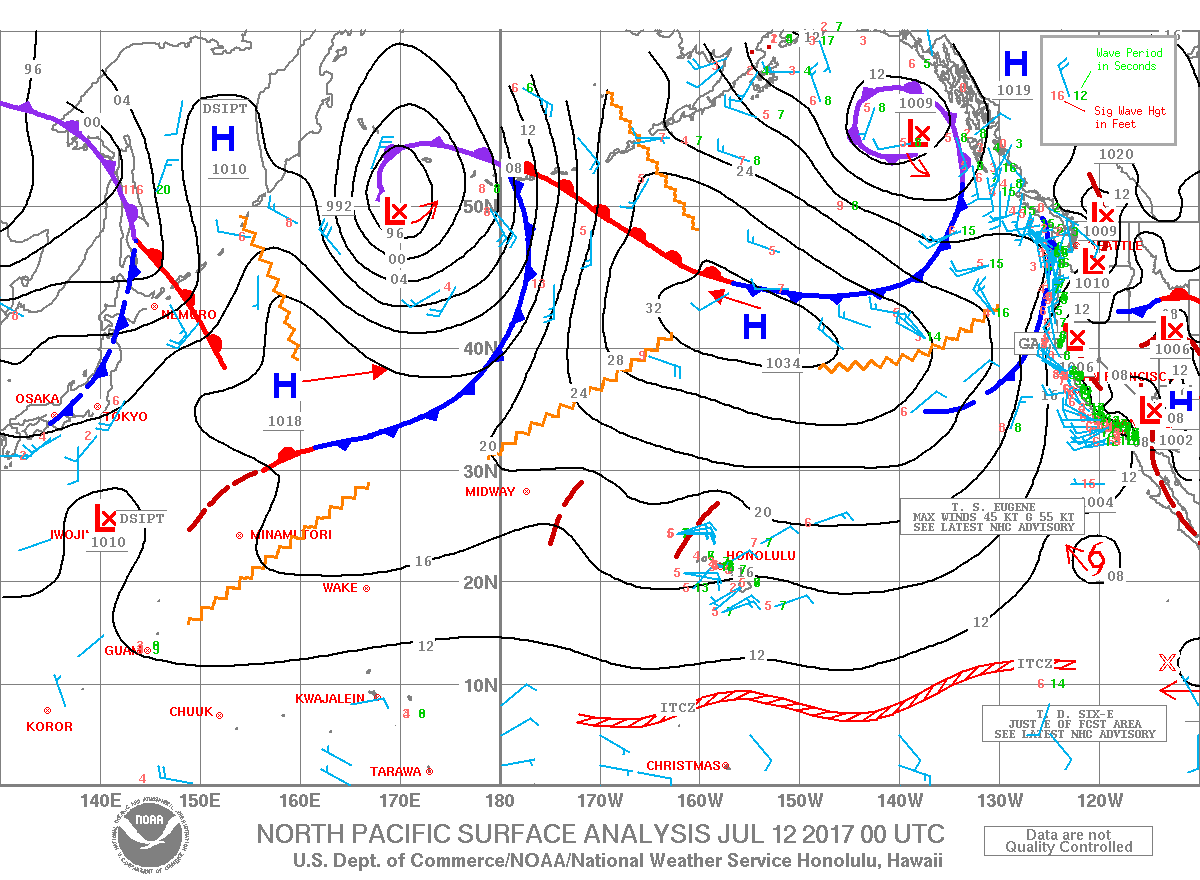
**Click directly on the images below to make them larger. Charts include: Big Island high/low forecasted temperatures, projected winds, chance of cloud cover, projected localized weather conditions, vog/SO2 forecast and expected wave heights.**
+
SWIPE LEFT OR RIGHT
ARTICLE CONTINUES BELOW AD
ARTICLE CONTINUES BELOW AD
Looking Ahead
Moist tropical air overspreading the islands, along with a weak disturbance, could block trade winds over the next couple of days. That means muggy conditions and enhanced showers for the next couple of days. Drier and more stable weather is forecast late Thursday and into the weekend.
ARTICLE CONTINUES BELOW AD
Today
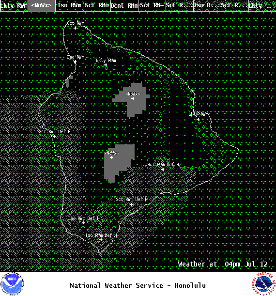
We expect east winds around 5 to 15mph with local sea breezes developing in the afternoon and humid conditions. High temperatures are forecast from 84° to 89°. Parlty cloudy skies with scattered morning showers for the Hilo side and morning sunshine for Kona with afternoon scattered showers. Some of those showers could be heavy.
UV index at 12 (“extreme” exposure level)
ARTICLE CONTINUES BELOW AD
Tonight
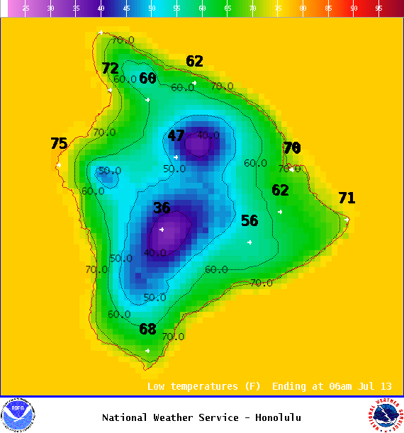
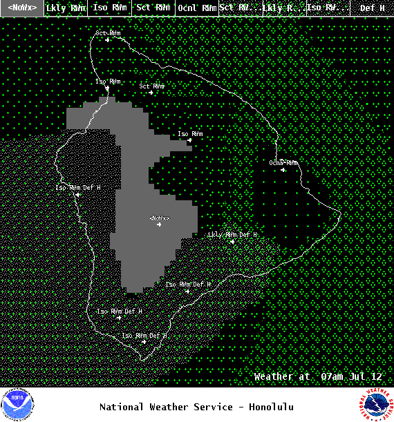
East winds are forecast around 5 to 15 mph with a land breeze developing. Partly cloudy skies with occasional windward showers, scattered leeward showers and clearing as the night goes on. Low temperatures from 71° to 76°.
This comments section is a public community forum for the purpose of free expression. Although Big Island Now encourages respectful communication only, some content may be considered offensive. Please view at your own discretion. View Comments