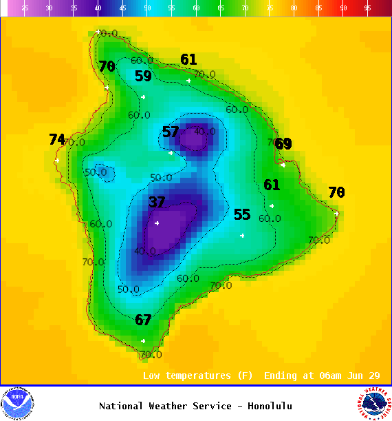
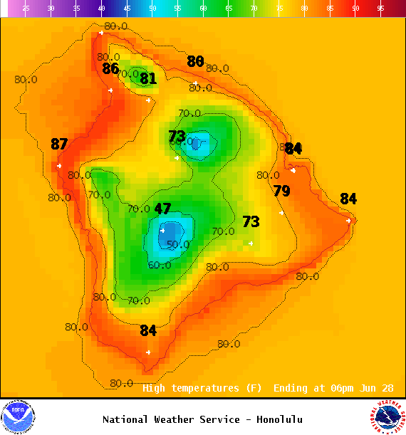
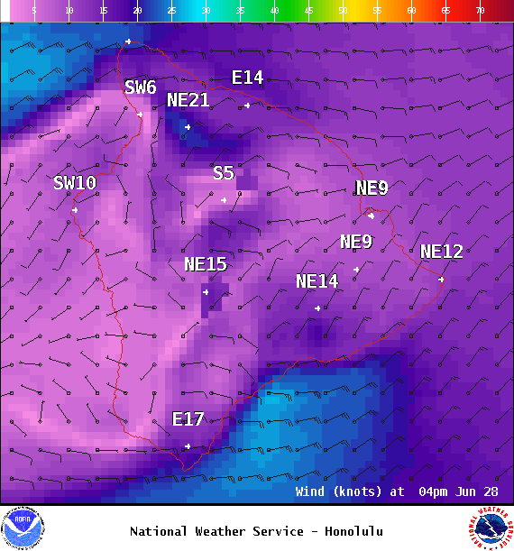
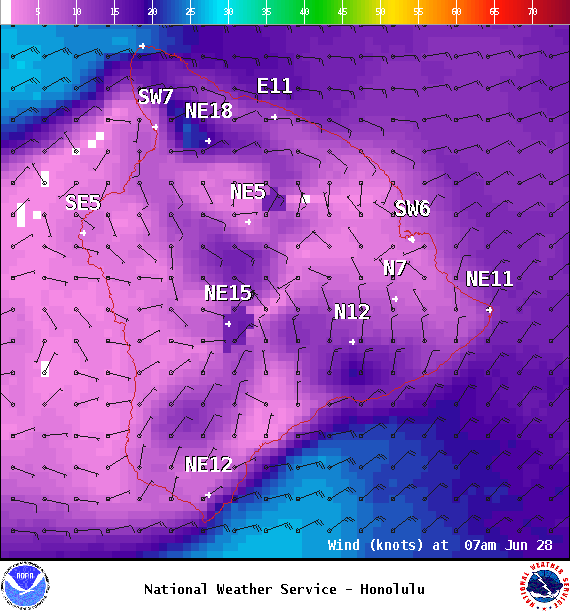
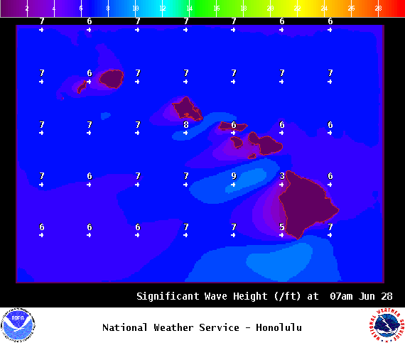
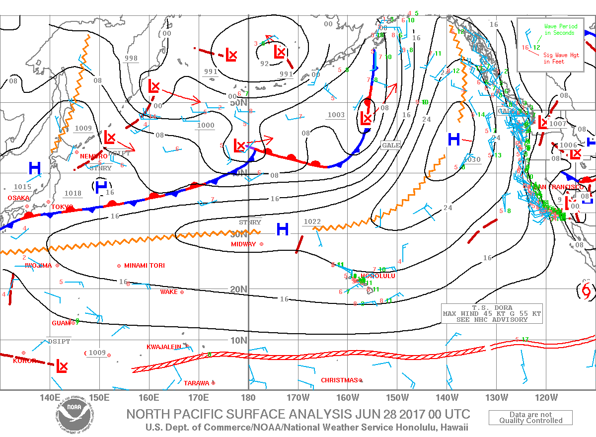
**Click directly on the images below to make them larger. Charts include: Big Island high/low forecasted temperatures, projected winds, chance of cloud cover, projected localized weather conditions, vog/SO2 forecast and expected wave heights.**
+
SWIPE LEFT OR RIGHT
ARTICLE CONTINUES BELOW AD
ARTICLE CONTINUES BELOW AD
Looking Ahead
Breezy trade winds are expected to continue through Thursday. Winds are forecast to slow down a bit over the weekend. Dry and stable conditions are forecast through Thursday with a slight increase in windward and mauka showers possible Friday into the weekend as a weak disturbance approaches the state.
ARTICLE CONTINUES BELOW AD
Today
We expect northeast winds around 15 to 25 mph with variable winds in Kona and Kau. High temperatures are forecast from 84° to 89°. Partly sunny skies with scattered morning windward showers for the Hilo side. Kona side may get some isolated afternoon showers and haze.
UV index at 12 (“extreme” exposure level)
ARTICLE CONTINUES BELOW AD
Tonight
Northeast winds are forecast around 15 to 25 mph with variable winds up to about 15 mph in Kona and Kau. Partly cloudy skies with scattered showers in windward spots and just isolated showers for the Kona side. Low temperatures from 71° to 76°.
This comments section is a public community forum for the purpose of free expression. Although Big Island Now encourages respectful communication only, some content may be considered offensive. Please view at your own discretion. View Comments