A cold front is moving through the state Sunday, the National Weather Service in Honolulu reported on Saturday, Jan. 28, at 8:40 p.m.
The front will pass south of the Big Island Sunday night.
High pressure will pass north of the state Sunday through Monday.
ARTICLE CONTINUES BELOW AD
ARTICLE CONTINUES BELOW AD
Increasing northerly winds are expected to spread across the Big Island on Sunday.
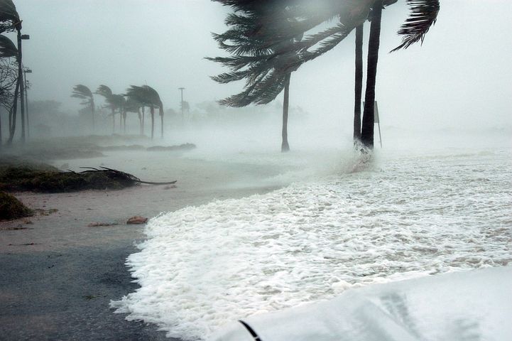
Windy conditions are expected to continue across the entire state Sunday night into Monday. While winds are not expected to be as strong as those observed during the damaging wind event which occurred
last weekend, sustained winds around 30 mph with gusts around 50 mph will be possible in the typically windy locations Sunday through Monday.
The strongest winds will occur over higher terrain, through mountain gaps, and downslope of the mountains.
ARTICLE CONTINUES BELOW AD
Loose outdoor objects may become airborne under these strong winds. Prepare now by securing these objects before winds increase. The strong cross winds may bring hazardous driving conditions, especially for high -profile vehicles.
If you have outdoor plans for Sunday into Monday, be prepared for windy conditions. If your plans involve marine activities, you may want to consider postponing them.
This comments section is a public community forum for the purpose of free expression. Although Big Island Now encourages respectful communication only, some content may be considered offensive. Please view at your own discretion. View Comments