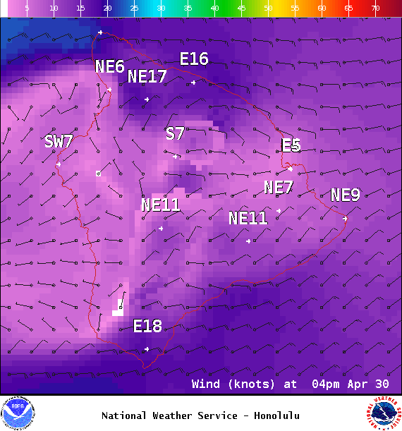
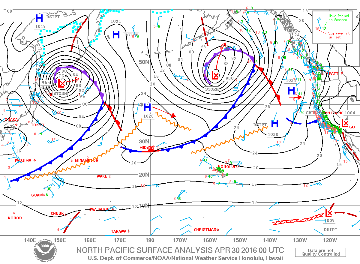
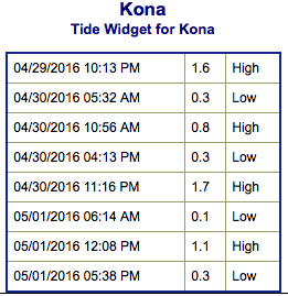
**Click directly on the images below to make them larger. Charts include: Big Island projected winds, tides, swell direction & period and expected wave heights.**
+
SWIPE LEFT OR RIGHT
ARTICLE CONTINUES BELOW AD
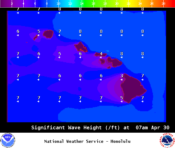
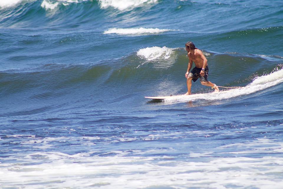
Big Island Surf Forecast
Hilo side: Wave heights for spots exposed to the swell are expected to be shoulder high today with the best breaks getting slightly overhead. Spots without direct exposure to the swell will be smaller.
Kona side: Wave heights are expected to be waist high or less to start. By the end of day, the best breaks could get up to chest high on the sets.
ARTICLE CONTINUES BELOW AD
South: Wave heights are expected to be waist high or less to start. By the end of day, the best breaks could get up to chest high on the sets. Spots with exposure from wind waves could be bigger than that.
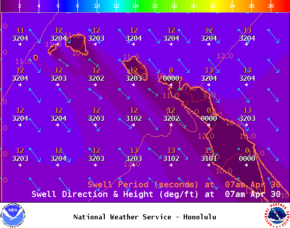
A northwest pulse is expected this weekend, building Saturday and easing Sunday. Another pulse is possible around May 3rd. The Big Island will largely be blocked with minimal amounts of this energy sneaking in… maybe only up to knee/thigh high.
A fun south-southwest swell is expected to start building Saturday and peak May 1st, hold through Monday before beginning to ease. A south-southeast is filling in into the weekend but the Kona side will be shadowed.
Keep in mind, surf heights are measured on the face of the wave from trough to crest. Heights vary from beach to beach, and at the same beach, from break to break.
This comments section is a public community forum for the purpose of free expression. Although Big Island Now encourages respectful communication only, some content may be considered offensive. Please view at your own discretion. View Comments


 Big Island Surf Forecast
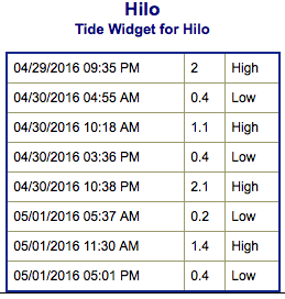 A northwest pulse is expected this weekend, building Saturday and easing Sunday. Another pulse is possible around May 3rd. The Big Island will largely be blocked with minimal amounts of this energy sneaking in… maybe only up to knee/thigh high.