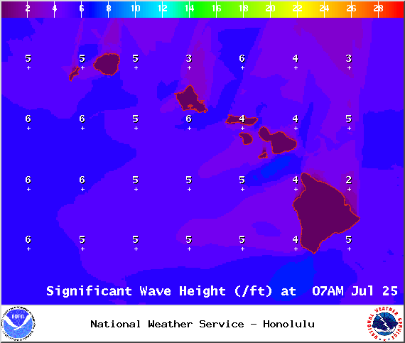
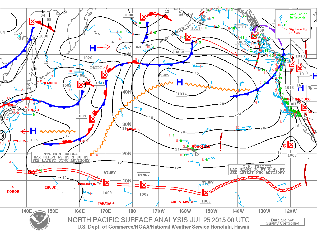
A High Surf Advisory is posted for south facing shores of the Big Island from 6:00 a.m. Saturday to 6:00 a.m. Monday. Wave heights of 6 to 10 foot faces are forecasted. Expect strong breaking waves, shore break and strong longshore and rip currents making swimming difficult and dangerous.
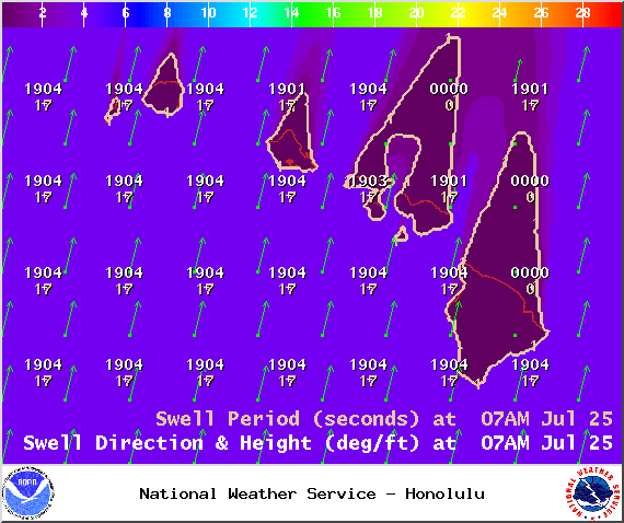
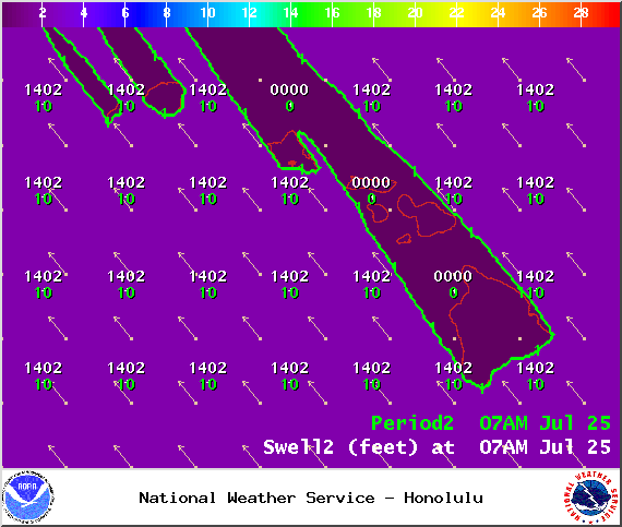
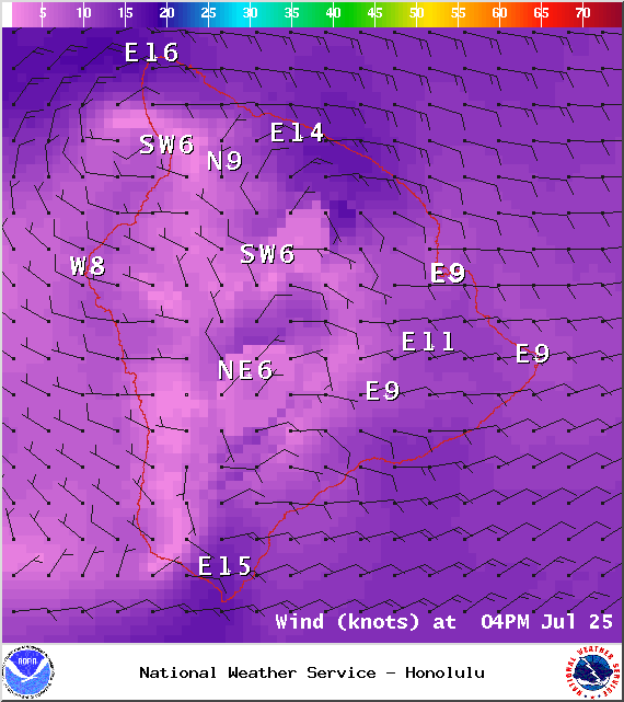
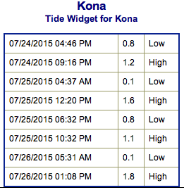
**Click directly on the images below to make them larger. Charts include: Big Island projected winds, tides, swell direction & period and expected wave heights.**
+
SWIPE LEFT OR RIGHT
ARTICLE CONTINUES BELOW AD
ARTICLE CONTINUES BELOW AD
Big Island Surf Forecast
Hilo side: Knee/waist high waves expected today for well exposed breaks. Best breaks could see sets up to tummy/chest high waves from time to time.
ARTICLE CONTINUES BELOW AD
Kona side: Wave heights of chest/head high in the morning, rising to overhead or more by the afternoon. The best exposures may even get up to double overhead from time to time. Smaller surf for spots that have less exposure to the south.
South: Wave heights of chest/head high in the morning, rising to overhead or more by the afternoon. The best exposures may even get up to double overhead from time to time.
Thanks to a storm that recently developed east of New Zealand, a large south swell is building this weekend for southerly exposures. The swell is large enough to bring advisory level surf heights and is expected to peak late Saturday and hold through Sunday. The swell is expected to begin to slowly fade through next week.
ARTICLE CONTINUES BELOW AD
Small trade swell will push into northeasterly exposures. Otherwise, the north Pacific is looking very quiet.
Keep in mind, surf heights are measured on the face of the wave from trough to crest. Heights vary from beach to beach, and at the same beach, from break to break.
This comments section is a public community forum for the purpose of free expression. Although Big Island Now encourages respectful communication only, some content may be considered offensive. Please view at your own discretion. View Comments


 Big Island Surf Forecast
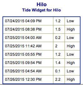 Thanks to a storm that recently developed east of New Zealand, a large south swell is building this weekend for southerly exposures. The swell is large enough to bring advisory level surf heights and is expected to peak late Saturday and hold through Sunday. The swell is expected to begin to slowly fade through next week.