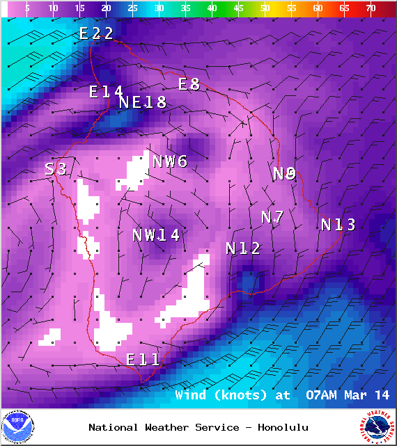
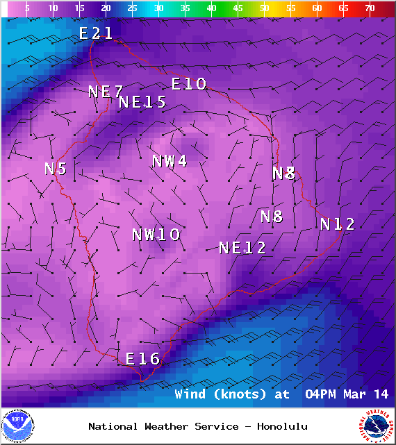
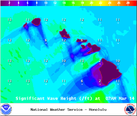
A High Surf Advisory is in effect for north exposures of the Big Island. The advisory is posted through Saturday at 6 a.m. Surf heights from 10 to 15 feet are expected. Expect strong breaking waves, shore break and strong longshore and rip currents making swimming difficult and dangerous.
A Small Craft Advisory is posted for all island waters through 6 a.m. Saturday. Northeast winds up to 30 knots are expected along with rough seas of 10 to 16 feet. Inexperienced mariners should avoid navigating in these conditions.
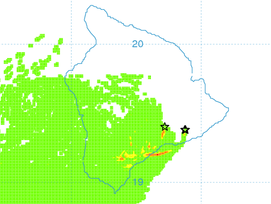
**Click directly on the images below to make them larger. Charts include: Big Island high/low forecasted temperatures, projected winds, chance of cloud cover, projected localized weather conditions, vog/SO2 forecast and expected wave heights.**
+
SWIPE LEFT OR RIGHT
Today
ARTICLE CONTINUES BELOW AD
ARTICLE CONTINUES BELOW AD
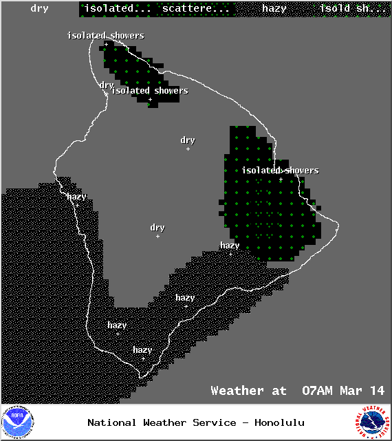
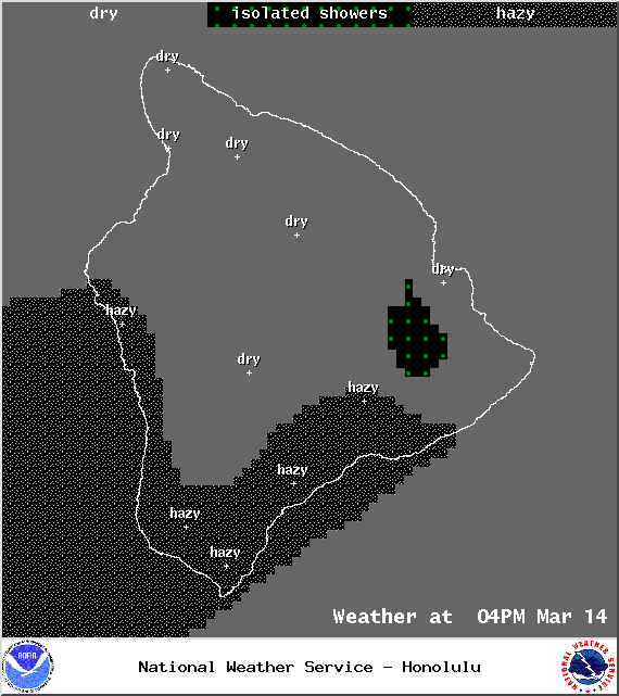
Partly cloudy skies are expected today with isolated to scattered morning windward showers and isolated afternoon showers for leeward spots. Northeast winds are forecasted around 15 mph. High temperatures from 78° to 83°.
UV index at 10 (“very high” exposure level)
Tonight
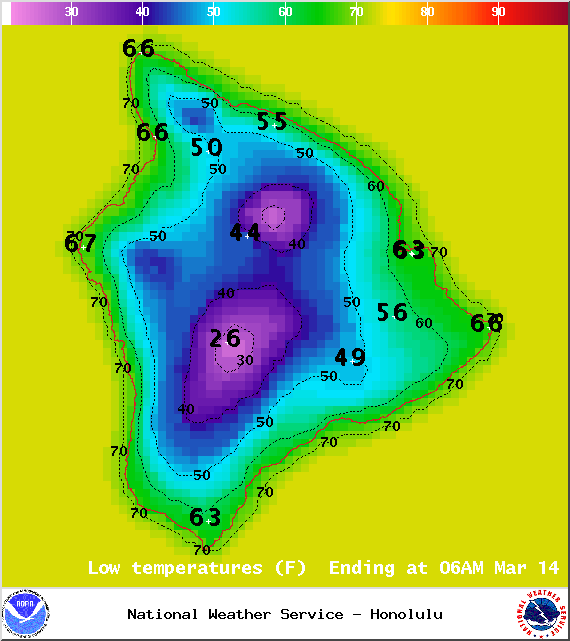
Partly cloudy skies are expected with scattered windward showers and mostly clear skies for the leeward side. Northeast winds are forecasted around 15 mph. Low temperatures from 66° to 71° are expected.
ARTICLE CONTINUES BELOW AD
Sunday
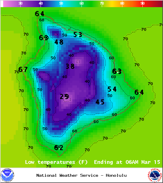
Partly sunny skies are expected with isolated to scattered morning showers for windward locations. The Kona side will have mostly sunny skies in the morning and some afternoon cloud cover and possible isolated afternoon showers. Winds are forecasted out of the northeast around 15 mph. High temperatures from 78° to 81° and low temperatures from 66° to 71°.
Looking Ahead
ARTICLE CONTINUES BELOW AD
Cool and dry conditions are expected to continue. Our north winds are forecasted to veer east on Saturday then trend lighter Sunday and Monday as a weak cold front approaches from the northwest. Winds will become light and variable through the middle of next week, with building trade winds Thursday and Friday. The weak front is expected to provide a slight uptick in showers.
This comments section is a public community forum for the purpose of free expression. Although Big Island Now encourages respectful communication only, some content may be considered offensive. Please view at your own discretion. View Comments