A High Surf Advisory is posted through 6:00 p.m. Saturday for west shore of the island of Hawaii. Surf from 6 to 8 feet is expected. Expect strong breaking waves, shore break and strong longshore and rip currents making swimming difficult and dangerous.
A Small Craft Advisory is posted for the Alenuihaha Channel through 6:00 p.m. Saturday for rough seas of 6 to 11 feet. Inexperienced mariners should avoid navigating in these conditions.
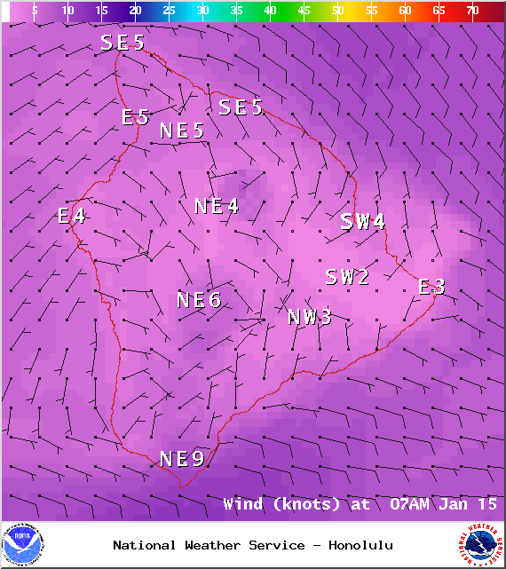
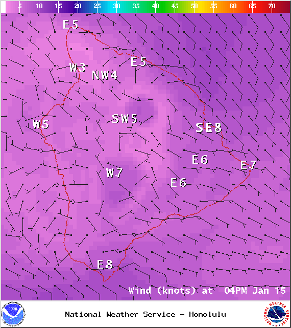
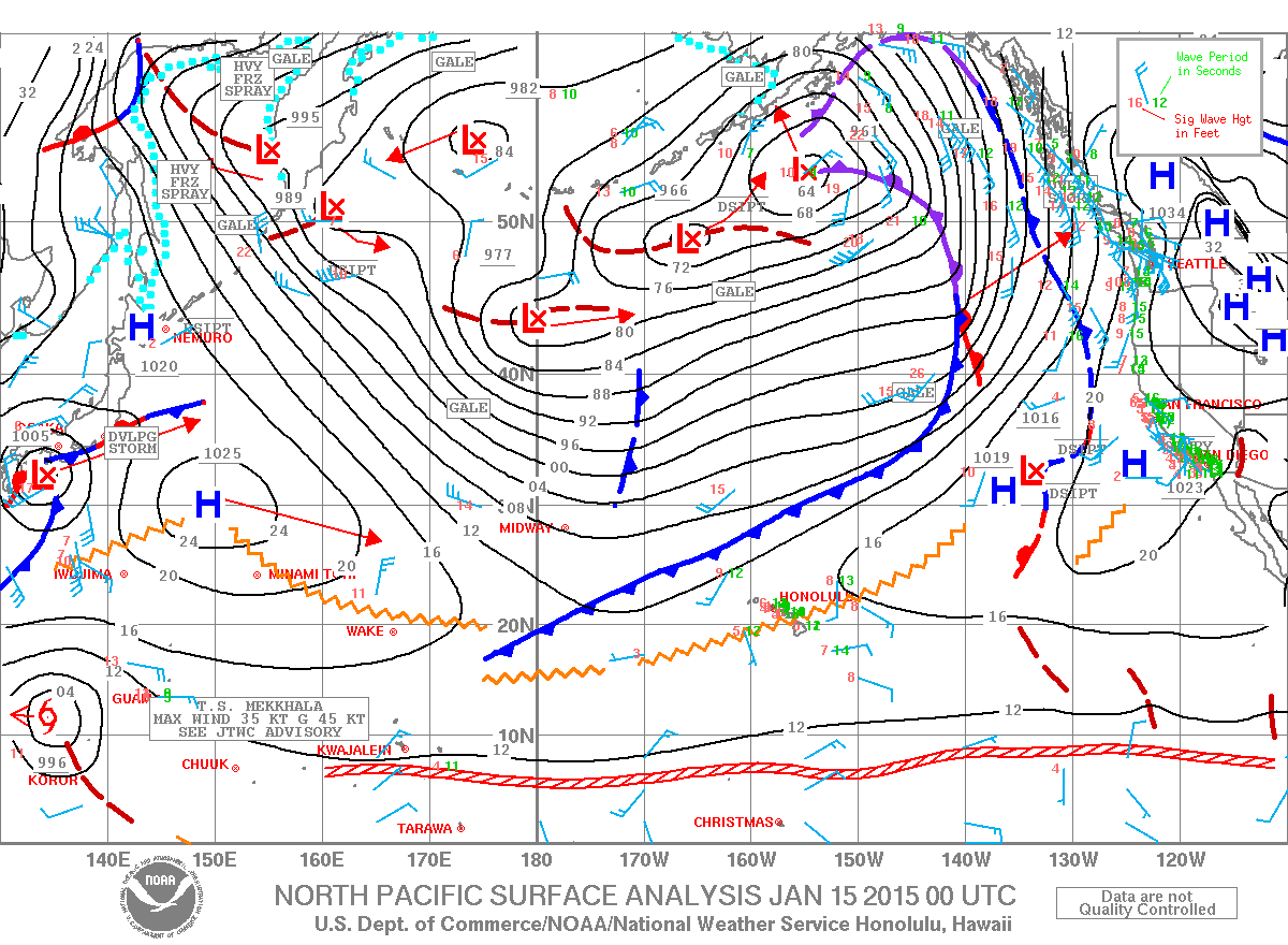
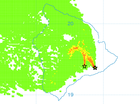
**Click directly on the images below to make them larger. Charts include: Big Island high/low forecasted temperatures, projected winds, chance of cloud cover, projected localized weather conditions, vog/SO2 forecast and expected wave heights.**
+
SWIPE LEFT OR RIGHT
Today, Thursday, January 15, 2015
ARTICLE CONTINUES BELOW AD
ARTICLE CONTINUES BELOW AD
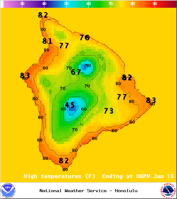
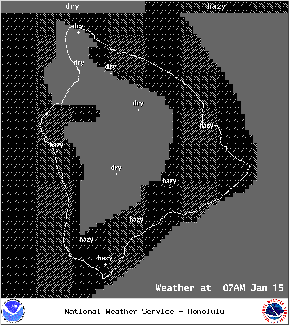
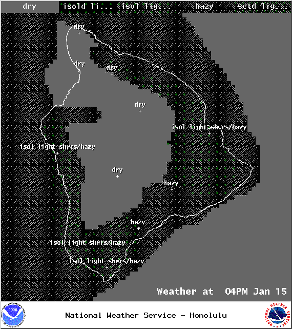
Mostly cloudy skies are expected today. Light and variable winds are also expected up to 15 mph. As the land heats up, sea breezes are expected to develop which will lead to afternoon cloud cover and possible isolated showers. Hazy skies are expected for much of the Big Island (see UHSOEST vog model above). High temperatures should fall in the range of 80° to 85°.
Sunrise: 6:58 a.m.
Sunset: 6:02 p.m.
UV index at 7 (“high” exposure level)
ARTICLE CONTINUES BELOW AD
Tonight
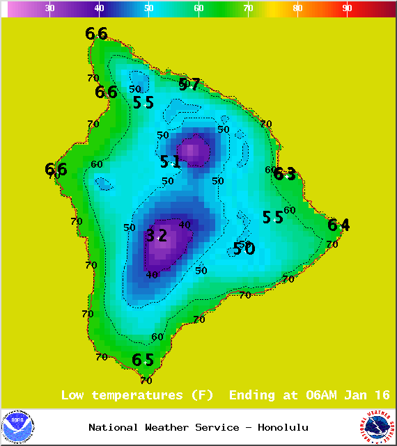
Mostly clear skies are expected. Leeward spots may be cloudy to start but are expected to clear as the land breeze takes hold. Variable winds up to 15 mph are expected. Low temperatures are forecasted from 61° to 66° degrees.
Moonrise: 2:14 a.m.
Moonset: 1:52 p.m.
Next New Moon: Jan. 20 at 3:14 a.m.
ARTICLE CONTINUES BELOW AD
Next Full Moon: 1:09 p.m. on Feb. 3
Looking Ahead
Dry and hazy weather can be expected over the next several days as a ridge of high pressure lies across the area. A weak front is expected north of the state and will help to continue to block our trade winds through the end of the work week. Light to moderate trade winds are expected later this weekend and into early next week as an area of high pressure passes by to our north. A slight increase in showers can be expected over windward and mauka areas at that time. Light southeast winds are expected to make their way back into the forecast middle of next week.
This comments section is a public community forum for the purpose of free expression. Although Big Island Now encourages respectful communication only, some content may be considered offensive. Please view at your own discretion. View Comments