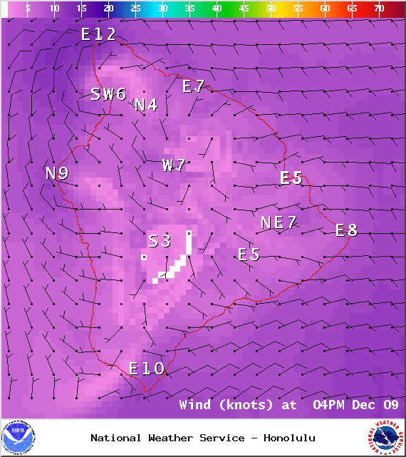
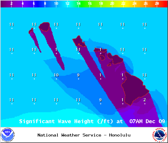
A Small Craft Advisory has been issued by the National Weather Service for Big Island windward waters and the Alenuihaha channel through 6 a.m. Thursday for northeast winds of 10 to 20 knots and rough seas of 8 to 14 feet. This advisory may need to be extended as another large NW swell is expected to build late in the day.
**Click directly on the images below to make them larger. Charts include: Big Island high/low forecasted temperatures, projected winds, chance of cloud cover, projected localized weather conditions, vog/SO2 forecast and expected wave heights.**
+
SWIPE LEFT OR RIGHT
Today, Tuesday December 9, 2014
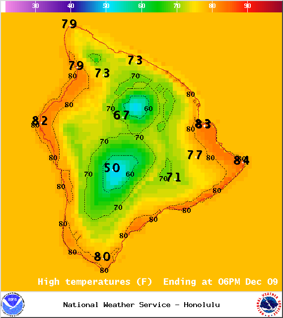
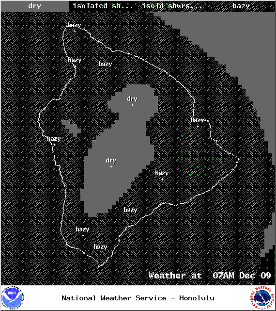
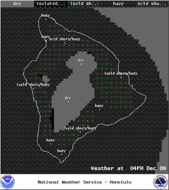
Widespread haze is expected for another day today due to our variable wind conditions. Winds are expected up to 15 mph. Mostly clear skies are forecasted in the morning with partly to mostly cloudy conditions in the afternoon as the sea breeze kicks in and contributes to local convection. We could see some isolated showers in the afternoon as well. High temperatures should fall in the range of 78° to 83° and around 68° at 5000 feet.
ARTICLE CONTINUES BELOW AD
ARTICLE CONTINUES BELOW AD
Sunrise: 6:43 a.m.
Sunset: 5:42 p.m.
UV index at 6 (“high” exposure level)
Tonight
ARTICLE CONTINUES BELOW AD
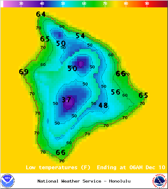
Mostly clear skies are expected tonight with variable winds up to 15 mph. Without cloud cover to trap the heat, greater radiational cooling is expected to occur making for a crisp night. Low temperatures are expected in the range of 65° to 70° with a low of about 49° at 5000 feet.
Moonrise: 8:55 p.m.
Moonset: 10:00 a.m. on Dec 10
Next New Moon: Dec. 21 at 3:36 p.m.
Next Full Moon: Jan. 4 at 6:54 p.m.
ARTICLE CONTINUES BELOW AD
The Geminid Meteor shower is currently active. Peak nights are Dec. 12-13 and 13-14.
Looking Ahead
Winds are forecasted to increase Wednesday and Thursday as a front moves across the islands. This weak front is not expected to be a huge rain-maker but light showers will favor windward and mauka areas. The timing of this front brings it to the Big Island Thursday. Moisture from the front is expected to linger around Hawaii County through the end of the work week for windward areas. Winds will fill in behind the front out of the north then northeast, turning easterly by Friday. A second stronger front expected next weekend is forecasted to reach Hawaii County Sunday night and Monday and will bring strong and gusty winds in its wake.
This comments section is a public community forum for the purpose of free expression. Although Big Island Now encourages respectful communication only, some content may be considered offensive. Please view at your own discretion. View Comments