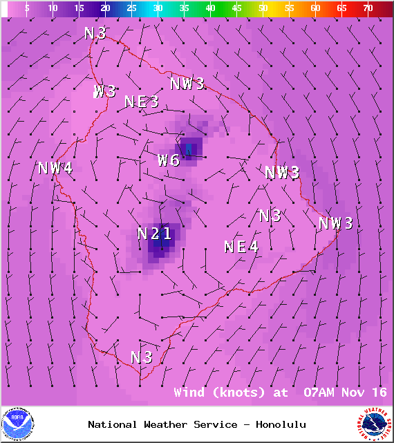
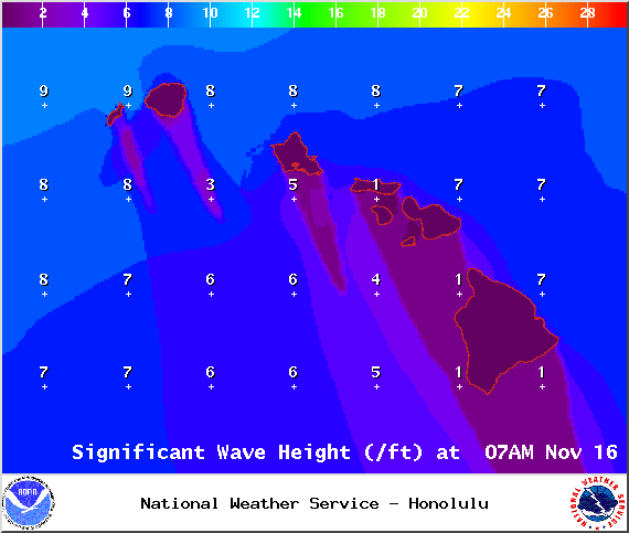
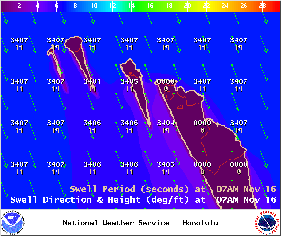
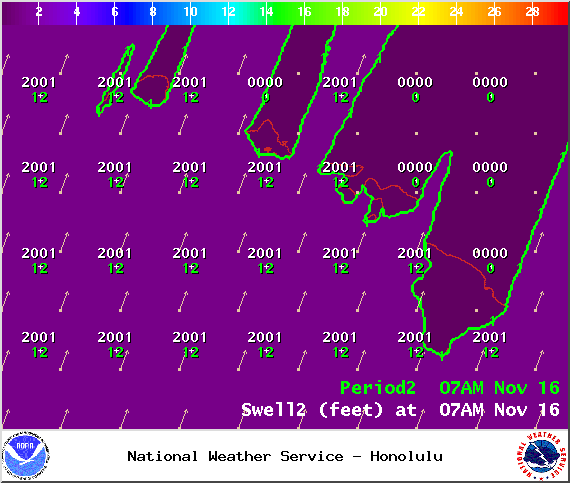
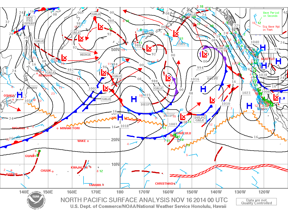
**Click directly on the images below to make them larger. Charts include: Big Island projected winds, tides, swell direction & period and expected wave heights.**
+
SWIPE LEFT OR RIGHT
ARTICLE CONTINUES BELOW AD
ARTICLE CONTINUES BELOW AD
Big Island Surf Forecast, Sunday November 16, 2014
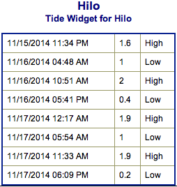
Hilo side: Surf is expected shoulder high to slightly overhead at the best breaks.
Kona side: Breaks not exposed to the swells will be flat today. Spots that catch some of the fading north-northwest wrap could see waves up to knee high.
South: Waves expected knee high or less.
ARTICLE CONTINUES BELOW AD
Our current north-northwest swell (325-350°) continues to fade through the weekend and remain below advisory level. The swell is still showing best on the Hilo side and along the Hamakua coast up to Kohala.
A larger north-northwest swell (330-350°) is expected to fill in Sunday night, peak late on Monday with advisory level surf heights expected, then gradually lower Tuesday and Wednesday. We expect to see another round of overhead to double overhead surf for the best breaks along the Hamakua coast.
Another, but slightly smaller northwest swell is expected to slowly build Wednesday afternoon and peak just below advisory levels through the day on Thursday, then gradually fade on Friday.
Super small trace amounts of swell expected out of the SPAC. There isn’t much on the horizon out of the South Pacific. Possibly a small bump building on Tuesday but not expected to be over waist high at the best breaks.
ARTICLE CONTINUES BELOW AD
Keep in mind, surf heights are measured on the face of the wave from trough to crest. Heights vary from beach to beach, and at the same beach, from break to break.
This comments section is a public community forum for the purpose of free expression. Although Big Island Now encourages respectful communication only, some content may be considered offensive. Please view at your own discretion. View Comments


 Big Island Surf Forecast, Sunday November 16, 2014
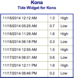 A larger north-northwest swell (330-350°) is expected to fill in Sunday night, peak late on Monday with advisory level surf heights expected, then gradually lower Tuesday and Wednesday. We expect to see another round of overhead to double overhead surf for the best breaks along the Hamakua coast.