**A breakdown of expected conditions specific to the Big Island is presented below in graphical form. All graphics are provided by the National Weather Service in Honolulu.**
Alerts
The National Weather Service has continued the HIGH SURF ADVISORY for east shores of the Big Island until 6 a.m. Saturday, Nov. 1, 2014. Hazardous ocean conditions are expected due to a combo of north swell and increasing winds. Watch out for rip currents, dangerous shore break conditions and strong breaking waves.
A SMALL CRAFT ADVISORY is posted for waters near South Point and the Alenuihaha channel until 6:00 a.m. Thursday. Winds of 25 to 30 knots are expected with rough seas from 8 to 12 feet. Inexperienced mariners are cautioned to avoid navigating these conditions.
Today
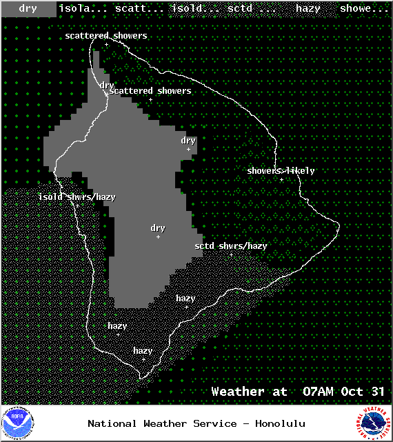
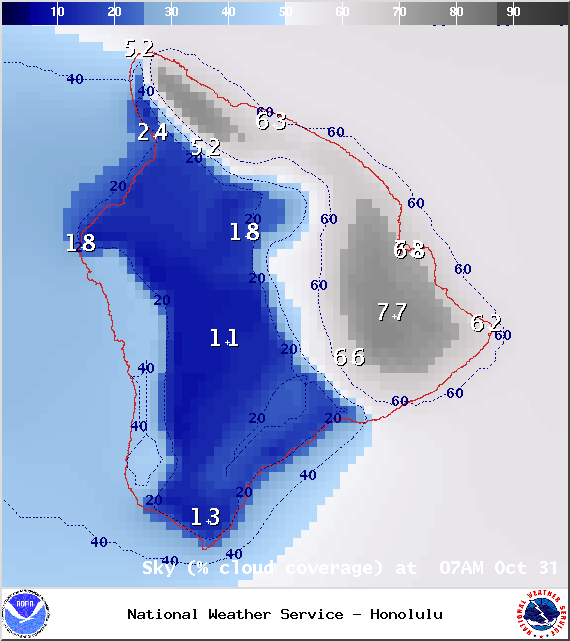
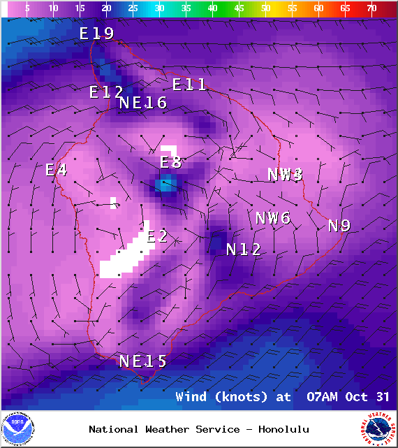
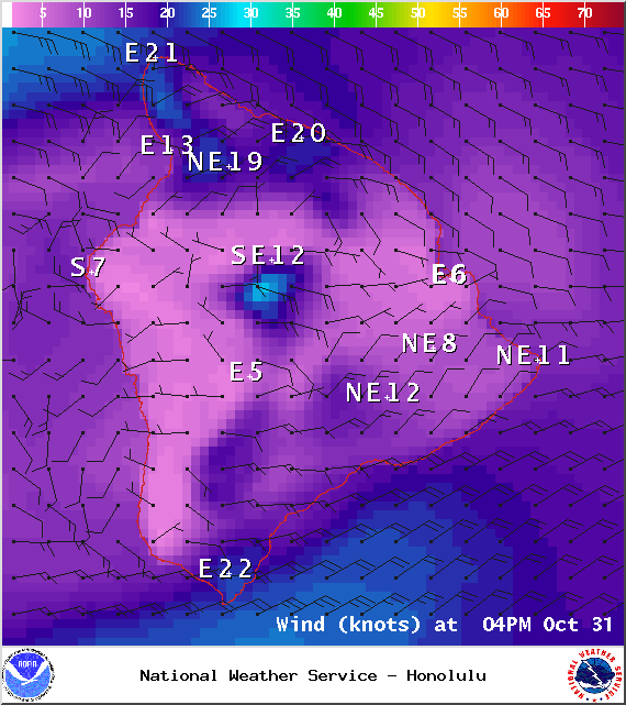
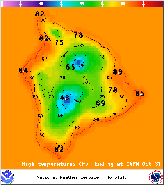
A typical trade wind weather pattern is expected for Hawaii County with mostly cloudy skies for windward and mauka areas and scattered showers. Meanwhile, the Kona side should see clear skies and light winds early on with clouds building late in the day possibly spawning some scattered afternoon showers. High temperatures should fall in the range of 80° to 85° up to around 71° at 5000 feet. In general, trade winds should fall in the 15 – 25 mph range. Along the Hamakua coast and above 5000 feet gusts could reach 35 mph early on and 50 mph by the afternoon. At South Point and in the Kohala and Waikoloa areas winds could gust up to 30 or 40 mph.
Sunrise: 6:21 a.m.
Sunset: 5:46 p.m.
UV index at 7 (“high” exposure level)
ARTICLE CONTINUES BELOW AD
ARTICLE CONTINUES BELOW AD
Halloween Night
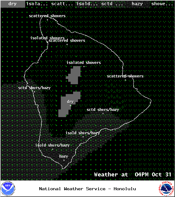
We expect mostly cloudy skies tonight with showers likely for windward and mauka areas. The Kona side will be mostly cloudy in the evening but gradually clearing as the night goes on. Low temperatures should fall in the range of 69° to 74° with lower temperatures expected at higher elevations. Trade winds are expected from 15 – 25 mph.
Leeward side: Mostly cloudy, 40% chance of scattered showers, gradual clearing through the night, winds E at 10 mph South Point / Pahala: Mostly cloudy, 50% chance of scattered showers, winds 10 – 15 mph, gusts to 35 mph Windward Coast: Mostly cloudy, 80% chance of showers, winds 10 – 15 mph, gusts to 30 mph Kohala / Waikoloa: Mostly clear, 20% chance of showers, winds 10 mph, gusting to 25 mph
Moonrise: 1:18 p.m.
Moonset: 1:15 a.m.
Next Full Moon: Nov 6, 2014 at 12:23 p.m.
Next New Moon: Nov 22, 2014 at 2:33 a.m.
Looking Ahead
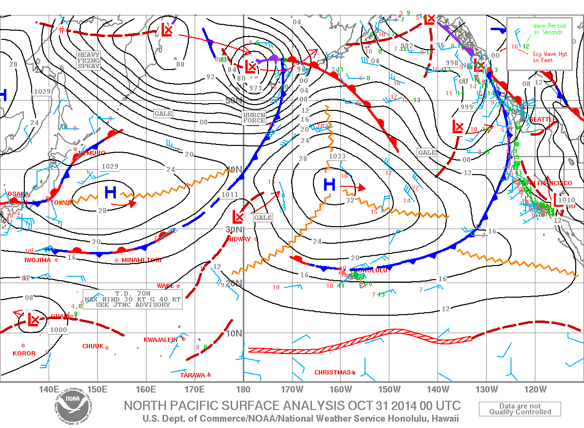
Lingering moisture from a dissipating front is expected to affect mainly windward and mauka spots through the weekend. Some of those showers could pass leeward from time to time. Trade winds are expected to weaken over the weekend. Another front is expected to affect us next week. Ahead of the front winds are forecasted to shift out of the east-southeast. By midweek trade winds are expected to build back in.
ARTICLE CONTINUES BELOW AD
Surf & Seas Hilo: Surf is expected in the chest high to overhead range all day. Spots best exposed to the swell could see sets of a couple feet overhead, especially late in the day. Kona: Surf from ankle to waist high is forecasted. Breaks not exposed to the swell will see much smaller surf. South: Waist to chest high waves are expected with sets up to a foot or so overhead at the best breaks exposed to the swell. The southeast coast will also catch the trade swell.
Our current north-northwest swell (340-360°) will fade throughout the day. Another reinforcing swell is expected to fill in, peaking late in the day through early Saturday morning at a couple feet overhead. This swell is expected to fade out starting late Saturday. A new northwest swell (305-325°) is expected by midweek.
A nice sized trade wind swell is affecting our eastern shores which are under a high surf advisory at this time. Sloppy, choppy conditions are expected for northeast shores.
Our current south-southwest swell (200-180°) is fading out today and into the weekend. A reinforcing swell (200-185°) is expected over the weekend, peaking in the knee to chest high range Saturday into Sunday morning before fading out. After that swell subsides, surf goes quiet with not much on the horizon out of the South Pacific.
ARTICLE CONTINUES BELOW AD
Keep in mind, surf heights are measured on the face of the wave from trough to crest. Heights vary from beach to beach, and at the same beach, from break to break.
Almanac for Hilo Airport Maximum Temperature for today:
Normal 82°
Record 86° / Set in 1961 and tied in 2003
Minimum Temperature for today:
Normal 68°
Record 62° / Set in 1954 and tied in 1985
This comments section is a public community forum for the purpose of free expression. Although Big Island Now encourages respectful communication only, some content may be considered offensive. Please view at your own discretion. View Comments


 Today
Today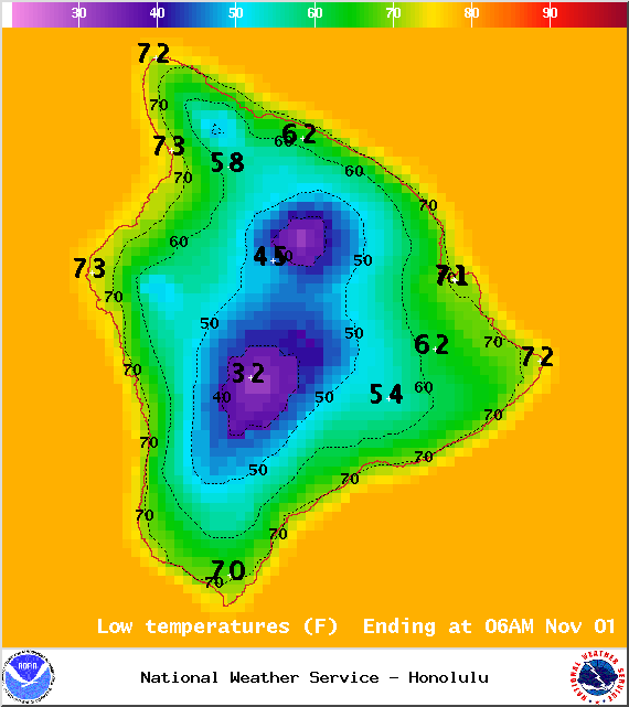 Halloween Night
 Surf & Seas
 A nice sized trade wind swell is affecting our eastern shores which are under a high surf advisory at this time. Sloppy, choppy conditions are expected for northeast shores.