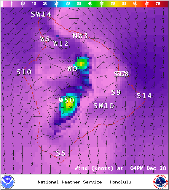
A Marine Weather Statement has been issued by the National Weather Service. A cold front has entered the Kauai coastal waters and will move into the coastal waters around Maui County and then to the Big Island later today and tonight. The front will bring a distinct shift and increase in winds from westerly to northwesterly. Along the front and after it passes winds will increase to 20 to 30 knots and become northwesterly. Winds could gust as high as 45 knots with seas becoming rough and steep at 7 to 13 feet. Well out ahead of the front scattered brief heavy showers with strong gusty winds are moving from southwest to northeast across the waters. Isolated thunderstorms and lightning are another possibility.
A Winter Weather Advisory has been issued by the National Weather Service in effect from midnight tonight through 8:00 a.m. Thursday morning. Snow and freezing rain are expected above 11,500 feet on the summits of Mauna Kea and Mauna Loa. Very strong winds with low visibility and fog are expected. A High Wind Warning is in effect for the summits at this time. Accumulations of 1 to 2 inches of snow are forecasted. A temperature of 30 degrees is expected. Travel on foot or by vehicle is not recommended and will become very dangerous overnight.
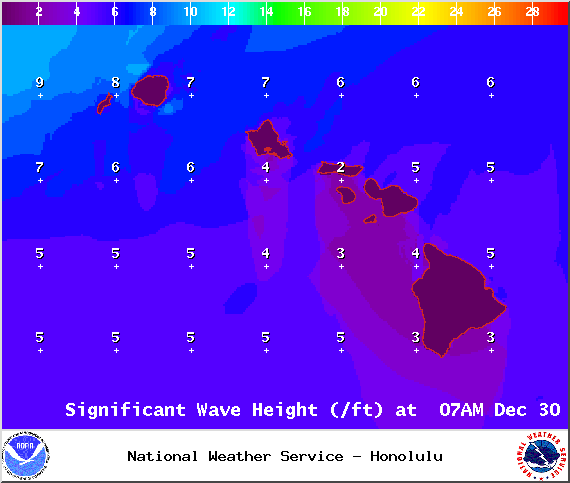
A Small Craft Advisory is posted for all Big Island windward coastal waters and the Alenuihaha channel from 6:00 a.m. Tuesday Dec. 30, 2014 to 6:00 a.m. Wednesday Dec. 31, 2014. Winds are expected out of the northeast from 20 to 30 knots with higher gusts with rough seas rising to 8 to 14 feet.
The High Wind Watch has been upgraded to a High Wind Warning by the National Weather Service for the summits of Mauna Kea and Mauna Loa from 6:00 a.m. Tuesday morning Dec. 30, 2014 to 6:00 a.m. Wednesday Dec. 31, 2014. West to southwest winds are expected from 45 to 70 mph with gusts over 90 mph possible.
**Click directly on the images below to make them larger. Charts include: Big Island high/low forecasted temperatures, projected winds, chance of cloud cover, projected localized weather conditions, vog/SO2 forecast and expected wave heights.**
+
SWIPE LEFT OR RIGHT
ARTICLE CONTINUES BELOW AD
ARTICLE CONTINUES BELOW AD
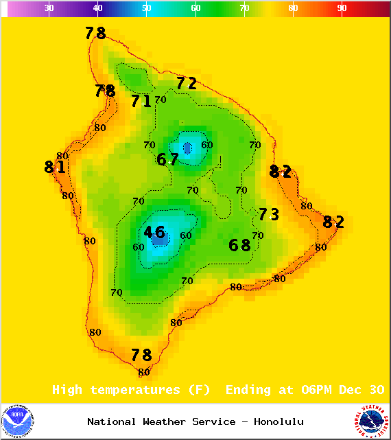
Today, Tuesday, December 30, 2014
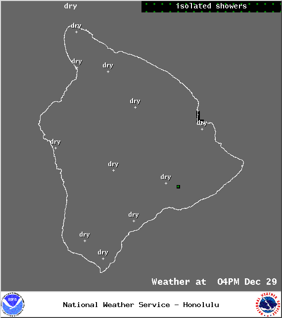
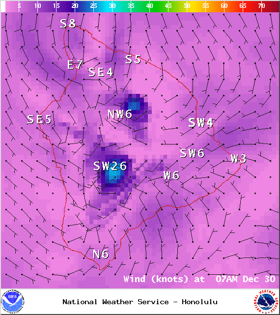
Today, we expect partly sunny skies for the Big Island with isolated showers in the afternoon. The UHSOEST vog model shows haze islandwide through the day. Winds will be breezy out of the southwest from 15 to 25 mph. High temperatures should fall in the range of 78° to 83°.
Sunrise: 6:54 a.m.
Sunset: 5:52 p.m.
ARTICLE CONTINUES BELOW AD
UV index at 5 (“moderate” exposure level)
Tonight
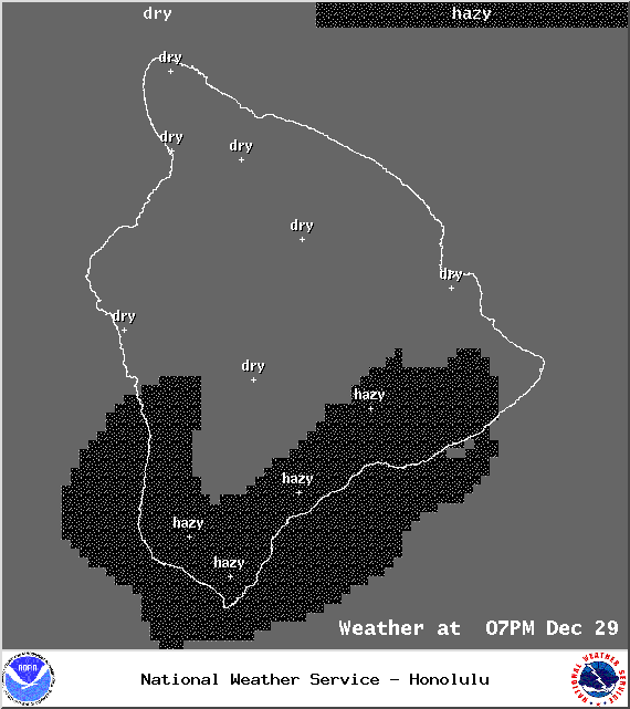
Partly cloudy skies are expected on the Big Island with isolated showers expected for the windward side after midnight and scattered showers forecasted for the leeward side after midnight. Haze is also expected to hang around. West winds are expected from 15 to 25 mph. Low temperatures from 64° to 69° degrees.
Moonrise: 1:48 p.m.
ARTICLE CONTINUES BELOW AD
Moonset: 2:51 a.m. on Dec. 31
Next Full Moon: Jan. 4 at 6:54 p.m.
Next New Moon: Jan. 20 at 3:14 a.m.
Looking Ahead
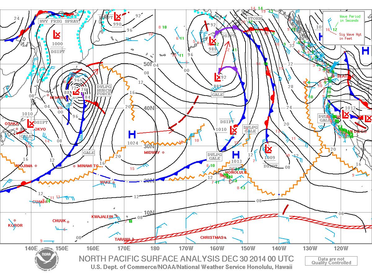
A cold front will sweep down the island chain today bringing stronger winds and showers, along with the possibility for a few thunderstorms. The front will reach Kauai around midday today, Oahu later this afternoon, Maui county early this evening, and the Big Island tonight. A brief period of rather dry northerly flow is expected New Year’s Eve and into New Year’s morning with decreased wind speeds. Thursday night through Saturday models are indicating a chance of thunderstorms. Uncertainty is still quite high so I will continue to watch this feature and bring you the latest as the forecast becomes more certain.
This comments section is a public community forum for the purpose of free expression. Although Big Island Now encourages respectful communication only, some content may be considered offensive. Please view at your own discretion. View Comments