

High Winds and Big Waves Expected Wednesday
Alerts
The National Weather Service has issued a High Surf Warning for West facing shores of the Big Island until 6 p.m. Wednesday.
Forecasters say that 8-12 foot surf, possibly higher in some areas, is expected along the West side of the island. Some of the biggest waves have been reported at beach parks south of Kailua-Kona. Some beach parks are closed. We have a list here.
A High Surf Advisory has been extended for the Big Island’s north facing shores. Surf is expected to increase to 10 – 20 feet. Therefore the advisory is posted through 6:00 p.m. this evening.
Expect strong breaking waves, shore break and strong longshore and rip currents making swimming difficult and dangerous.
A Small Craft Advisory is posted for Big Island windward waters through 6:00 p.m. today. Seas up to 13 feet are expected.
This swell will create hazardous conditions for smaller vessels. Inexperienced mariners should avoid navigating in these conditions.
A High Wind Warning is posted for the summits of Mauna Kea and Mauna Loa through 6:00p.m. today. Northwest winds from 30 to 60 mph are possible above 12,000 feet of elevation. Winds are expected to peak early this morning then gradually weaken.
***Click directly on the images below to make them larger. Charts include: Big Island high/low forecasted temperatures, projected winds, chance of cloud cover, projected localized weather conditions, vog/SO2 forecast and expected wave heights.***
Today
We expect hazy skies today especially in leeward spots. Partly cloudy skies are forecasted with isolated afternoon showers for the Kona side and scattered showers for windward and mauka areas. High temperatures should fall in the range of 81° to 86° and around 72° at 5000 feet. In general, variable winds up to 15 mph are expected with higher winds at higher elevations.
Sunrise: 6:27 a.m.
Sunset: 5:42 p.m.
UV index at 7 (“high” exposure level)
Tonight
We expect partly cloudy skies tonight with scattered showers. Variable winds are expected up to 15 mph. Low temperatures should fall in the range of 69° to 74° with a low of about 55° at 5000 feet. The moon is 71.2% full.
Moonrise: 11:04 p.m.
Moonset: 12:05 p.m.
Next New Moon: Nov 22 at 2:33 a.m.
Next Full Moon: Dec 6 at 2:27 a.m.
Looking Ahead
A front that stalled over Oahu yesterday is expected to linger and help draw moisture up from the south and over the Big Island tonight and Thursday. These showers will be quite disorganized and scattered in nature. A second front is expected to approach and interact with the first one reinforcing it as it moves down the island chain. The moisture from the deep tropics that is lingering in our area may be enough to fuel substantial rainfall and even thunderstorms over the weekend. Will keep an eye on it. Cooler, drier conditions are expected late in the weekend and early next week.
 Surf and Seas
Hilo side: Surf is expected well overhead to double overhead or more for spots best exposed to the advisory level north-northwest swell.
Kona side: Surf is expected to be knee high or less. Breaks not exposed to the swells will be flat today. Spots that catch some of the north-northwest wrap could see waves chest to shoulder high.
South: Waves expected waist high or less.
Former super typhoon Nuri made history. After becoming extratropical and merging with a frontal system a couple of days ago, the storm became the strongest non-tropical storm ever recorded in the NPAC.
 Though it’s not a giant XXL swell, the system is bringing us a solid large northwest swell (310-335°) peaking today with double overhead waves, maybe even bigger sets at the best exposures. The Kona side is shadowed from the swell and will be significantly smaller but may still catch a wrap at the best exposed breaks.
A series of northwest and north-northwest swells is expected to bring swell energy through the weekend with a couple of reinforcing swells showing up on models for early next week as well.
Small leftovers are expected to bring us waves in the thigh high or less range and gradually fade through the week. Most Kona spots will remain flat. There isn’t much on the horizon out of the South Pacific.
Keep in mind, surf heights are measured on the face of the wave from trough to crest. Heights vary from beach to beach, and at the same beach, from break to break.
Almanac for Hilo Airport
Maximum Temperature for today:
Normal 81°
Record 86° / Set in 1968 and tied in 1988
Minimum Temperature for today:
Normal 68°
Record 62° / Set in 1993
Image: UHSOEST
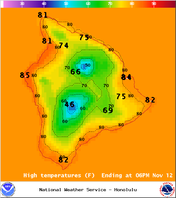
Image: NOAA / NWS
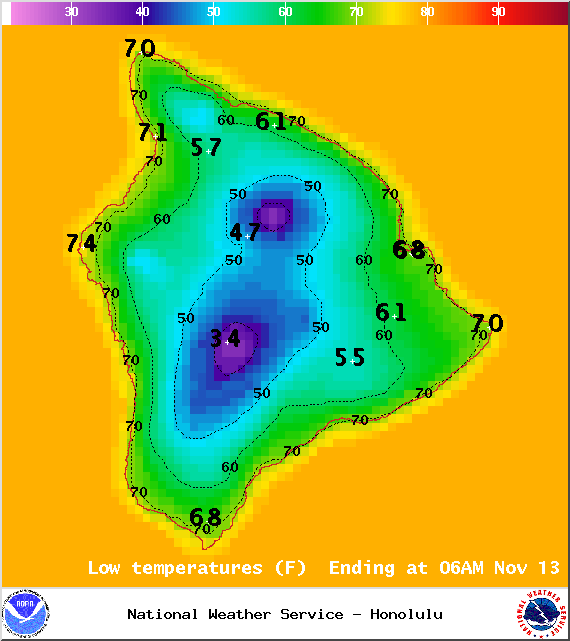
Image: NOAA / NWS
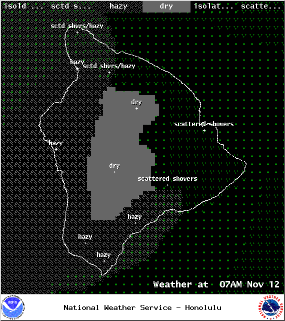
Image: NOAA / NWS
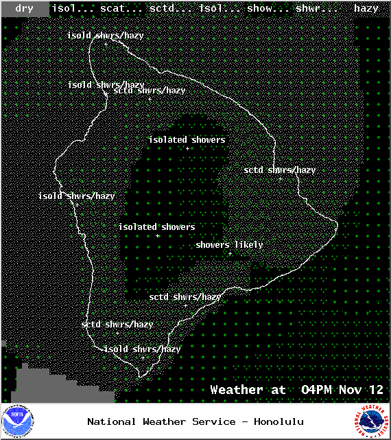
Image: NOAA / NWS
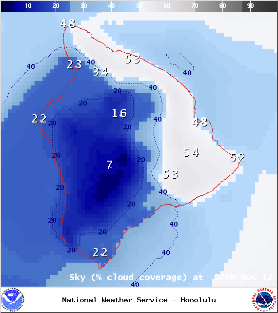
Image: NOAA / NWS
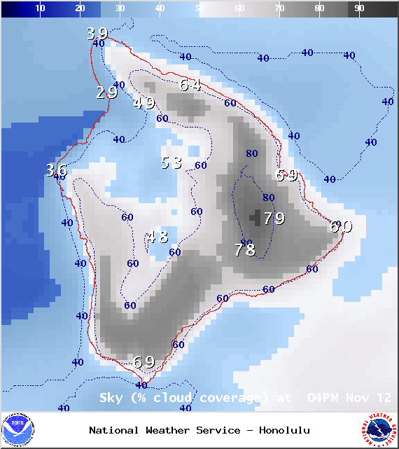
Image: NOAA / NWS
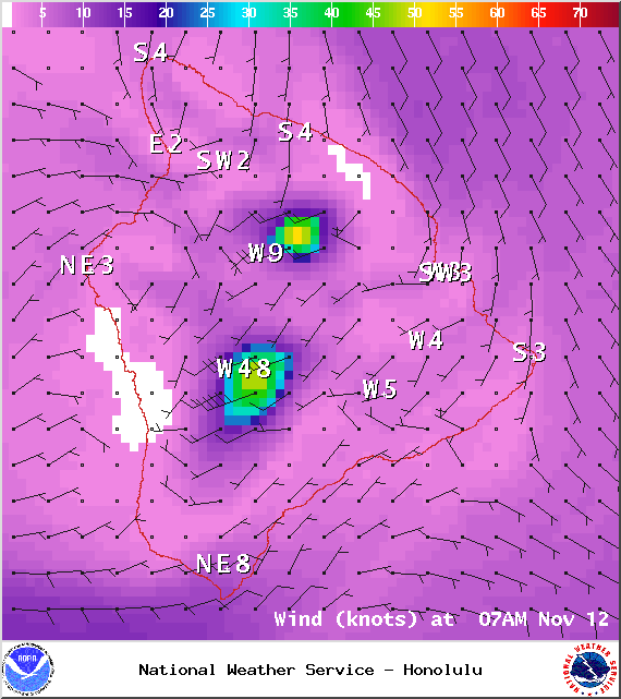
Image: NOAA / NWS
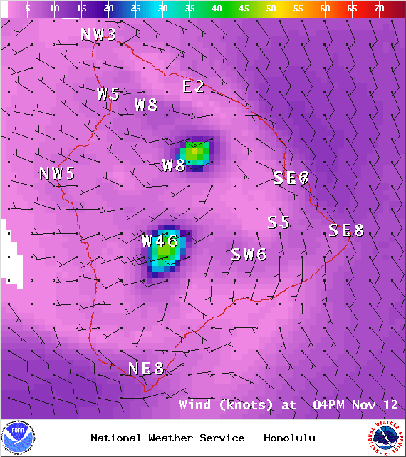
Image: NOAA / NWS
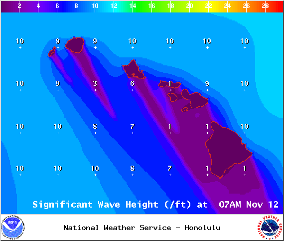
Image: NOAA / NWS
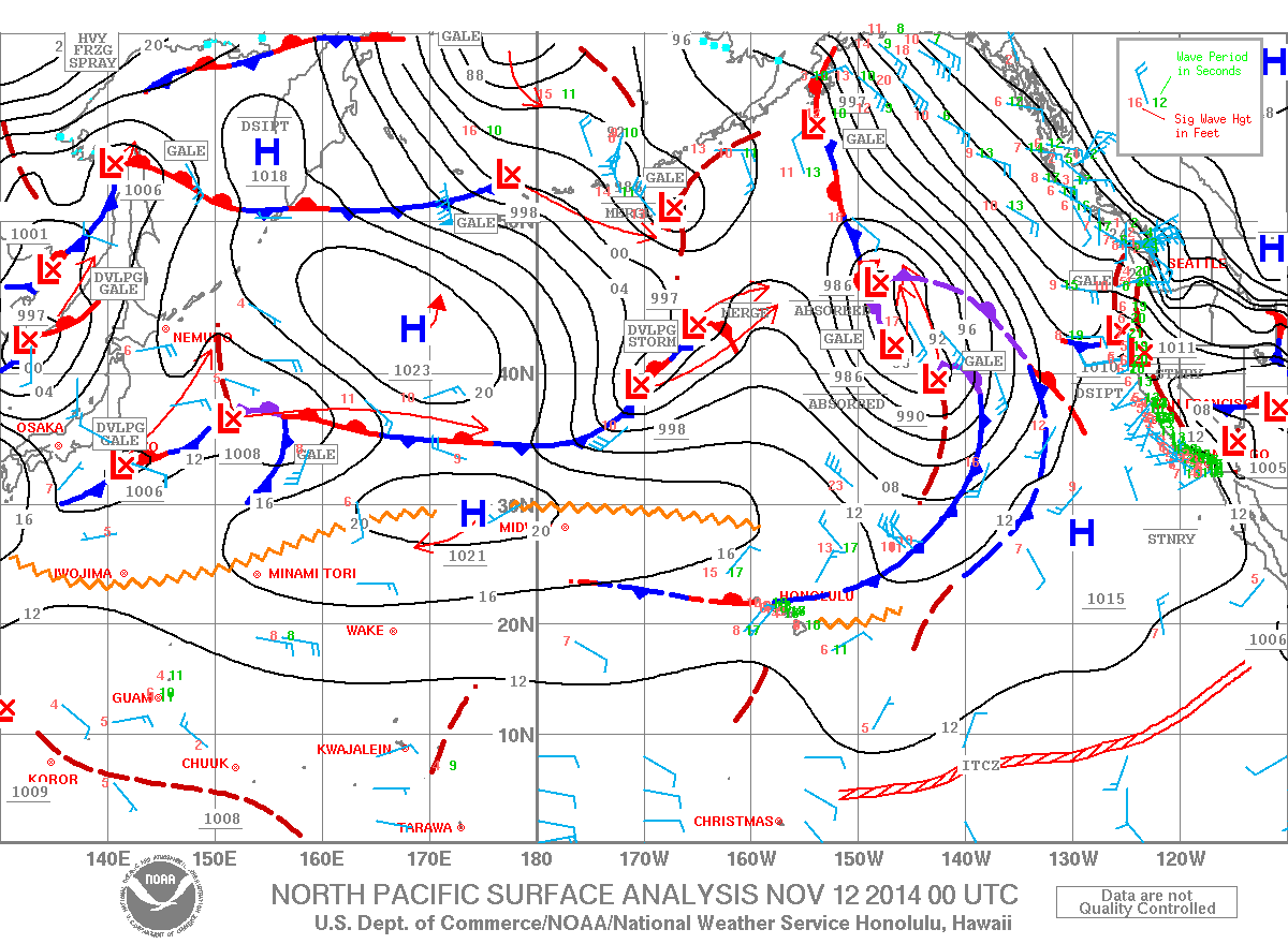
Image: NOAA / NWS
Leeward side / Image: James M Grenz
Sponsored Content


