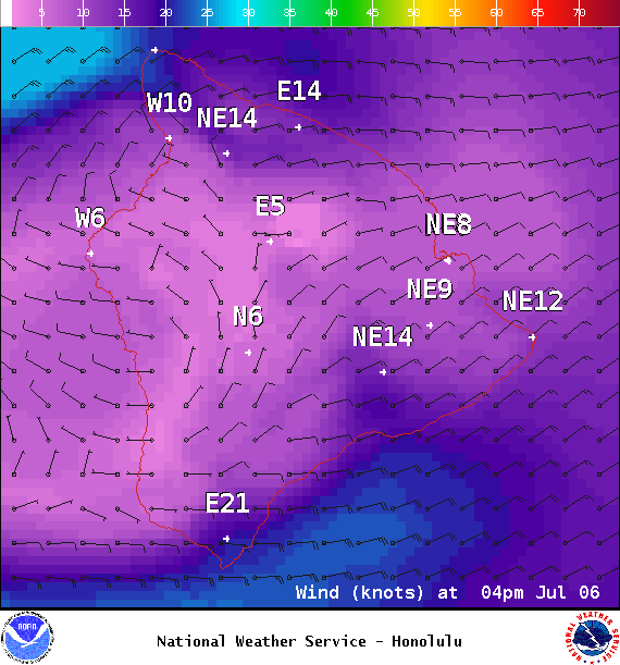
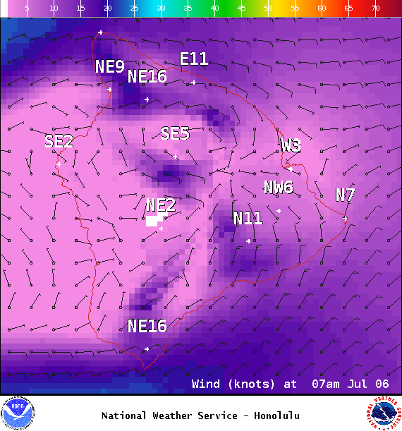
**Click directly on the images below to make them larger. Charts include: Big Island projected winds, tides, swell direction & period and expected wave heights.**
ARTICLE CONTINUES BELOW AD
ARTICLE CONTINUES BELOW AD
+
SWIPE LEFT OR RIGHT
Big Island Surf Forecast
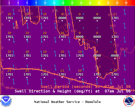
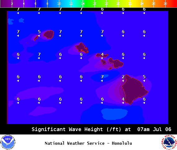
Hilo side: Wave heights for spots exposed to the trade swell are expected to be around waist/head high.
ARTICLE CONTINUES BELOW AD
Kona side: Wave heights are expected to be ankle/knee high today or even flat.
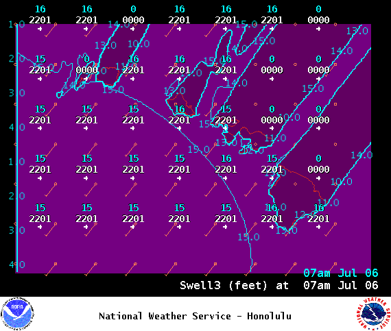
South: Wave heights are expected to be knee high or less today. Strongest around South Point with trade swell filling in.
Small southerly swells are showing for the next few days but fading. We may see another round of swell starting around July 7th and peaking Friday into Saturday morning.
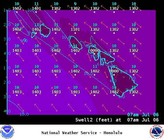
Trade swell will bring surf to northeast exposures but onshore breeze will pick up quickly during the day to chop it up.
ARTICLE CONTINUES BELOW AD
Quiet in the North Pacific at this time. A possible swell may be generated in the Eastern Pacific later this weekend or early next week. If everything stays on track we could see some energy building around the 9th and 10th.
Keep in mind, surf heights are measured on the face of the wave from trough to crest. Heights vary from beach to beach, and at the same beach, from break to break.
This comments section is a public community forum for the purpose of free expression. Although Big Island Now encourages respectful communication only, some content may be considered offensive. Please view at your own discretion. View Comments


 Big Island Surf Forecast
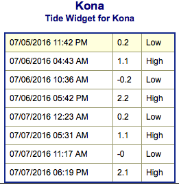 Small southerly swells are showing for the next few days but fading. We may see another round of swell starting around July 7th and peaking Friday into Saturday morning.