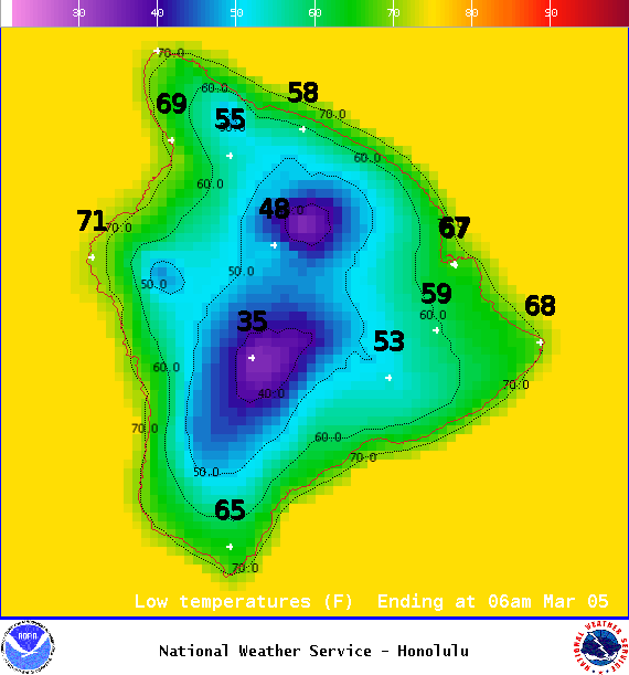
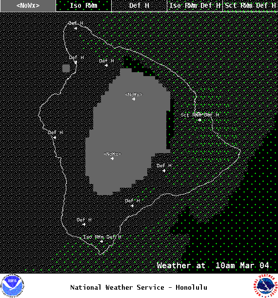
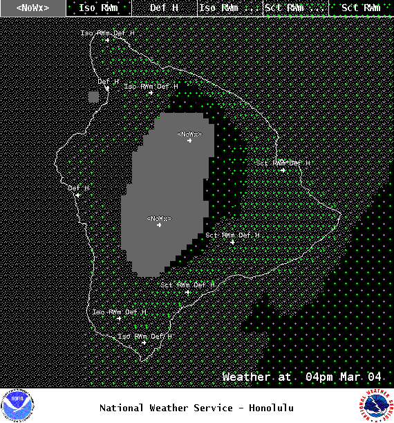
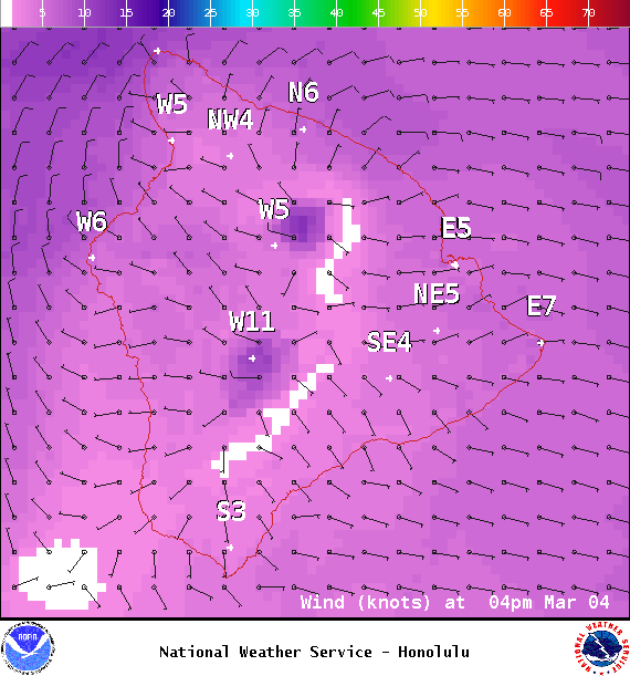
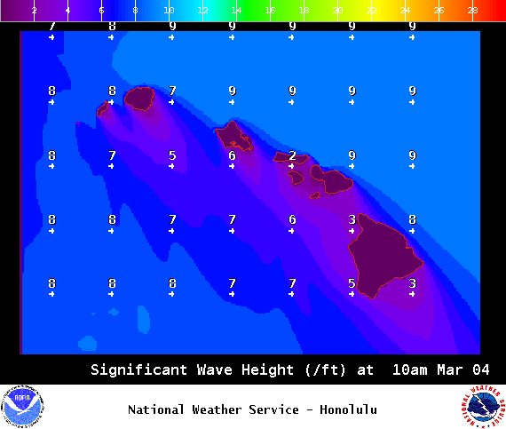
**Click directly on the images below to make them larger. Charts include: Big Island high/low forecasted temperatures, projected winds, chance of cloud cover, projected localized weather conditions, vog/SO2 forecast and expected wave heights.**
+
SWIPE LEFT OR RIGHT
ARTICLE CONTINUES BELOW AD
ARTICLE CONTINUES BELOW AD
Looking Ahead
Light winds with a stable and relatively dry sea and land breeze weather pattern will prevail over most of the Hawaiian islands through this evening, while a weak trade wind flow will continue to produce modest showers along windward facing slopes of the Big Island. Trade winds will briefly return on Saturday, before southerly flow develops on Sunday ahead of a new front approaching from the northwest. This front is expected to push down the island chain on Tuesday and Wednesday, followed by an extended period of breezy northeasterly winds.
ARTICLE CONTINUES BELOW AD
Today
Today we expect partly cloudy skies with isolated windward showers. Leeward spots could see isolated showers in the afternoon but are sunny to start. Hazy skies are expected. High temperatures from 79° to 84°. East winds are expected from 10 to 15 mph.
UV index at 11 (“extreme” exposure level)
ARTICLE CONTINUES BELOW AD
Tonight
East winds are expected from 10 to 15 mph. Low temperatures from 67° to 72° with mostly clear skies and isolated showers.
This comments section is a public community forum for the purpose of free expression. Although Big Island Now encourages respectful communication only, some content may be considered offensive. Please view at your own discretion. View Comments