**A breakdown of expected conditions specific to the Big Island is presented below. Most graphics are provided by the National Weather Service in Honolulu. Click directly on the image to make it larger.**
Alerts
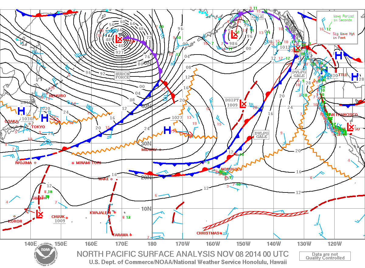
A HIGH SURF ADVISORY has been issued by the National Weather Service for the northeast facing shores of the Big Island from 6:00 am this morning until 6:00 pm Sunday evening.
Expect strong breaking waves, shore break and strong currents making swimming difficult and dangerous. Anyone entering the water could face significant injury due to the dangerous hazards this swell will pose. Boaters are asked to be aware of the increased number of surfers likely to be in the water.
ARTICLE CONTINUES BELOW AD
ARTICLE CONTINUES BELOW AD
A SMALL CRAFT ADVISORY will be posted for the Alenuihaha channel and both Big Island windward and leeward waters from 6:00 pm today through 6:00 am Sunday. North to northeast winds of 25 knots are expected with rough seas up to 11 feet. Inexperienced mariners should avoid navigating in these conditions.
+
SWIPE LEFT OR RIGHT
Today
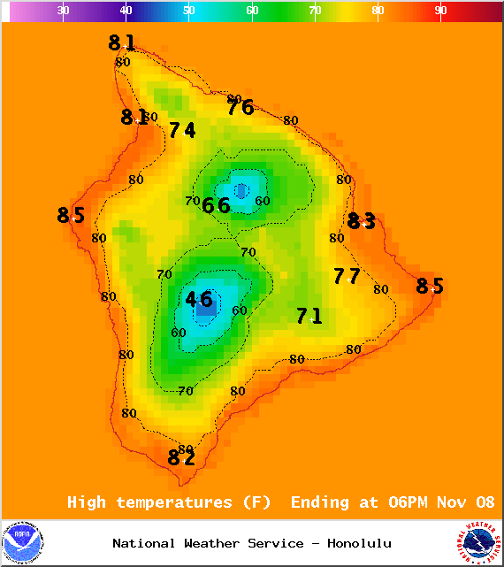
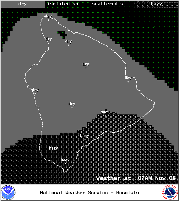
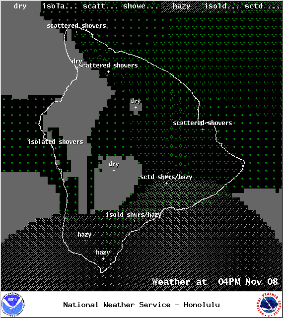
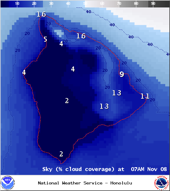
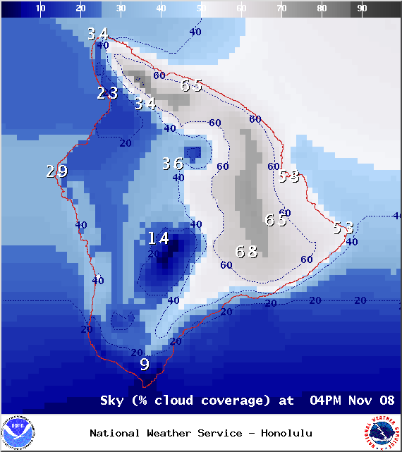
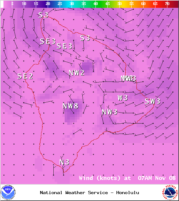
Partly cloudy skies are expected today. Rainfall is likely for the windward side in the afternoon while isolated showers are expected in Kona and along the coast to South Point. Areas of haze are also forecasted. High temperatures should fall in the range of 81° to 86° and around 72° at 5000 feet. In general, north winds around 15 mph are expected.
ARTICLE CONTINUES BELOW AD
Sunrise: 6:25 a.m.
Sunset: 5:43 p.m.
UV index at 6 (“high” exposure level)
Tonight
ARTICLE CONTINUES BELOW AD
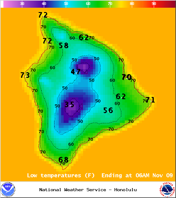
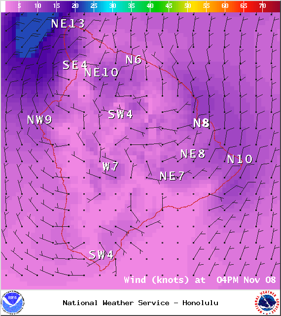
Tonight we should get north winds around 15 mph. Scattered showers are possible windward spots while leeward areas are only expected to get isolated showers. Low temperatures should fall in the range of 69° to 74° with a low of about 57° at 5000 feet.
Moonrise: 7:39 p.m.
Moonset: 9:01 a.m.
Next New Moon: Nov 22 at 2:33 a.m.
Next Full Moon: Dec 6 at 2:27 a.m.
Looking Ahead
A fast moving front is expected to impact Hawaii County late Saturday and clear out by Sunday morning. Cooler temperatures are forecasted today through Monday. Briefly strong northerly winds will follow the front but become lighter and more easterly into next week as frontal showers diminish. Dry conditions are expected in the wake of the front, persisting through at least Veteran’s Day. Another front could impact the state as early as Wednesday.
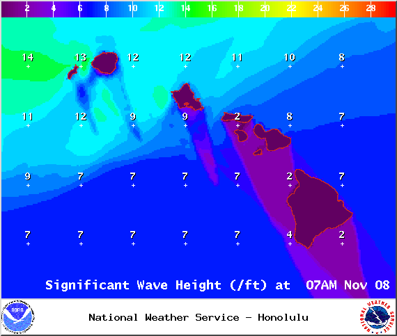
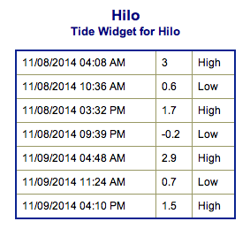
Surf & Seas
Hilo: Surf is expected in the waist to shoulder high range for spots best exposed to the trade swell. The north-northwest is expected to build to head high or bigger by late in the day.
Kona: Surf is expected to be thigh high or less. Breaks not exposed to the swell will be flat today.
South: Best breaks could see waist to chest high waves for spots exposed to the trade swell along the southeast coast. South breaks that are not exposed to the trade swell should see waves thigh high or less.
A new north-northwest swell (320-345°) is expected to build today and peak Sunday morning, peaking with waves overhead to double overhead, maybe even bigger on the sets at the best breaks. Former typhoon Nuri is expected to bring us a solid swell building through Veteran’s day, peaking in the afternoon and into Wednesday with overhead to double overhead waves, maybe even bigger sets at the best exposures despite being heavily shadowed. The Kona side will be significantly smaller but may still catch waves in the waist to chest high range at the best breaks. If the storms develop, we may get a series of swells Thursday through the weekend too.
Small swells generated in the South Pacific are expected to bring us waves in the thigh high or less range. You might see possible plusses at the best tides and exposures but they will be inconsistent at best and most Kona spots will remain flat. There isn’t much on the horizon out of the South Pacific.
Keep in mind, surf heights are measured on the face of the wave from trough to crest. Heights vary from beach to beach, and at the same beach, from break to break.
This comments section is a public community forum for the purpose of free expression. Although Big Island Now encourages respectful communication only, some content may be considered offensive. Please view at your own discretion. View Comments


 Surf & Seas
 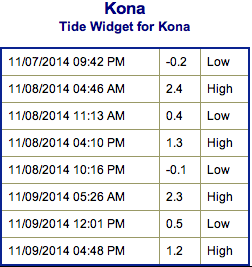 A new north-northwest swell (320-345°) is expected to build today and peak Sunday morning, peaking with waves overhead to double overhead, maybe even bigger on the sets at the best breaks. Former typhoon Nuri is expected to bring us a solid swell building through Veteran’s day, peaking in the afternoon and into Wednesday with overhead to double overhead waves, maybe even bigger sets at the best exposures despite being heavily shadowed. The Kona side will be significantly smaller but may still catch waves in the waist to chest high range at the best breaks. If the storms develop, we may get a series of swells Thursday through the weekend too.