**A breakdown of expected conditions specific to the Big Island is presented below. All graphics are provided by the National Weather Service in Honolulu. Click directly on the image to make it larger.**
+
SWIPE LEFT OR RIGHT
Alerts
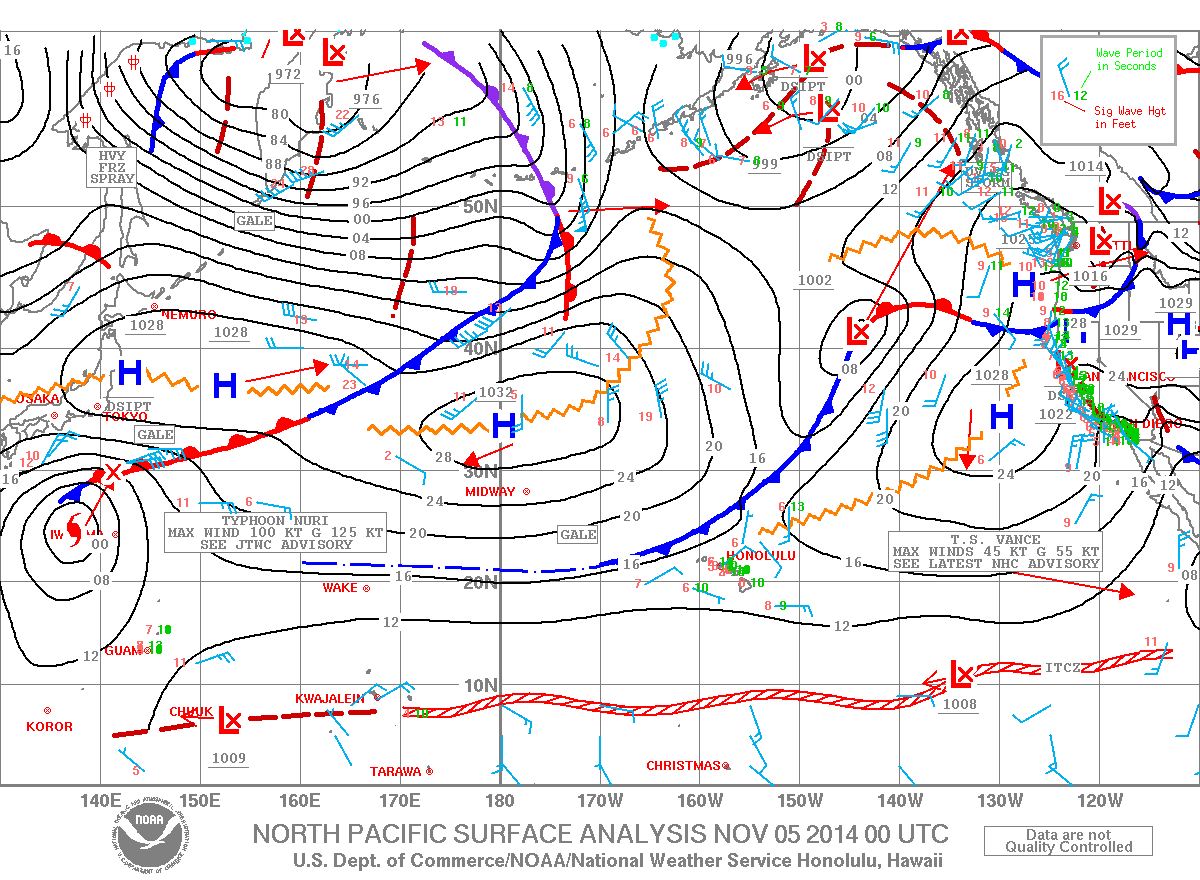
A SMALL CRAFT ADVISORY has been posted for waters near South Point, Big Island leeward waters and the Alenuihaha channel from 9:00 a.m. today until 6:00 a.m. Thursday. Northeast winds of 25 knots are expected with rough seas up to 11 feet. Inexperienced mariners are cautioned to avoid navigating these conditions.
Today
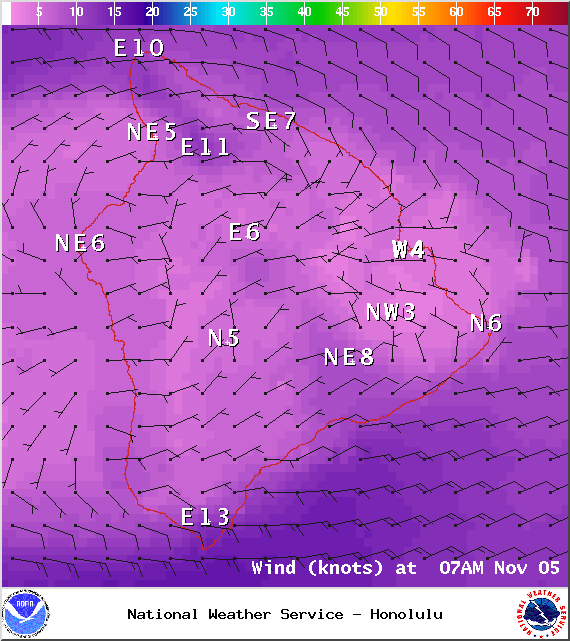
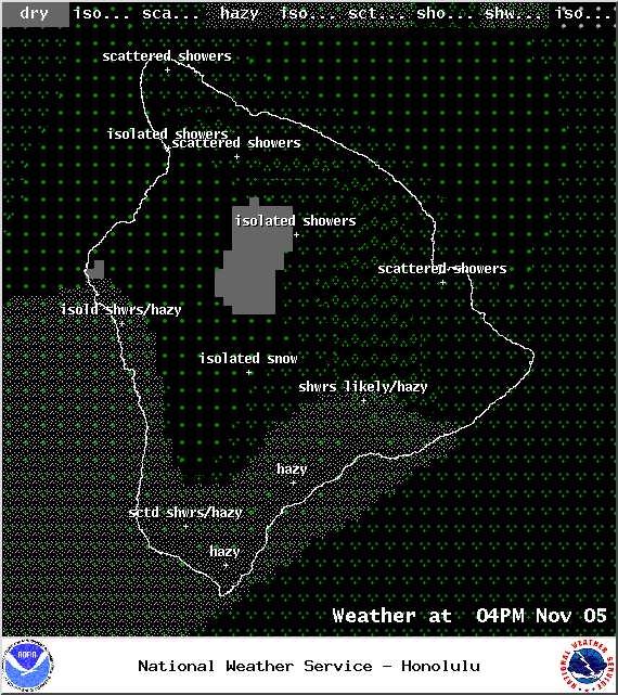
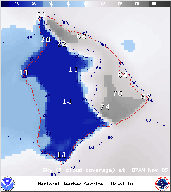
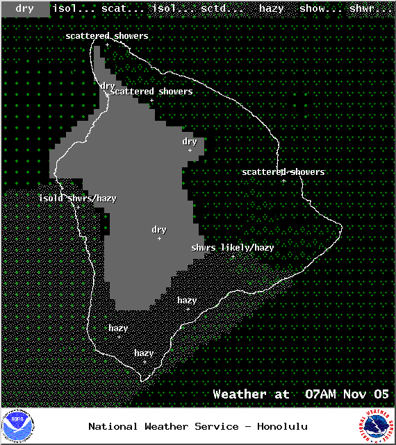
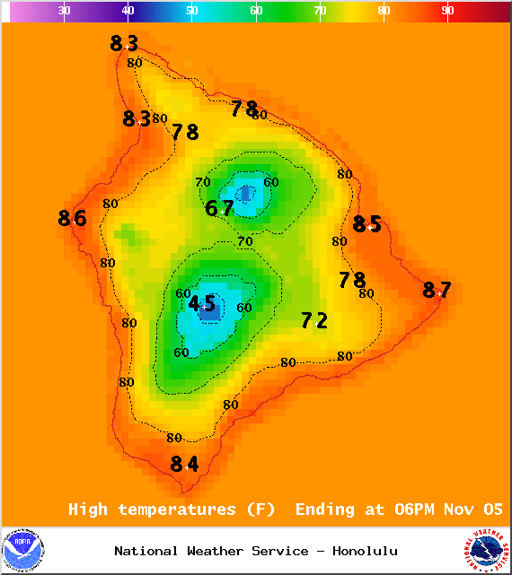
A hybrid weather pattern is expected on the Big Island today. It should not be as muggy as it was yesterday and we don’t expect the afternoon showers to be as intense. The general pattern will be for windward and mauka showers in the morning and cloud cover building in the afternoon for leeward spots. The Kona side can also expect some afternoon showers, but they should be isolated and mainly upslope. High temperatures should fall in the range of 82° to 87° and around 67° – 73° at 5000 feet. In general, trade winds should fall in the 10 – 20 mph range.
ARTICLE CONTINUES BELOW AD
ARTICLE CONTINUES BELOW AD
Sunrise: 6:23 a.m.
Sunset: 5:44 p.m.
UV index at 8 (“very high” exposure level)
Tonight
ARTICLE CONTINUES BELOW AD
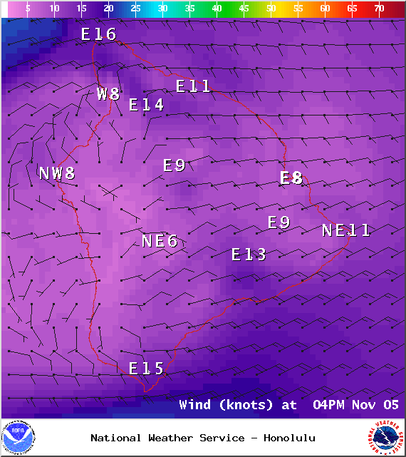
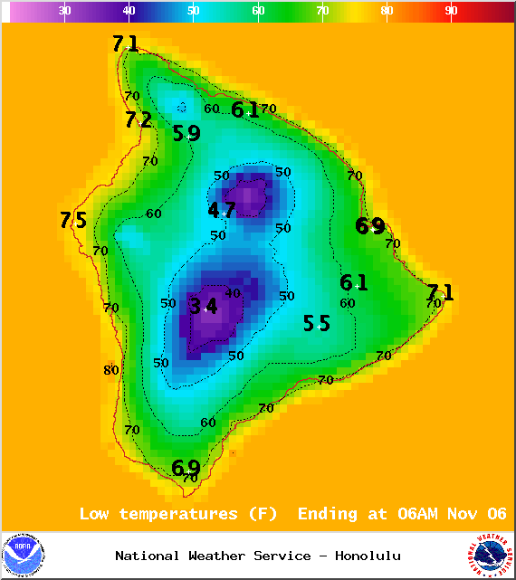
We expect mostly cloudy skies tonight with showers likely for windward and mauka areas. The Kona side is expected to clear in the evening. Low temperatures should fall in the range of 72° to 77° with a low of about 56° at 5000 feet. Trade winds are expected from 10 to 20 mph.
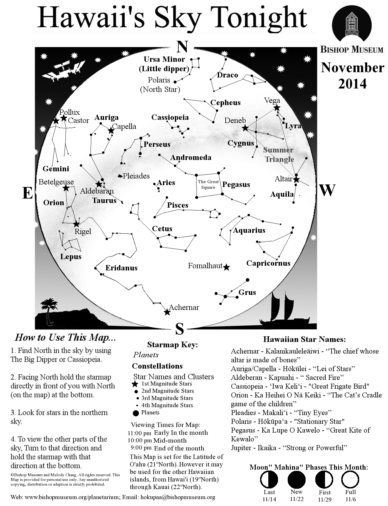
Moonrise: 5:09 p.m.
Moonset: 6:12 a.m.
Next Full Moon: Nov 6, 2014 at 12:23 p.m.
Next New Moon: Nov 22 at 2:33 a.m.
ARTICLE CONTINUES BELOW AD
Looking Ahead
Trade winds are expected to hang around for the next couple of days. Drier conditions are expected through tomorrow as lingering moisture continues to leave our vicinity. Another front is expected to approach the island chain starting Thursday, this will cut our trade winds off again. It’s still too far out to say for sure, but at this point the front is expected to impact the Big Island on Sunday. After the frontal passage, drier conditions will set up behind it.
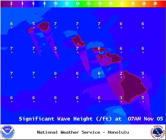
Surf & Seas
Hilo: Surf is expected in the waist to head high range with some plusses for spots best exposed to the trade swell. Spots best exposed to the north-northwest swell should see waist to chest high waves.
Kona: Surf is expected to be thigh high or less. Breaks not exposed to the swell may not see any surf today.
South: Best breaks could see waist to shoulder high waves for spots exposed to the trade swell along the southeast coast. South breaks that are not exposed to the trade swell should see waves thigh high or less.
Our current new northwest swell (315-335°) peaked overnight with a reinforcement on tap out of the north-northwest swell (330-360°) building today and peaking Thursday/Friday in the chest to head high range. The Kona side is not expected to catch this swell at all. Maybe an even bigger swell (310-345°) on the horizon for next weekend, possibly peaking with waves well overhead. Super Typhoon Nuri could possibly bring us a series of solid swells starting around 11/11.
Small swells generated in the South Pacific are expected to bring us waves in the thigh high or less range. You might see possible plusses at the best tides and exposures but they will be inconsistent at best and most Kona spots will remain flat. There isn’t much on the horizon out of the South Pacific.
Keep in mind, surf heights are measured on the face of the wave from trough to crest. Heights vary from beach to beach, and at the same beach, from break to break.
Almanac for Hilo Airport
Maximum Temperature for today:
Normal 82°
Record 86° / Set in 1968 and tied in 1991 and 2006
This comments section is a public community forum for the purpose of free expression. Although Big Island Now encourages respectful communication only, some content may be considered offensive. Please view at your own discretion. View Comments


 Surf & Seas
  Our current new northwest swell (315-335°) peaked overnight with a reinforcement on tap out of the north-northwest swell (330-360°) building today and peaking Thursday/Friday in the chest to head high range. The Kona side is not expected to catch this swell at all. Maybe an even bigger swell (310-345°) on the horizon for next weekend, possibly peaking with waves well overhead. Super Typhoon Nuri could possibly bring us a series of solid swells starting around 11/11.