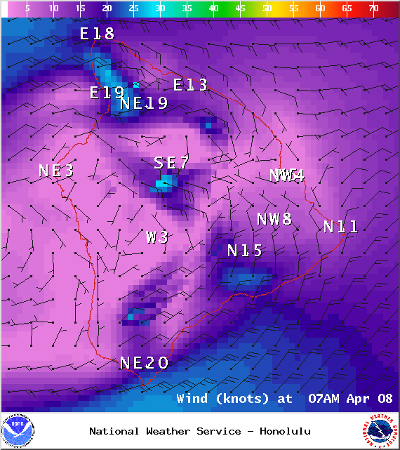
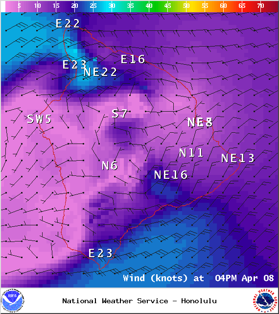
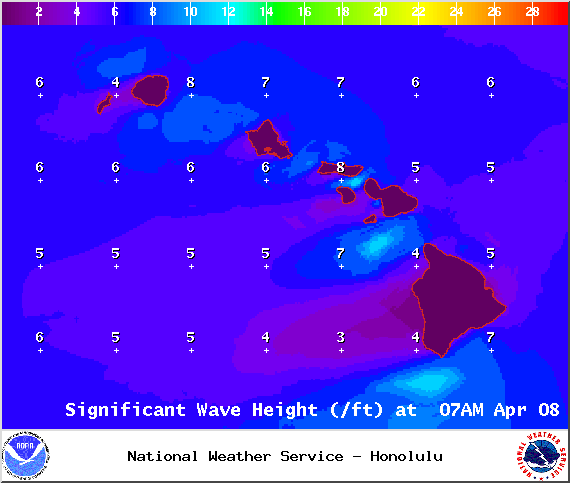
A Small Craft Advisory is posted for the ʻAlenuihāhā channel as well as waters to the south and west of the Big Island through 6:00 p.m. Thursday for east winds up to to 25 knots and rough seas up to 11 feet. Inexperienced mariners should avoid navigating in these conditions.
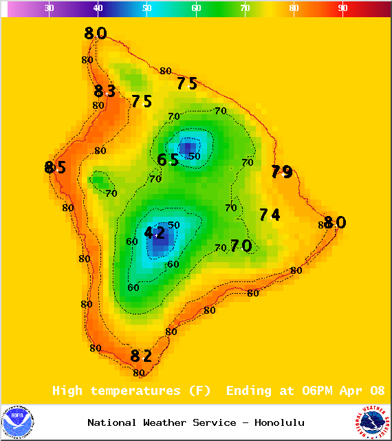
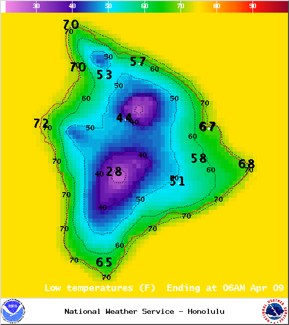
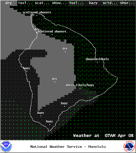
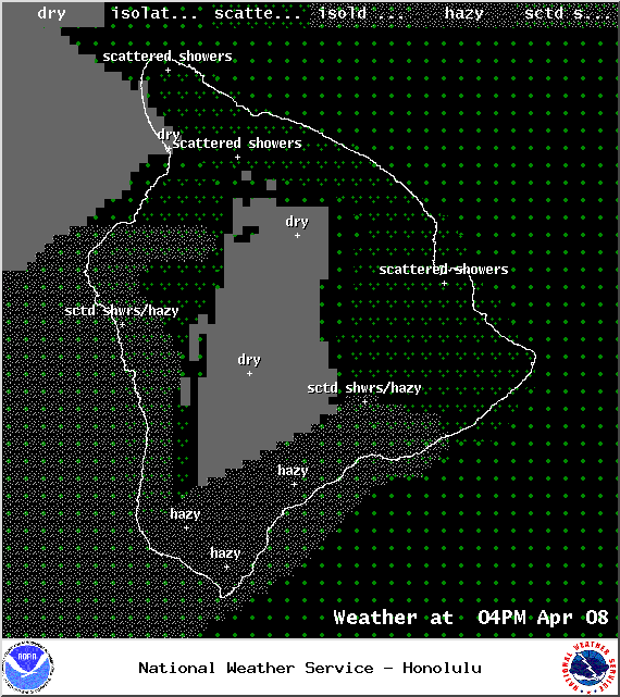
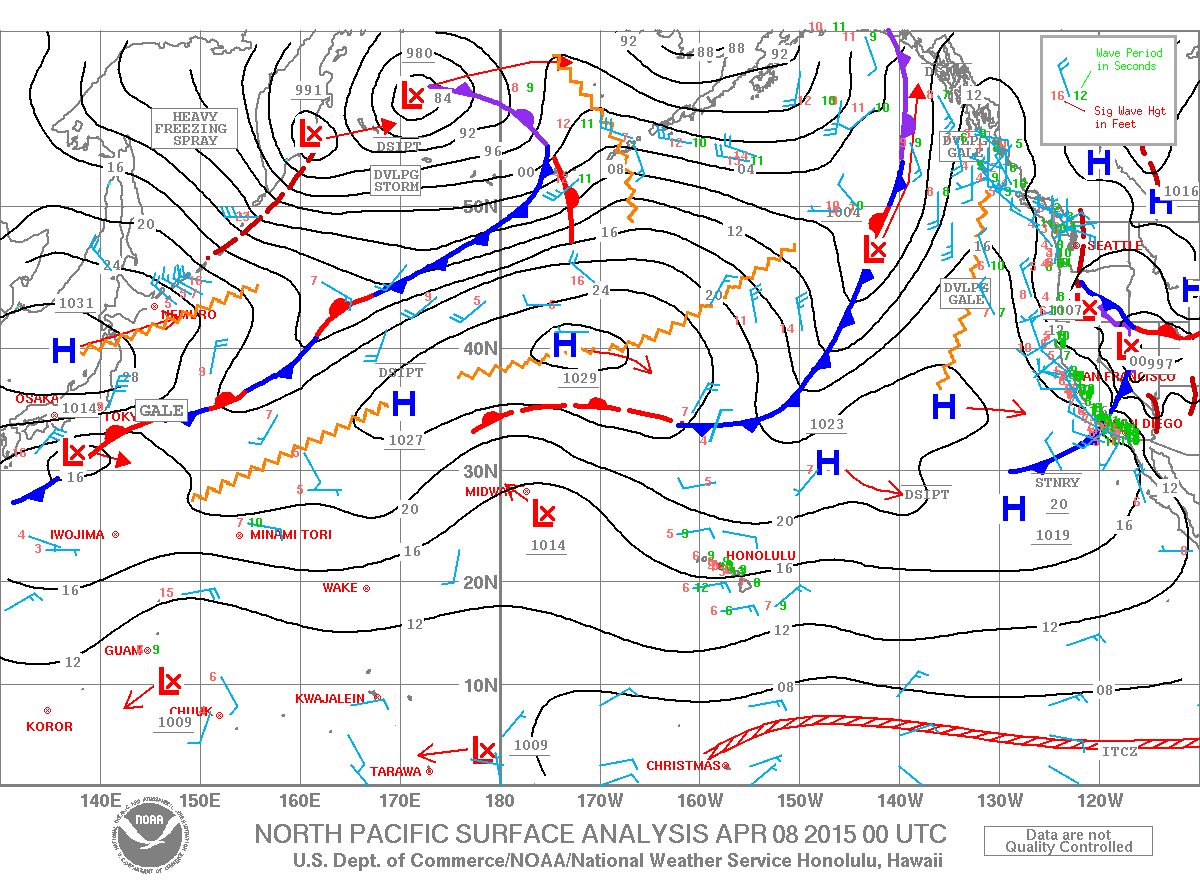
**Click directly on the images below to make them larger. Charts include: Big Island high/low forecasted temperatures, projected winds, chance of cloud cover, projected localized weather conditions, vog/SO2 forecast and expected wave heights.**
+
SWIPE LEFT OR RIGHT
Today
ARTICLE CONTINUES BELOW AD
ARTICLE CONTINUES BELOW AD
Mostly cloudy skies are in the forecast with scattered windward showers. Mostly sunny skies are expected for leeward areas in the morning with building cloud cover and scattered showers in the afternoon. Briefly heavy downpours are possible. Trade winds are forecasted from 15 to 30 mph with gusts up to 40 mph. High temperatures from 80° to 85°.
UV index at 10 (“very high” exposure level)
Tonight
ARTICLE CONTINUES BELOW AD
Showers are likely in windward and mauka areas tonight. Leeward spots are expected to have mostly cloudy skies and scattered showers in the evening, then some clearing. Trade winds are forecasted from 15 to 30 mph with higher gusts. Low temperatures from 67° to 73° are expected.
Looking Ahead
Gusty trade winds are expected through the weekend. Off and on showers should continue across windward areas with some rainfall blowing over to leeward locations of the smaller islands from time to time. The Kona side of the Big Island will have afternoon clouds and showers with some local downpours.
This comments section is a public community forum for the purpose of free expression. Although Big Island Now encourages respectful communication only, some content may be considered offensive. Please view at your own discretion. View Comments