**Click directly on the images below to make them larger. Charts include: Big Island high/low forecasted temperatures, projected winds, chance of cloud cover, projected localized weather conditions, vog/SO2 forecast and expected wave heights.**
+
SWIPE LEFT OR RIGHT
Today
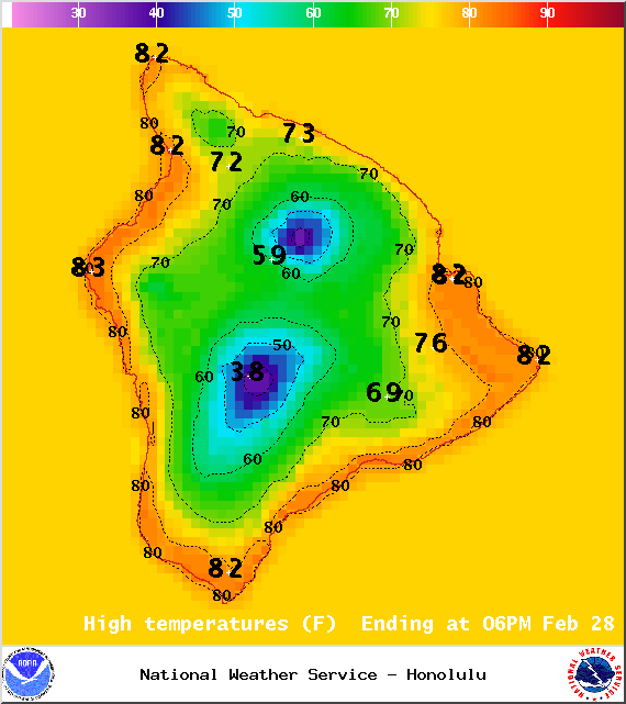
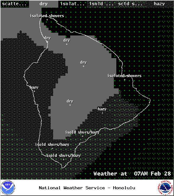
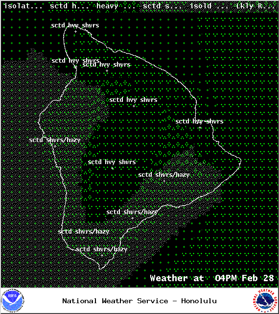
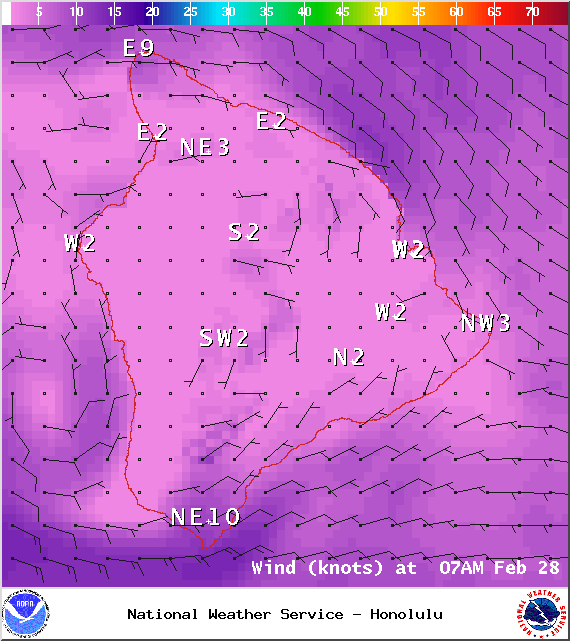
We expect partly cloudy skies this morning with cloudier skies expected as we go through the day. Scattered showers are expected in the afternoon. Some of these showers could be locally heavy. Areas of haze are expected over much of the Big Island today (see UHSOEST vog model). Variable winds are forecasted up to about 15 mph. High temperatures from 78° to 83°.
ARTICLE CONTINUES BELOW AD
ARTICLE CONTINUES BELOW AD
UV index at 8 (“very high” exposure level)
Tonight
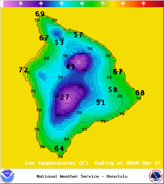
Mostly cloudy skies are expected with scattered showers and areas of haze. East winds are forecasted around 15 mph. Low temperatures from 67° to 72° are expected.
Next Full Moon: 8:06 a.m. on Mar. 5
ARTICLE CONTINUES BELOW AD
Sunday
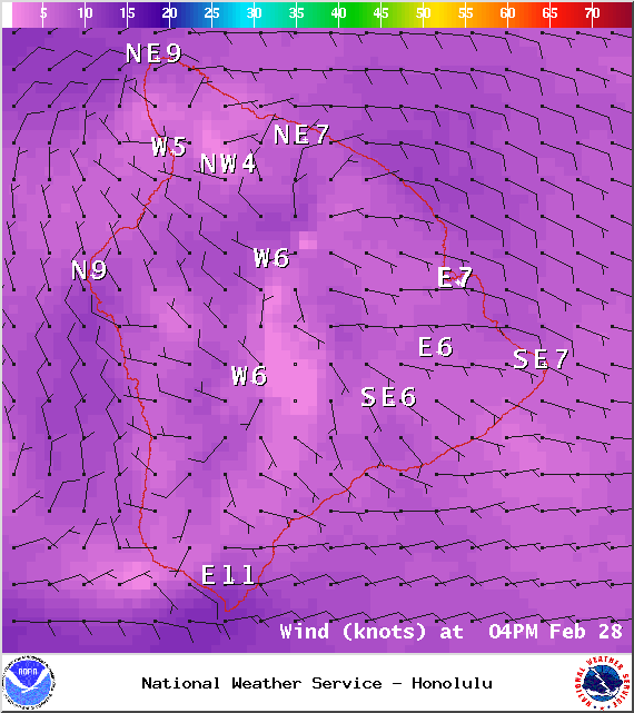
Windward spots are expected to be mostly cloudy with showers likely. The Kona side is forecasted to get partly to mostly cloudy skies with mainly scattered afternoon showers. Winds are forecasted out of the east around 15 mph. High temperatures from 78° to 83° and low temperatures from 67° to 73°.
Looking Ahead
ARTICLE CONTINUES BELOW AD
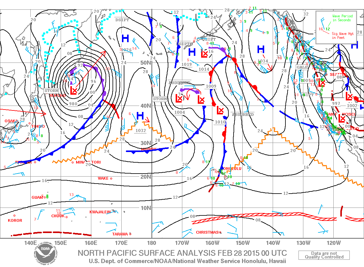
A weak front will drift slowly east through Saturday, disrupting the trade wind flow and acting as a focus for enhanced showers across the central and eastern parts of the state. An upper level trough lingering over the state will maintain a chance of locally heavy showers near the front, mainly during the afternoon hours as sea breezes drive convection. Drier weather will prevail across the western part of the state. Trade winds will rebuild on Sunday and continue into next week, with wet conditions developing across windward and mauka areas.
This comments section is a public community forum for the purpose of free expression. Although Big Island Now encourages respectful communication only, some content may be considered offensive. Please view at your own discretion. View Comments