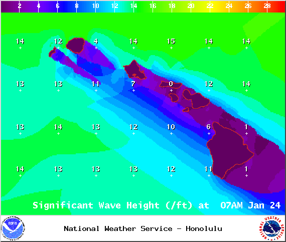
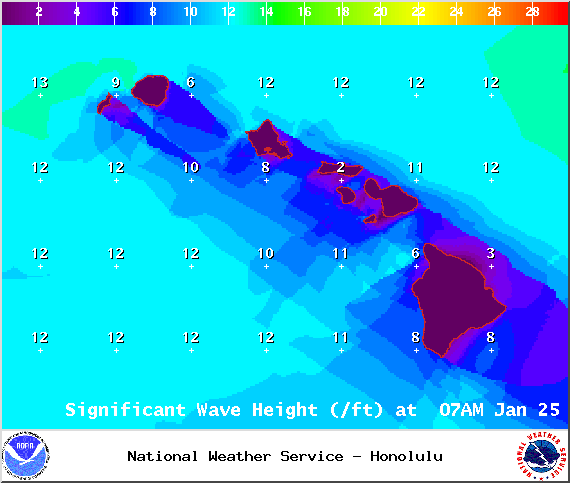
A Marine Weather Statement has been issued by the National Weather Service for a very large west-northwest swell. The Weather Service in Honolulu is warning of strong harbor surges and large breaking waves at harbor entrances exposed to the swell. Some locations that could expect such conditions are the Kawaihae and Honokohau harbors.
The High Surf Warning has been extended for the west side of the Big Island. The warning is posted through Sunday at 6:00 a.m. Wave heights of 10 to 15 foot faces are expected. Expect ocean water occasionally sweeping across portions of beaches, very strong breaking waves and strong longshore and rip currents. Breaking waves may occasionally impact harbors making navigating the harbor channel difficult. Large breaking surf, significant shore break and dangerous currents will make entering the water very hazardous. Boaters should be aware of an increased number of surfers in the water.
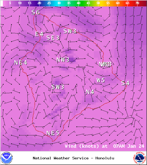
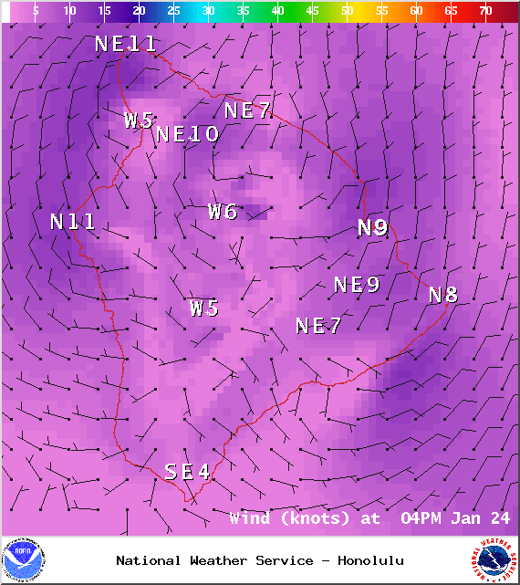
A Small Craft Advisory has been issued for all island waters through 6:00 a.m. Sunday for winds from 15 to 25 knots and rough seas of 7 to 17 feet.
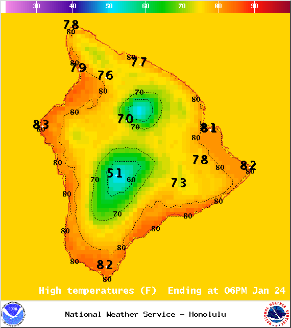
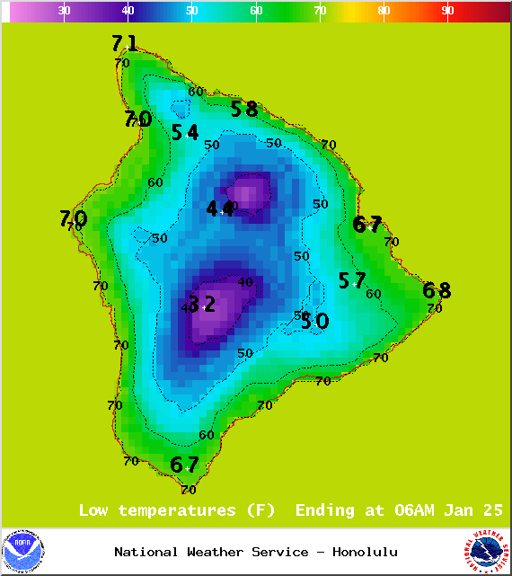
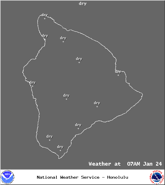
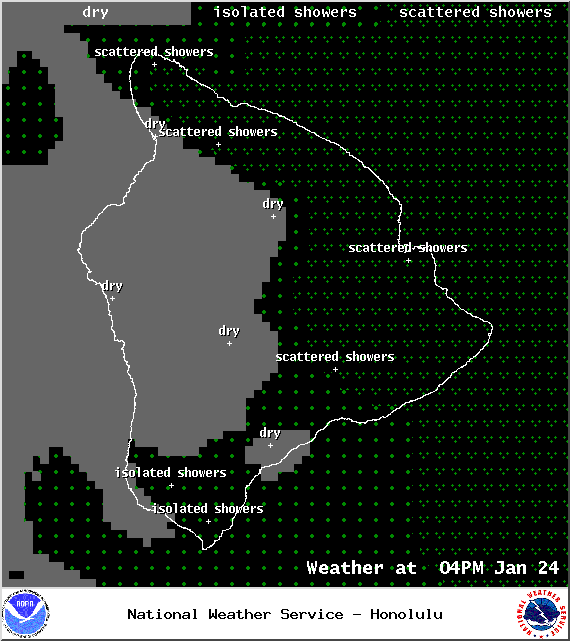
**Click directly on the images below to make them larger. Charts include: Big Island high/low forecasted temperatures, projected winds, chance of cloud cover, projected localized weather conditions, vog/SO2 forecast and expected wave heights.**
+
SWIPE LEFT OR RIGHT
ARTICLE CONTINUES BELOW AD
ARTICLE CONTINUES BELOW AD
Today
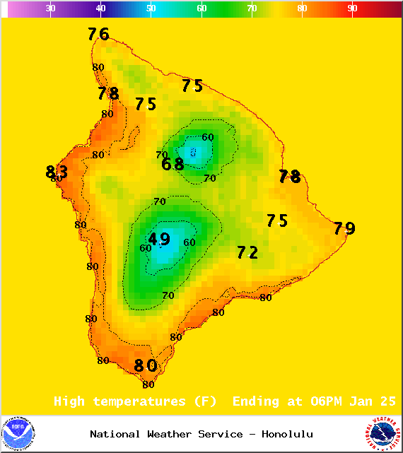
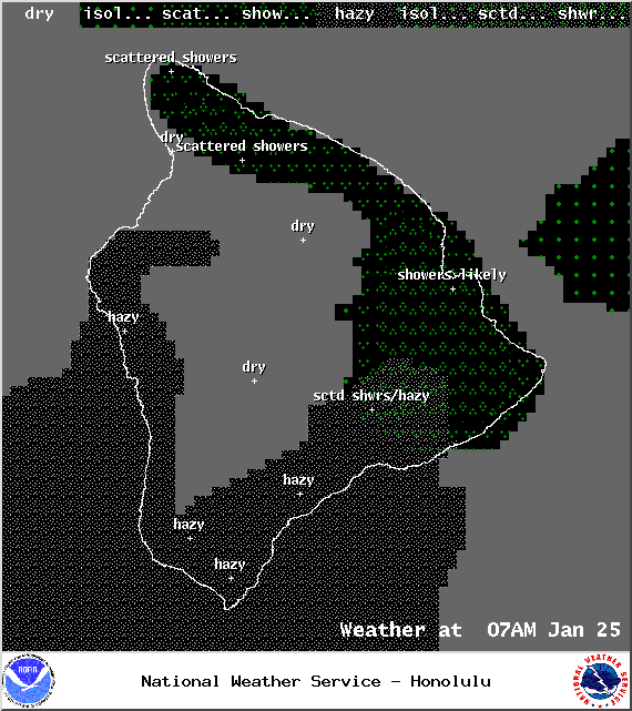
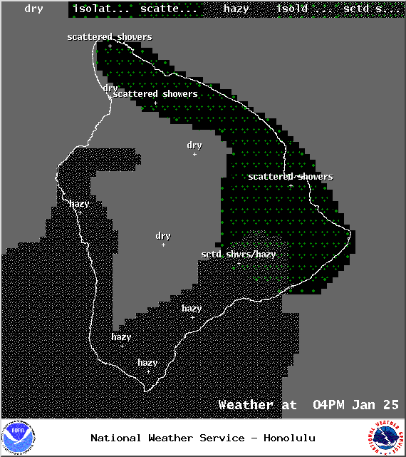
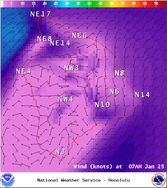
Partly sunny skies are expected today. Windward spots can expect scattered showers in the afternoon. Variable winds up to 15 mph are forecasted. Haze is expected to spread into the Hilo side of the island as well today (see UHSOEST vog model above). Afternoon sea breezes are expected to bring cloud cover and possible showers to the leeward side. High temperatures should fall in the range of 81° to 86°.
Sunrise: 6:57 a.m.
Sunset: 6:08 p.m.
UV index at 6 (“high” exposure level)
ARTICLE CONTINUES BELOW AD
Tonight
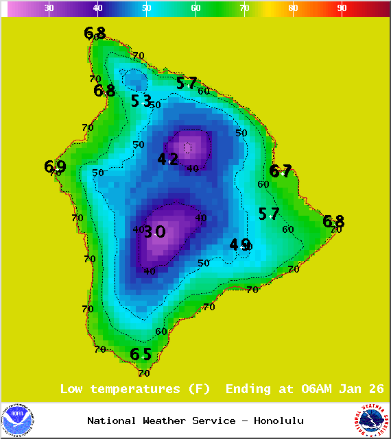
Partly cloudy skies are expected with scattered windward and mauka showers. Northeast winds up to 15 mph are expected. Low temperatures are forecasted from 68° to 73° degrees.
Moonrise: 10:16 a.m.
Moonset: 10:51 p.m.
ARTICLE CONTINUES BELOW AD
Next Full Moon: 1:09 p.m. on Feb. 3
Next New Moon: 1:47 p.m. on Feb. 18
Sunday
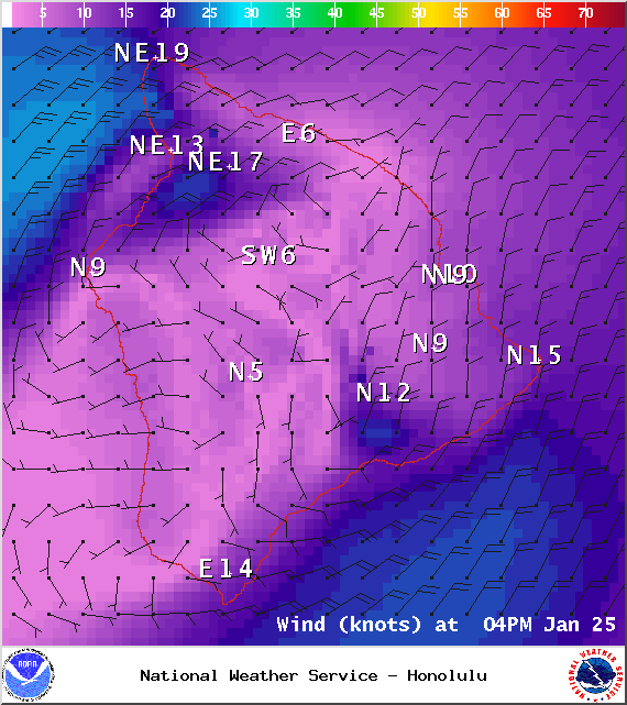
Mostly cloudy skies are expected for windward spots with scattered showers. Leeward areas should be mostly clear to start with afternoon cloud cover. Hazy skies are again in the forecast with land and sea breeze patterns setting up for the Big Island. Highs from 81° to 87° and lows from 64° to 70°. Trade winds are expected from 5° to 20°.
Sunrise: 6:57 a.m.
Sunset: 6:08 p.m.
UV index at 6 (“high” exposure level)
Looking Ahead
A front is expected to stall and weaken Sunday with showers expected to linger over windward Big Island. Winds will shift out of the north after the front passes, bringing cool and dry conditions. Dry northeast trade winds are expected Sunday and will continue through midweek. Another front is expected to reach the islands late next week.
This comments section is a public community forum for the purpose of free expression. Although Big Island Now encourages respectful communication only, some content may be considered offensive. Please view at your own discretion. View Comments