The U.S. Geological Survey released these photos of the Lower East Rift Zone taken on March 29, and April 2, 2019.
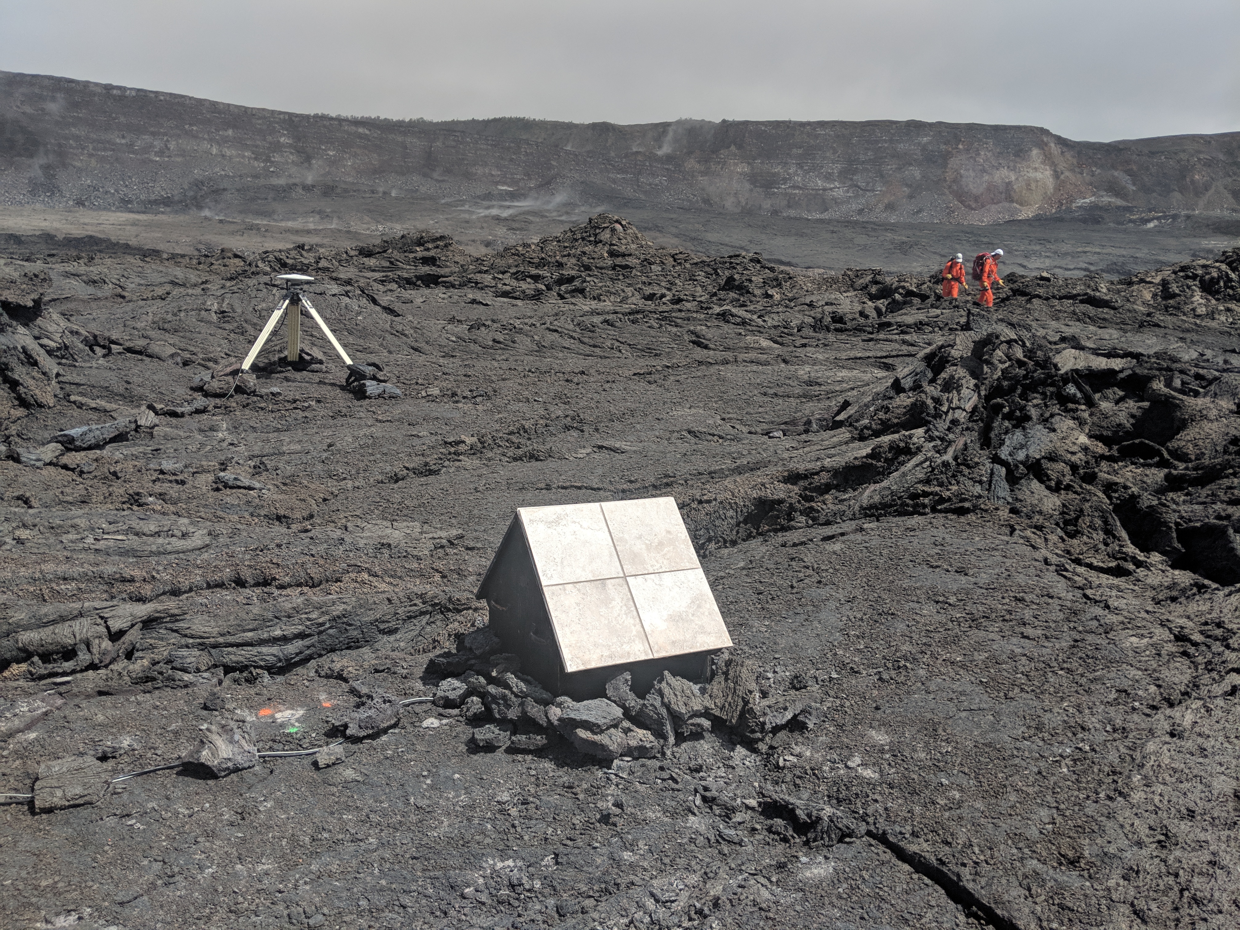
Scientists (in orange flight suits) hike toward one of HVO’s monitoring stations within Kīlauea caldera. The tripod supports a GPS antenna that provides information on deformation of the volcano. The doghouse-like structure (foreground) houses a gravimeter, which measures changes in subsurface mass over time.
Scientists (in orange flight suits) hike toward one of HVO’s monitoring stations within Kīlauea caldera. Click to enlagre. PC: USGS photo by M. Poland, 03/25/2019
Together, these two instruments keep continuous watch on changes in surface deformation and the gravity field, both of which are useful indicators of future magmatic activity at Kīlauea.
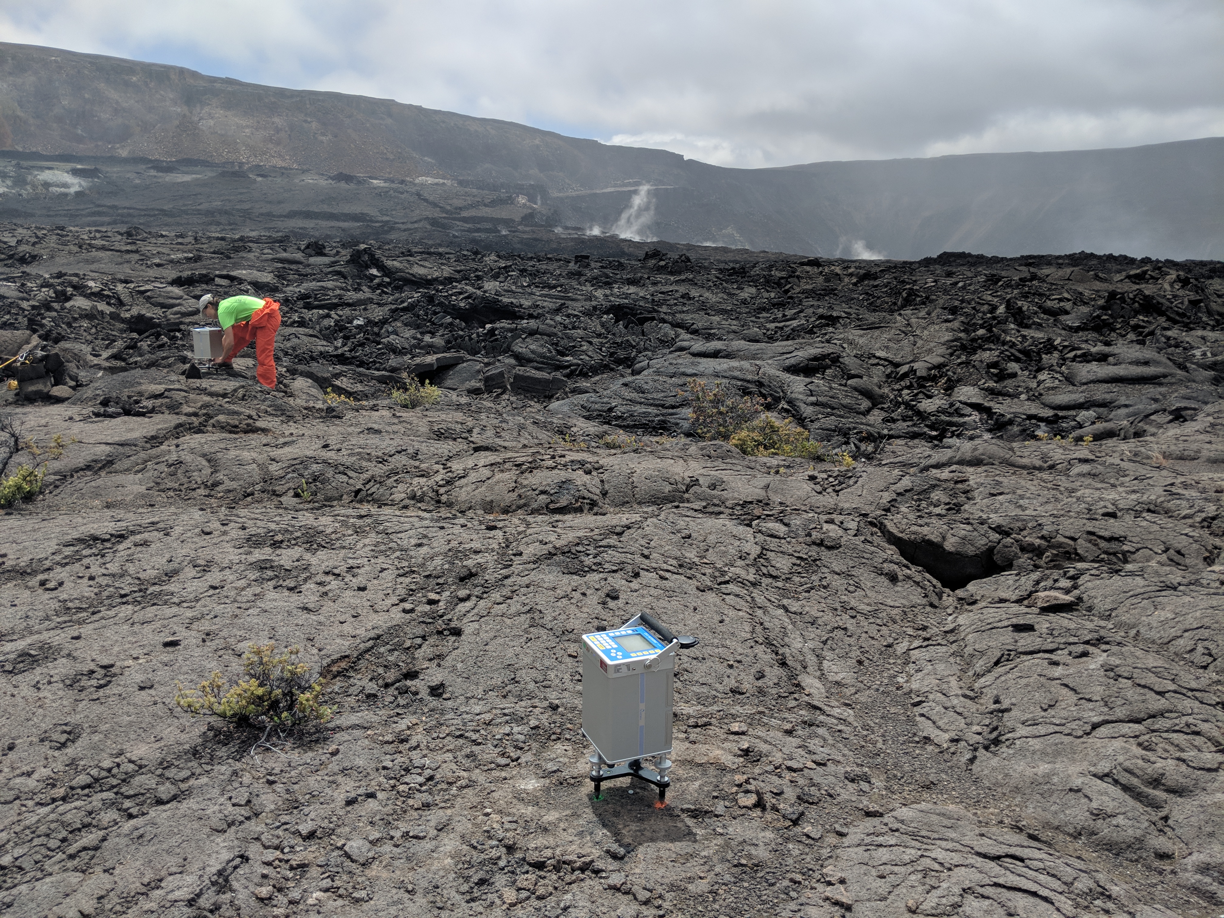
A scientist takes a gravity reading at a station located on the down-dropped block of Kīlauea caldera, which subsided as an intact structure, while a second gravity instrument (foreground) records data.
Remeasuring the stations now and comparing the data to previous results could provide information on what’s happening below ground within the volcano’s shallow magmatic system. Click to enlarge. PC: USGS photo by M. Poland, 03/25/2019.
Many of the preexisting gravity stations, which have been measured for years, survived Kīlauea’s 2018 summit collapse.
ARTICLE CONTINUES BELOW AD
ARTICLE CONTINUES BELOW AD
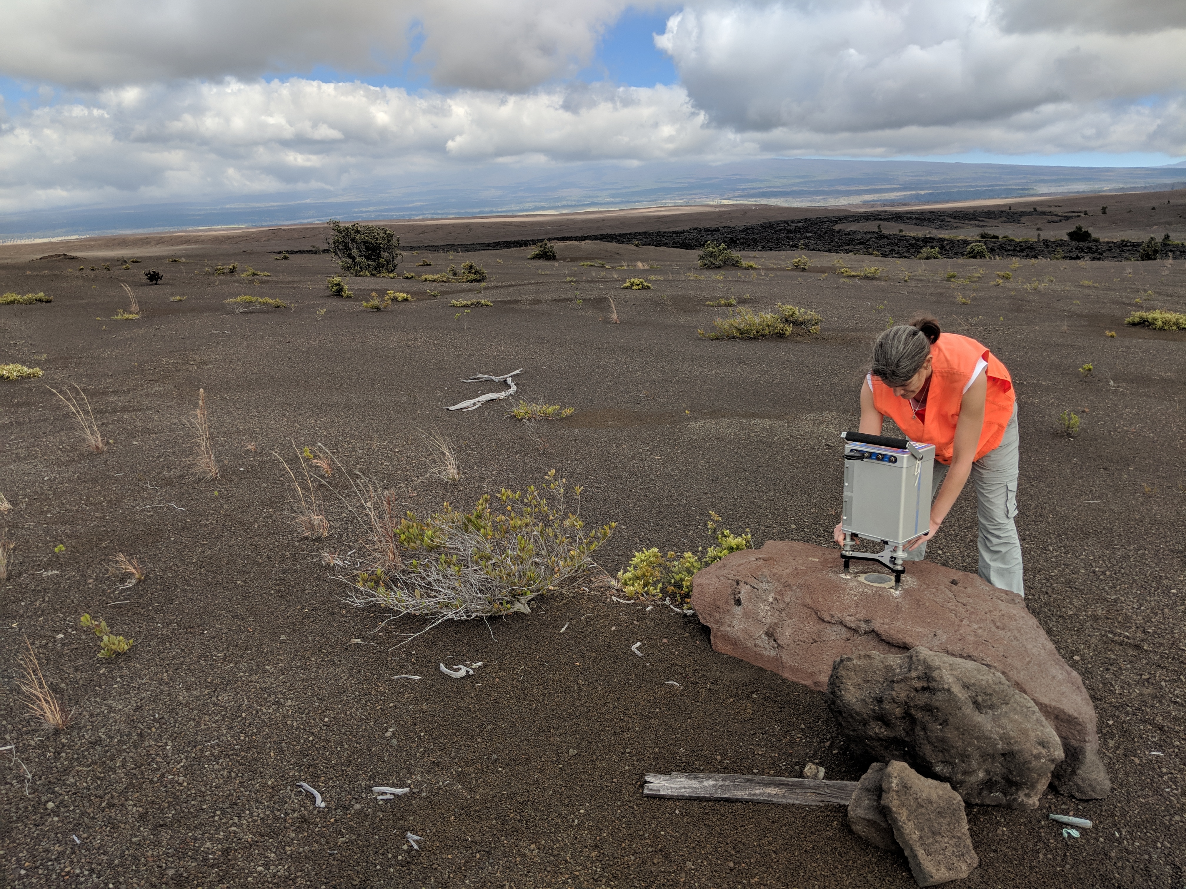
A closer view of a gravity reading at a station located in the south part of Kīlauea caldera. When repeated over time, gravity measurements can detect changes in subsurface mass that might not be detectable by other monitoring methods.
Scientists track this data because the changes could be related to magma movement within the volcano. Click to enlarge. PC: USGS photo by M. Poland, 03/20/2019.
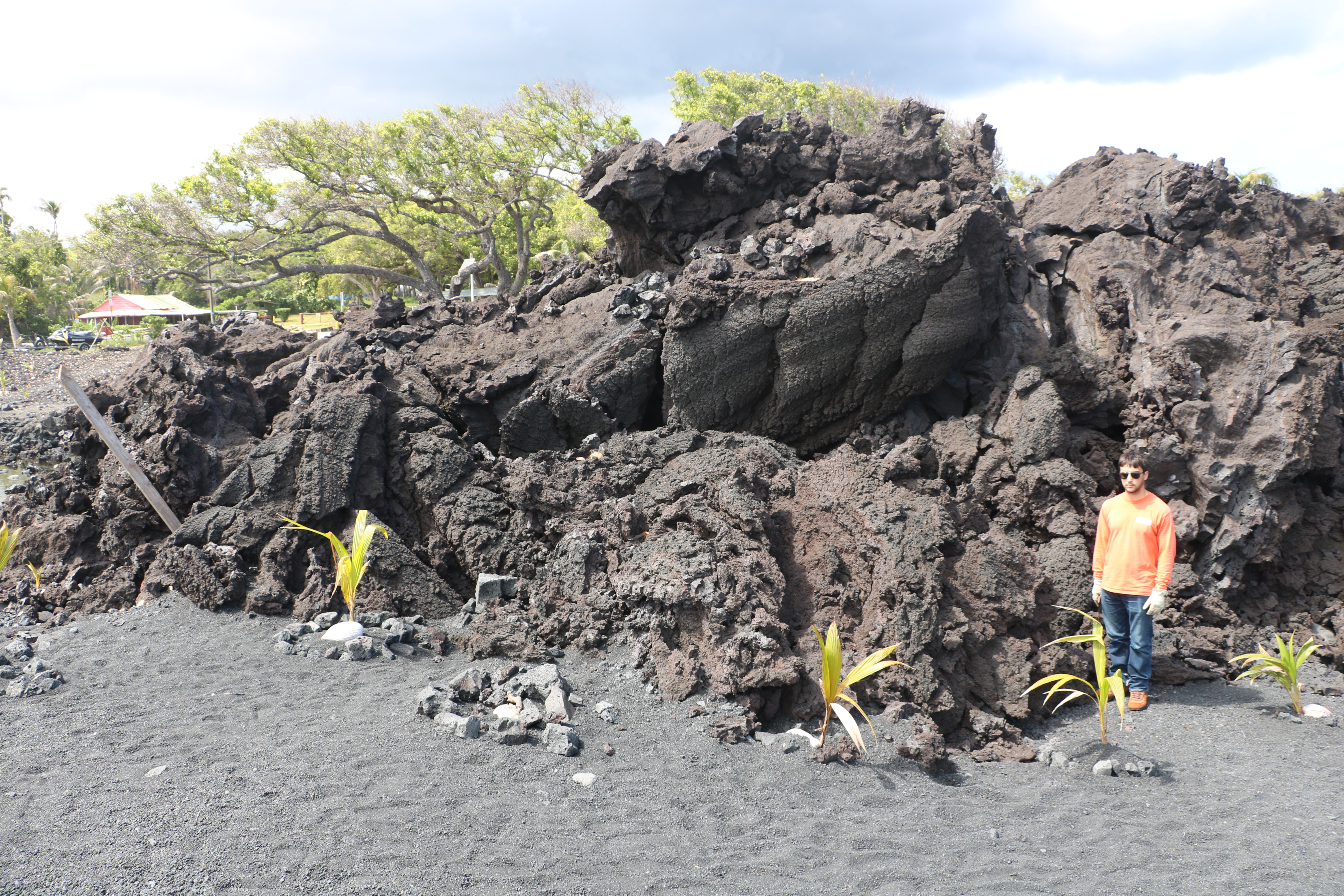
HVO geologists (one shown here for scale) examined Kīlauea Volcano’s 2018 lava flow near Isaac Hale Beach Park on March 29. This part of the lower East Rift Zone Fissure 8 flow is mostly “toothpaste lava”—an informal name for secondary spiny pāhoehoe lava that oozed out from the stalled primary ‘a‘ā flow that reached the coast.
This lobe, classic toothpaste lava, is about 3-4 m (9–13 ft) thick and about 70 m (76–77 yds) long. Click to enlarge. PC: USGS photo by M. Patrick.
A closer view of the “toothpaste lava” (glove for scale) spiny texture, which can result in serious injury if people fall while attempting to walk on it.
Toothpaste lava. Click to enlarge. PC: USGS photo by M. Patrick.
Because folks have already been hurt, the county advises people to avoid this hazard by staying off the lava flow.
ARTICLE CONTINUES BELOW AD
Activity Summary: Kīlauea Volcano is not erupting. Monitoring data over the past eight months have shown relatively low rates of seismicity, deformation, and gas emission at the summit and East Rift Zone (ERZ) including the area of the 2018 eruption.
As of last week, Kīlauea Volcano is at NORMAL/GREEN. For definitions of USGS Volcano Alert Levels and Aviation Color Codes.
Despite this classification, Kīlauea remains an active volcano, and it will erupt again. Although we expect clear signs prior to a return to eruption, the time frame of warning may be short. Island of Hawaiʻi residents should be familiar with the long-term hazard map for Kīlauea Volcano and how to stay informed about Kīlauea activity.
Observations: This past week saw no significant change in monitoring data or volcanic activity. Low rates of seismicity continue across the volcano, with earthquakes occurring primarily in the summit and south flank regions. GPS stations and tiltmeters continue to show motions consistent with refilling of the deep East Rift Zone magma reservoir. Sulfur dioxide emission rates from the summit and from Puʻu ʻŌʻō remain low. These rates have been steady over the past several months.
ARTICLE CONTINUES BELOW AD
A GPS station on the north flank of Puʻu ʻŌʻō has been showing steady slumping of the craters edge, and the motion has continued this week. This motion is not directly related to magmatic activity, but is interpreted to be sliding of the unstable edge of Puʻu ʻŌʻō cone. Small collapses at Puʻu ʻŌʻō have occurred since the eruption due to instability.
Hazards remain in the lower East Rift Zone eruption area and at the Kīlauea summit. Residents and visitors near the 2018 fissures, lava flows, and summit collapse area should heed Hawai‘i County Civil Defense and National Park warnings. Hawai‘i County Civil Defense advises that lava flows and features created by the 2018 eruption are primarily on private property and persons are asked to be respectful and not enter or park on private property.
The Hawaiian Volcano Observatory (HVO) continues to closely monitor Kīlauea’s seismicity, deformation, and gas emissions for any sign of increased activity. HVO maintains visual surveillance of the volcano with web cameras and occasional field visits. HVO will continue to issue a weekly update (every Tuesday) until further notice, and we will issue additional messages as warranted by changing activity.
This comments section is a public community forum for the purpose of free expression. Although Big Island Now encourages respectful communication only, some content may be considered offensive. Please view at your own discretion. View Comments