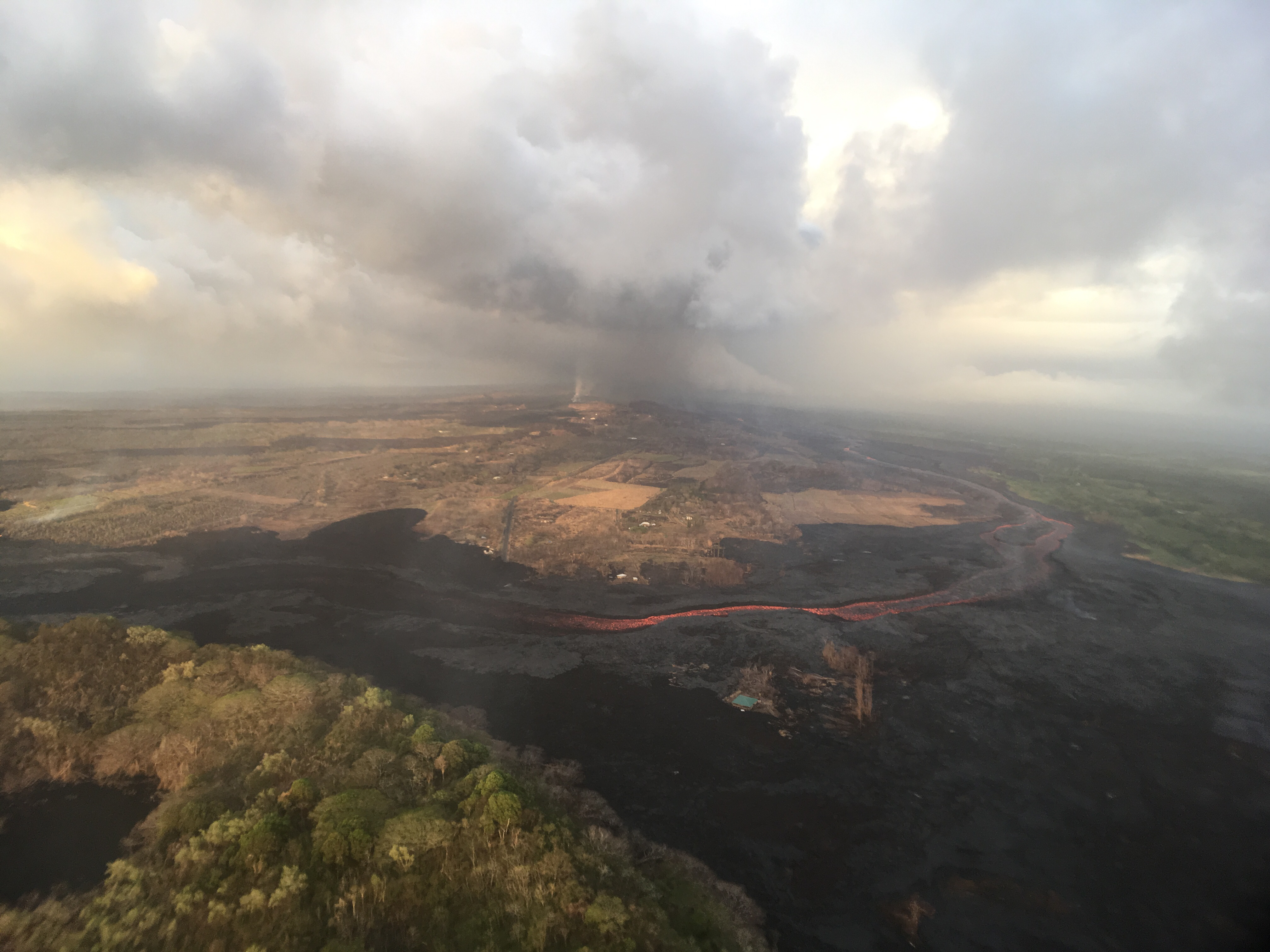
The U.S. Geological Survey released these photos of the Lower East Rift Zone on Tuesday, July 31, 2018.
In this aerial view, taken during HVO’s overflight this morning, you can follow the lava channel from Fissure 8 (gas plume visible in far distance) as it wends its way toward Kapoho Crater (lower left), where it then heads south toward the ocean.
East Rift Zone on July 31, 2018. Click to enlarge. PC: USGS
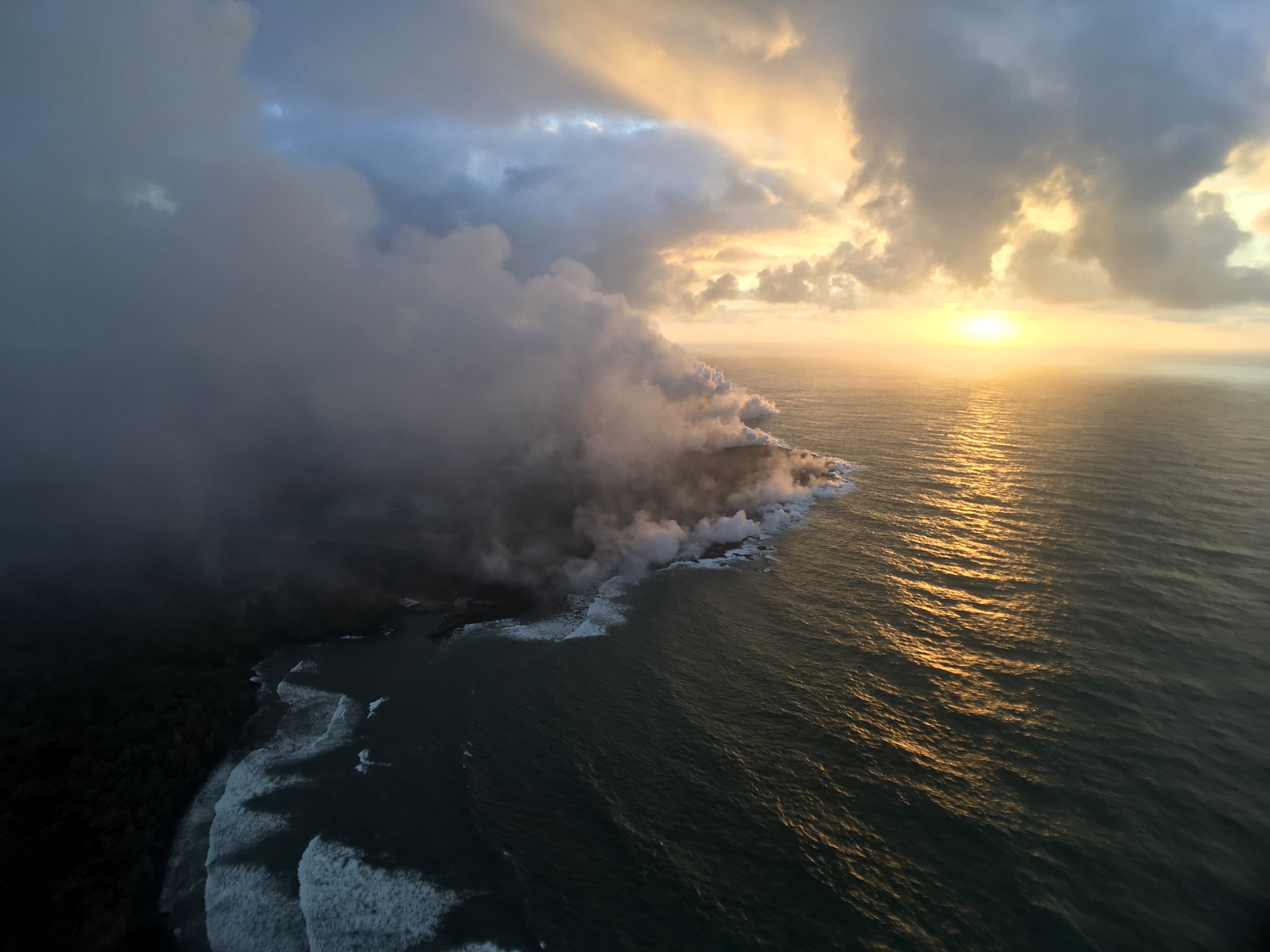
The Fissure 8 ocean entry and laze plume as they appeared at sunrise this morning.
Pohoiki on July 31, 2018. Click to enlarge. PC: USGS
The Pohoiki boat ramp is visible just below the plume (slightly left of center).
ARTICLE CONTINUES BELOW AD
ARTICLE CONTINUES BELOW AD
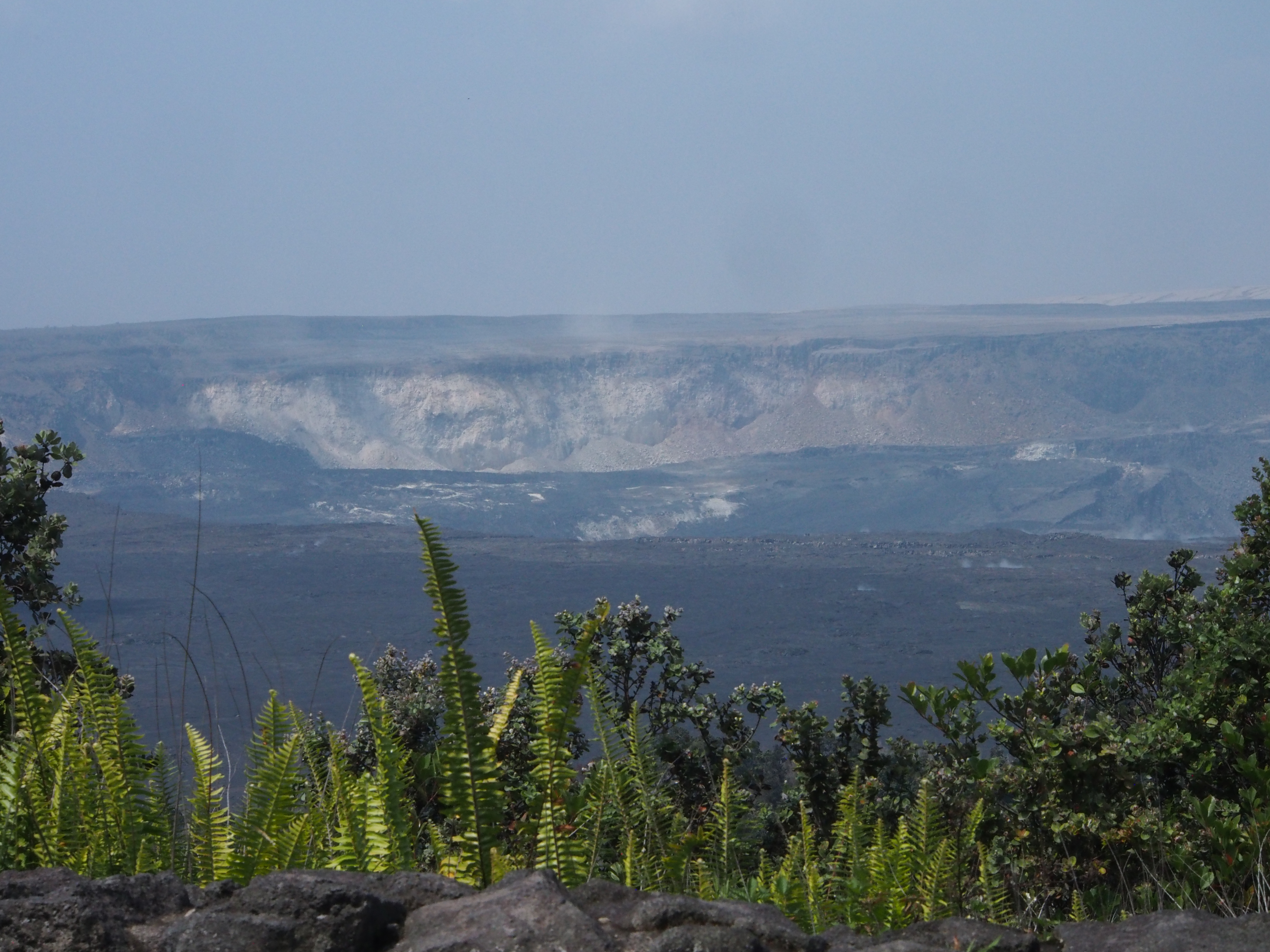
Kīlauea Summit
Kīlauea Volcano’s most recent summit collapse occurred at 8 a.m. Tuesday, July 31, 2018.
Kīlauea Summit on July 31, 2018. Click to enlarge. PC: USGS
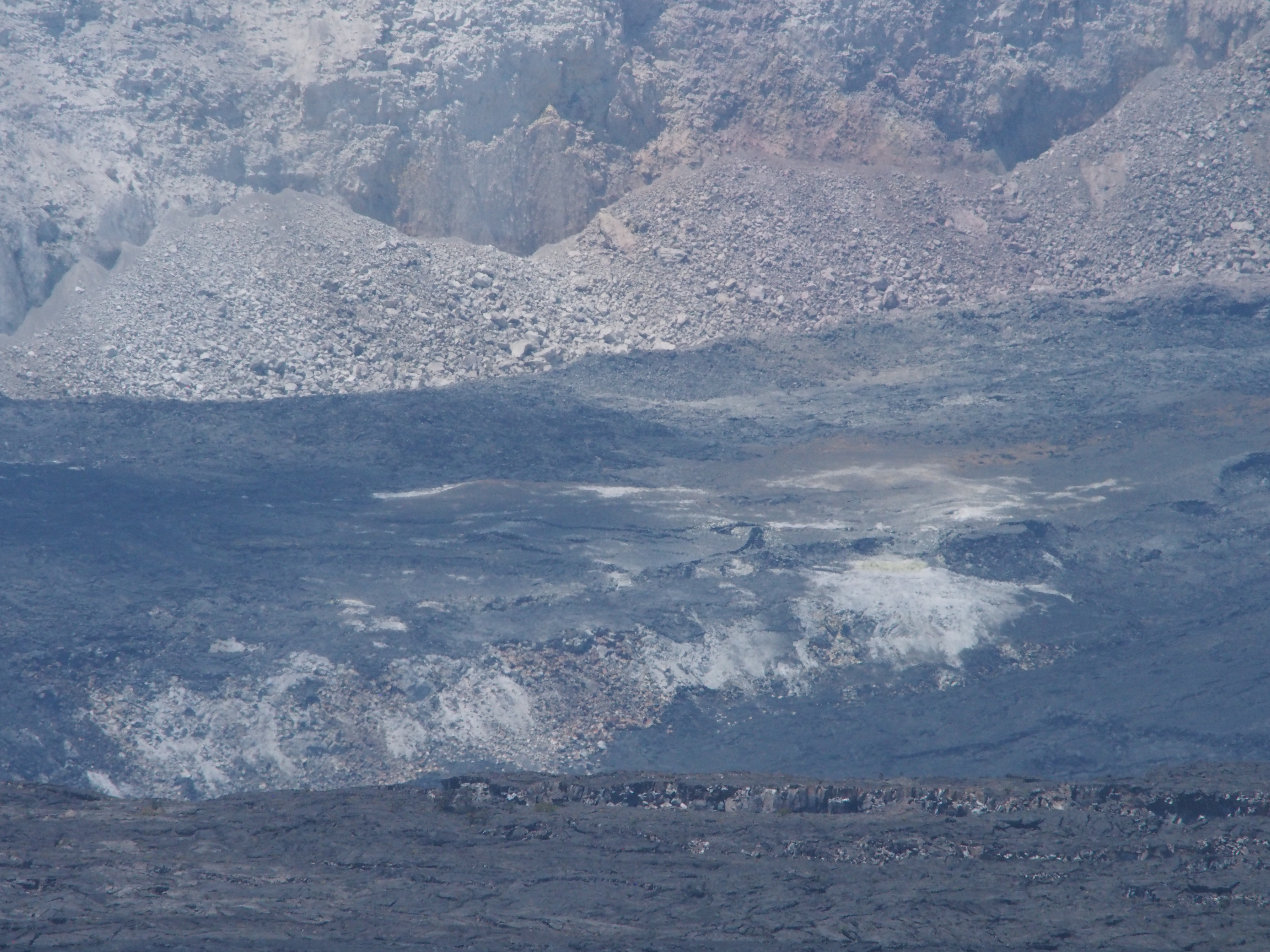
South Sulphur Bank, a cliff of altered, light-colored rock now more than 260 ft high, is visible on the far caldera wall. Another area of altered rock that’s being exposed as part of the caldera floor drops is visible near the center of this image.
Click to enlarge. PC: USGS
ARTICLE CONTINUES BELOW AD
A closer view of the area of altered rock that is being exposed as the caldera floor to the right drops down.
This comments section is a public community forum for the purpose of free expression. Although Big Island Now encourages respectful communication only, some content may be considered offensive. Please view at your own discretion. View Comments