Small Craft Advisory: All Hawaii County waters through 6 p.m. Thursday.
Gale Warning: ʻAlenuihāhā channel through 6 p.m. tonight.
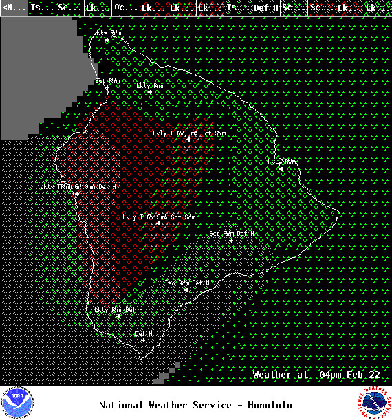
Special Weather Statement: There is potential for strong thunderstorms this afternoon over leeward slopes and interior parts of the island. Cloud to surface lightning strikes, gusty winds, small hail and low visibility due to heavy rain are possible. The summits could also see snowfall. When thunder roars, go indoors.
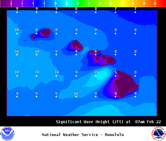
**Click directly on the images below to make them larger. Charts include: Big Island high/low forecasted temperatures, projected winds, chance of cloud cover, projected localized weather conditions, vog/SO2 forecast and expected wave heights.**
+
SWIPE LEFT OR RIGHT
Looking Ahead
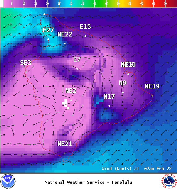
Our breezy, gusty winds are forecast to continue through the end of the week with a downward trend expected with wind speeds from Friday into the weekend. Windward and mauka areas will get clouds and showers with some leeward spots getting showers from time to time. A disturbance high in the atmosphere could enhance windward showers today and cause flare ups for the Kona side of the Big Island.
ARTICLE CONTINUES BELOW AD
Today
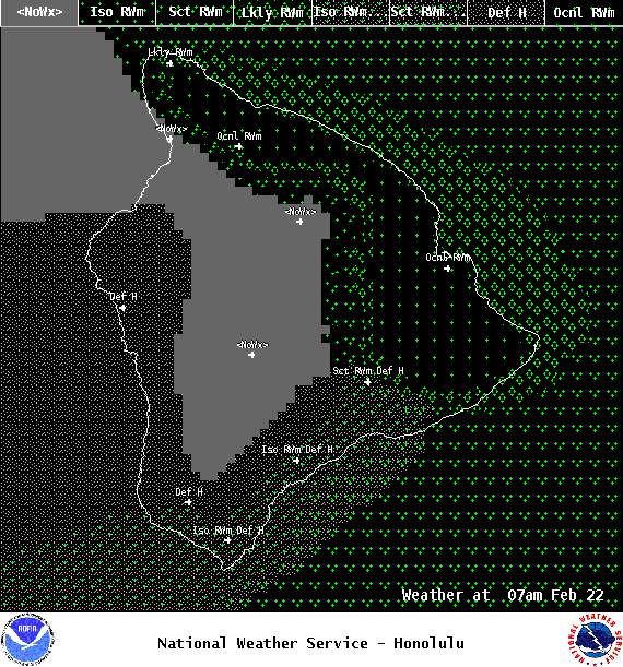
We have northeast winds today around 15 to 30 mph, gusting to 40 mph. High temperatures are forecast from 77° to 82°. Mostly cloudy skies are expected with showers likely in windward spots. Sunny morning for the Kona side with showers and thunderstorms likely in the afternoon. The thunderstorms could produce gusty winds and small hail.
UV index at 9 (“very high” exposure level)
Tonight
ARTICLE CONTINUES BELOW AD
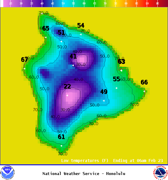
Northeast winds are forecast from 15 to 25 mph. Mostly cloudy skies are expected with showers likely for windward spots. Clear skies for leeward areas. Low temperatures from 63° to 68°.
This comments section is a public community forum for the purpose of free expression. Although Big Island Now encourages respectful communication only, some content may be considered offensive. Please view at your own discretion. View Comments