Minimal activity in the downslope portions of the June 27 lava flow continue to be observed by Hawai’i County Civil Defense.
Following its Thursday morning overflight assessment, Civil Defense noted that although the downslope areas remains still, activity about eight miles upslope and closer to the summit area remain active.
Small breakouts to the northeast of Puʻu ʻŌʻō have been noted throughout the week by Hawaiian Volcano Observatory. A breakout that began along the northern flank of Puʻu ʻŌʻō, the Feb. 21 breakout, has spread out at the northeastern base of the cone. The northern arm of the breakout near Kahauale’a is still burning trees that are located directly north of Pu’u Kahauale’a and the northeastern arm is following the edge of the flow.
Earlier in the week, breakouts were observed about 3-4 miles northeast of Puʻu ʻŌʻō. Those breakouts have become inactive as of Wednesday, according to HVO. A new set of breakouts, however, have been observed in the same proximity.
ARTICLE CONTINUES BELOW AD
ARTICLE CONTINUES BELOW AD
None of the current lava activity is posing an immediate threat to communities in the area. Civil Defense, along with HVO, will continue to maintain observation of the flow and keep the public informed of any changes.
Moderate to light smoke and vog conditions were observed Thursday morning as a light south wind was blowing smoke and vog in a northeast direction. These conditions, as usual, have the possibility of changing and individuals who are sensitive should take necessary precautions.
+
SWIPE LEFT OR RIGHT
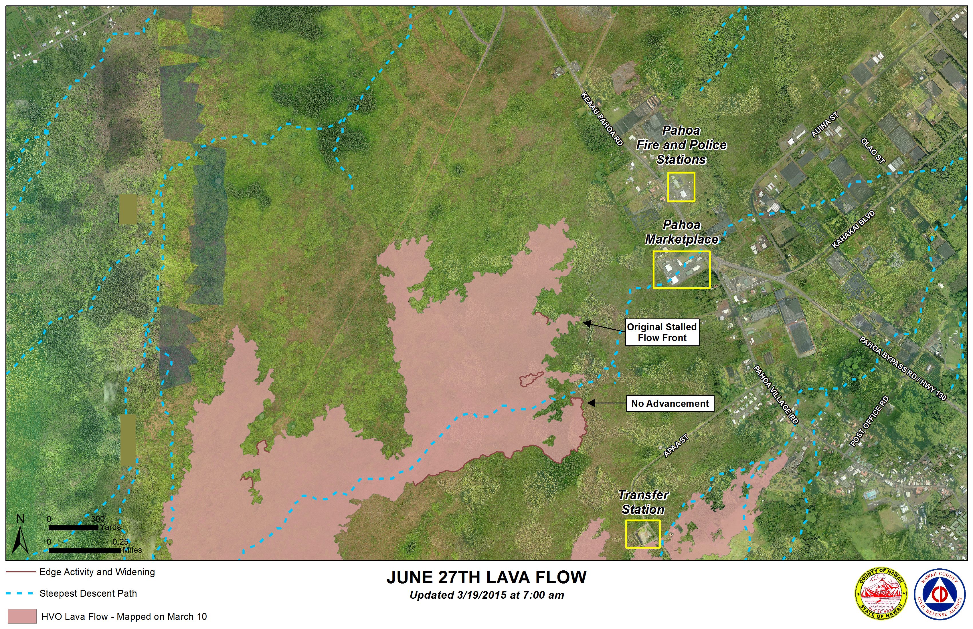
Hawai’i County Civil Defense lava flow map, as of March 19 at 7 a.m. Civil Defense image.
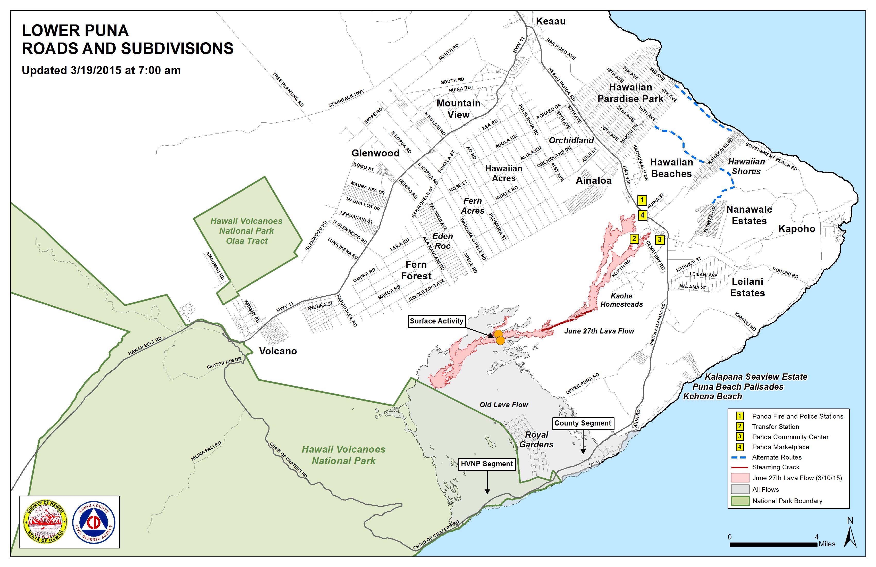
Hawai’i County Civil Defense lava flow map, as of March 19 at 7 a.m. Civil Defense image.
This comments section is a public community forum for the purpose of free expression. Although Big Island Now encourages respectful communication only, some content may be considered offensive. Please view at your own discretion. View Comments