After a prolonged period of moderate to heavy smoke and vog conditions that are associated with the June 27 lava flow, conditions slightly decreased Tuesday morning.
Hawai’i County Civil Defense reported light to moderate smoke and vog conditions as a slight south wind was blowing smoke in a north-northeast direction during the agency’s morning overflight assessment of flow activity.
These smoke and vog conditions are variable, an increase in certain areas is a possibility. Officials advise those who have respiratory issues to take necessary precautions.
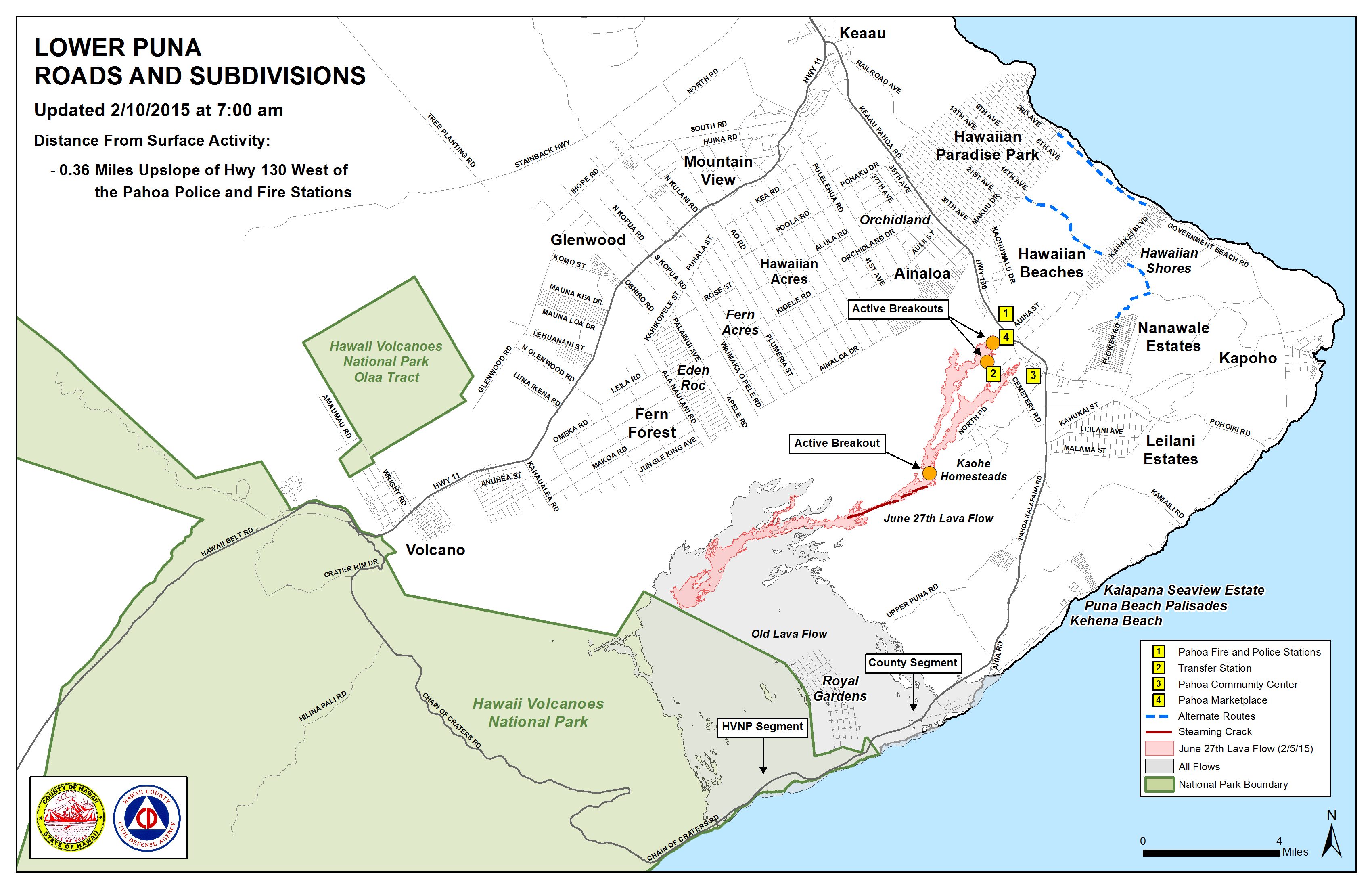
Lava flow advancement in the downslope areas of the flow continues to be at a standstill. Civil Defense reported, however, that continued surface breakouts and breakouts along the north and south margins of the flow are providing proof that the tube system is continuing to supply lava from the source.
ARTICLE CONTINUES BELOW AD
ARTICLE CONTINUES BELOW AD
Authorities say that none of the activity that is currently occurring poses a threat to communities in the area. Civil Defense, in coordination with Hawaiian Volcano Observatory, will continue to keep watch over activity and keep the public informed.
On Tuesday morning, a light rain was falling in the area and there has been no burning activity stemming from the brush fire that happened last week. Fire conditions continue to be monitored closely.
+
SWIPE LEFT OR RIGHT
In this photo, taken on Feb. 9, a toe of pahoehoe consumes ohia saplings established on an old ‘a‘a flow about a mile downslope of Pu‘u ‘O‘o. Photo credit: Extreme Exposure Media/Paradise Helicopters.
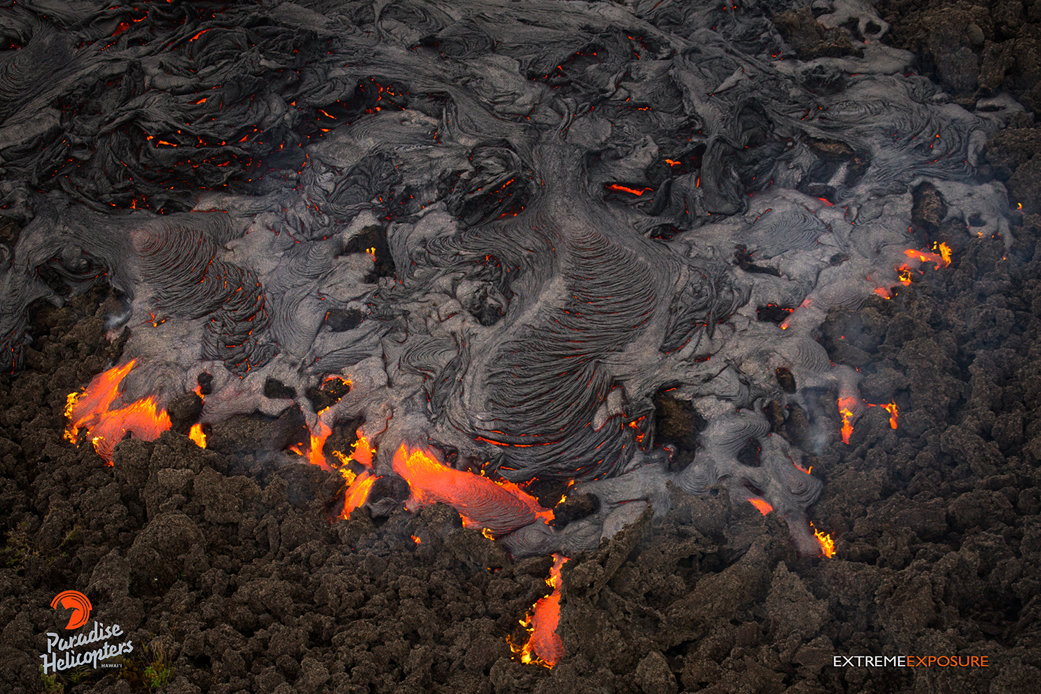
In this photo, taken on Feb. 9, a pahoehoe flow covers a field of ‘a‘a about a mile downslope of Pu‘u ‘O‘o. Photo credit: Exptreme Exposure Media/Paradise Helicopters.
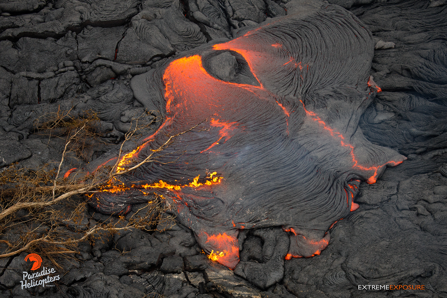
A breakout near the old geothermal pad consumes a toppled tree, seen in this photo taken on Feb. 9. Photo credit: Extreme Exposure Media/Paradise Helicopters.
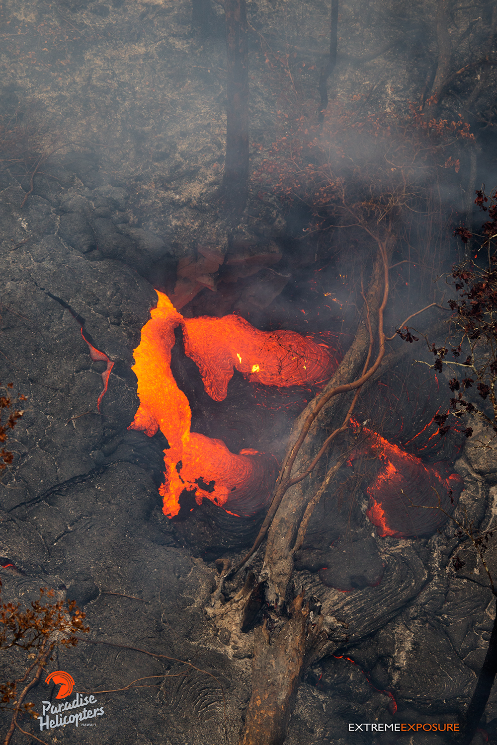
A burning tree trunk gets consumed by pahoehoe in this photo taken on Feb. 9. Photo credit: Extreme Exposure Media/Paradise Helicopters.
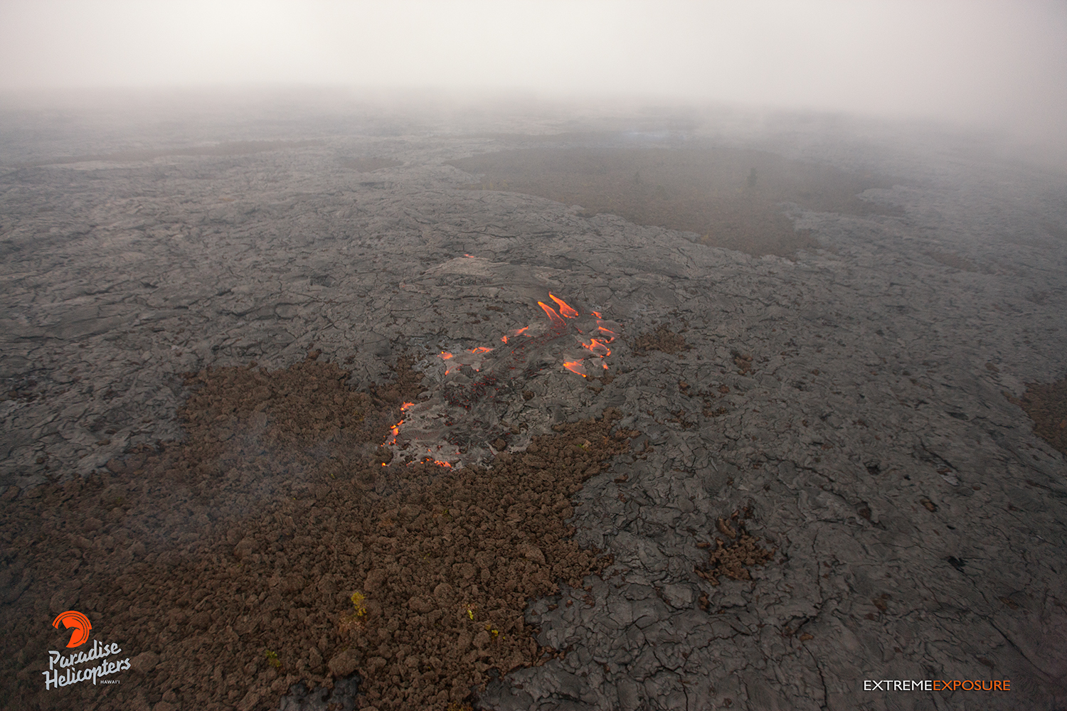
In this photo, taken on Feb. 9, a fresh breakout near the stalled flow front pours lava into a depression. Photo credit: Extreme Exposure Media/Paradise Helicopters.
In this photo, taken on Feb. 9, a fresh breakout near the stalled flow front pours lava into a depression. Photo credit: Extreme Exposure Media/Paradise Helicopters.
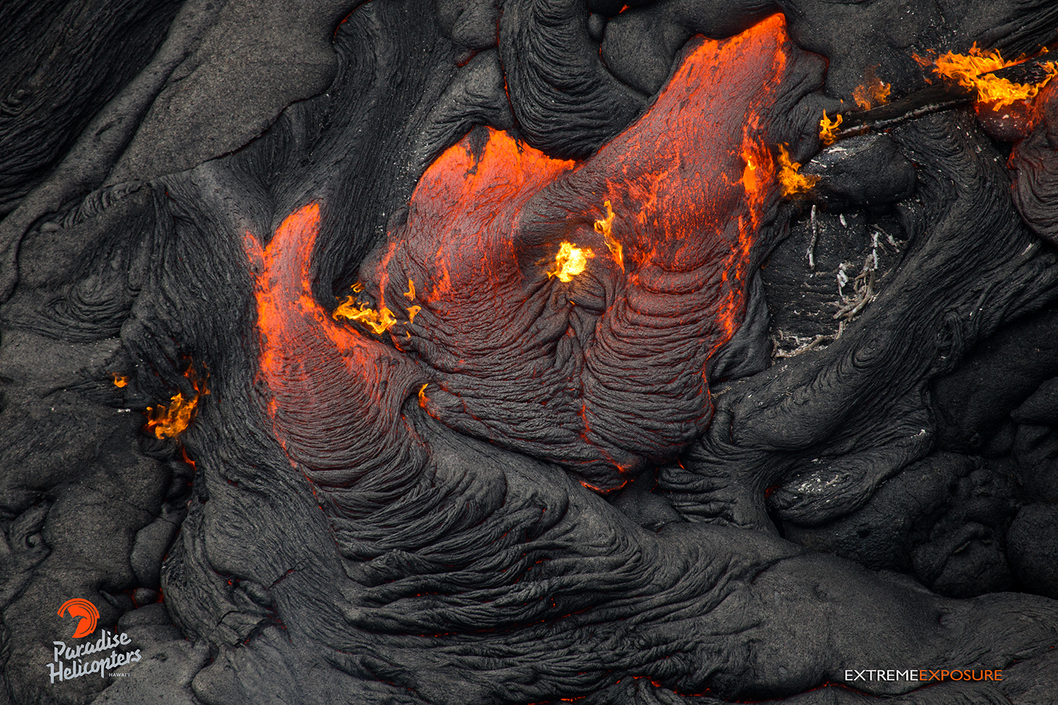
This photo, taken on Feb. 9, shows that activity continues in the vicinity of the perched channel, roughly a mile downslope of Pu‘u ‘O‘o. Photo credit: Extreme Exposure Media/Paradise Helicopters.
In this photo, taken on Feb. 9, a breakout along the southern perimeter looks to have advanced within the flow’s boundaries (lighter toned lava on the right), and now begins to enter the brush. Photo credit: Extreme Exposure Media/Paradise Helicopters.
Activity resumes about 100 yards upslope of the stalled flow front, as lava from a fresh breakout was pouring into a depression or crack in the ground, indicated by the rising smoke near the center of the photo, taken on Feb. 9. Photo credit: Extreme Exposure Media/Paradise Helicopters.
View of the stalled distal tip at the bottom of this photo, taken on Feb. 9, and the active hot spot about 100 yards upslope as smoke rises from lava burning trees within the depression. Photo credit: Extreme Media Exposure/Paradise Helicopters.
Seen in this photo taken on Feb. 9 is a new breakout (lighter toned lava), more than 200 yards in length, which has begun expanding the flow field along the southern perimeter. Photo credit: Extreme Media Exposure/Paradise Helicopters.
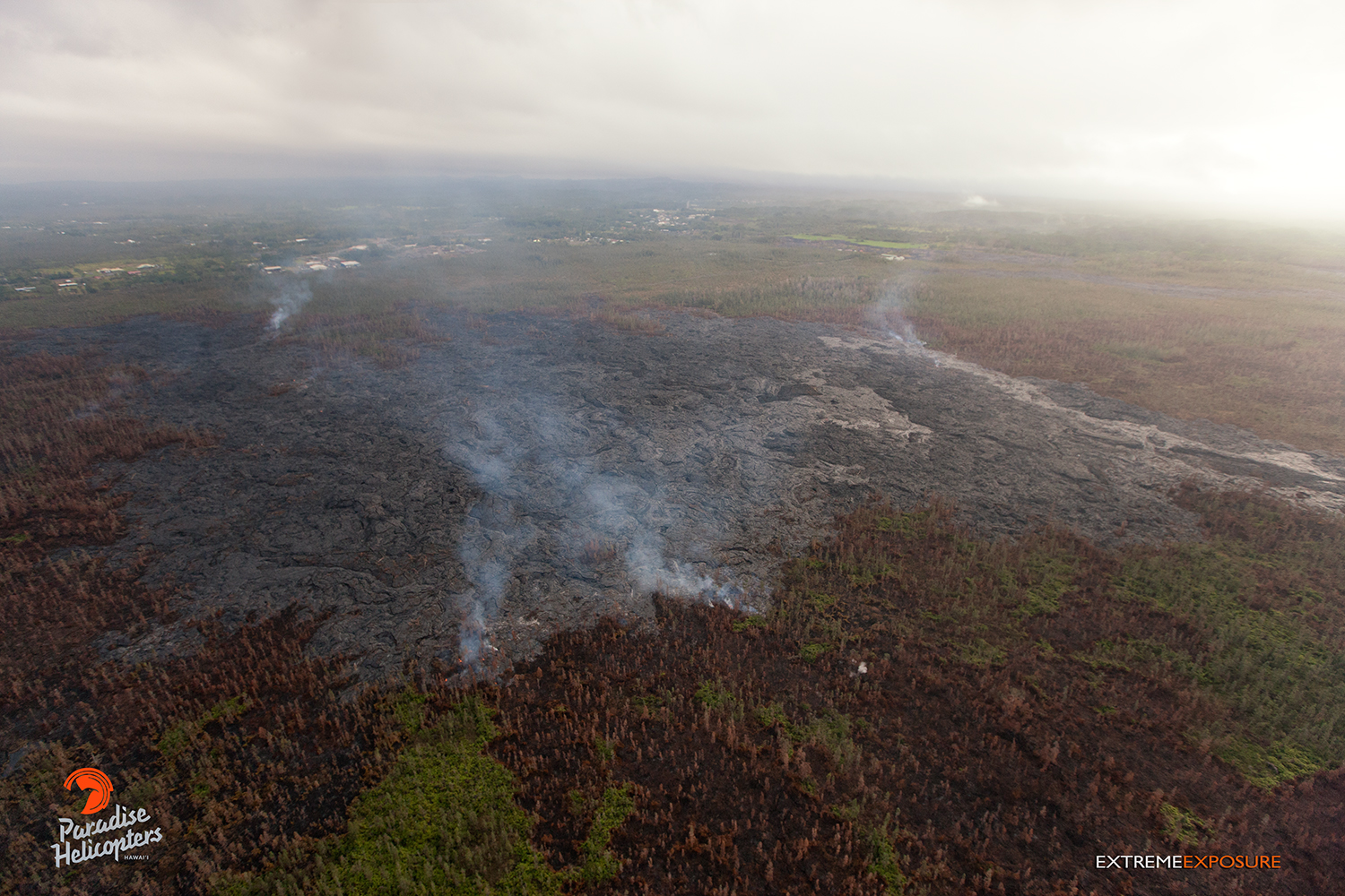
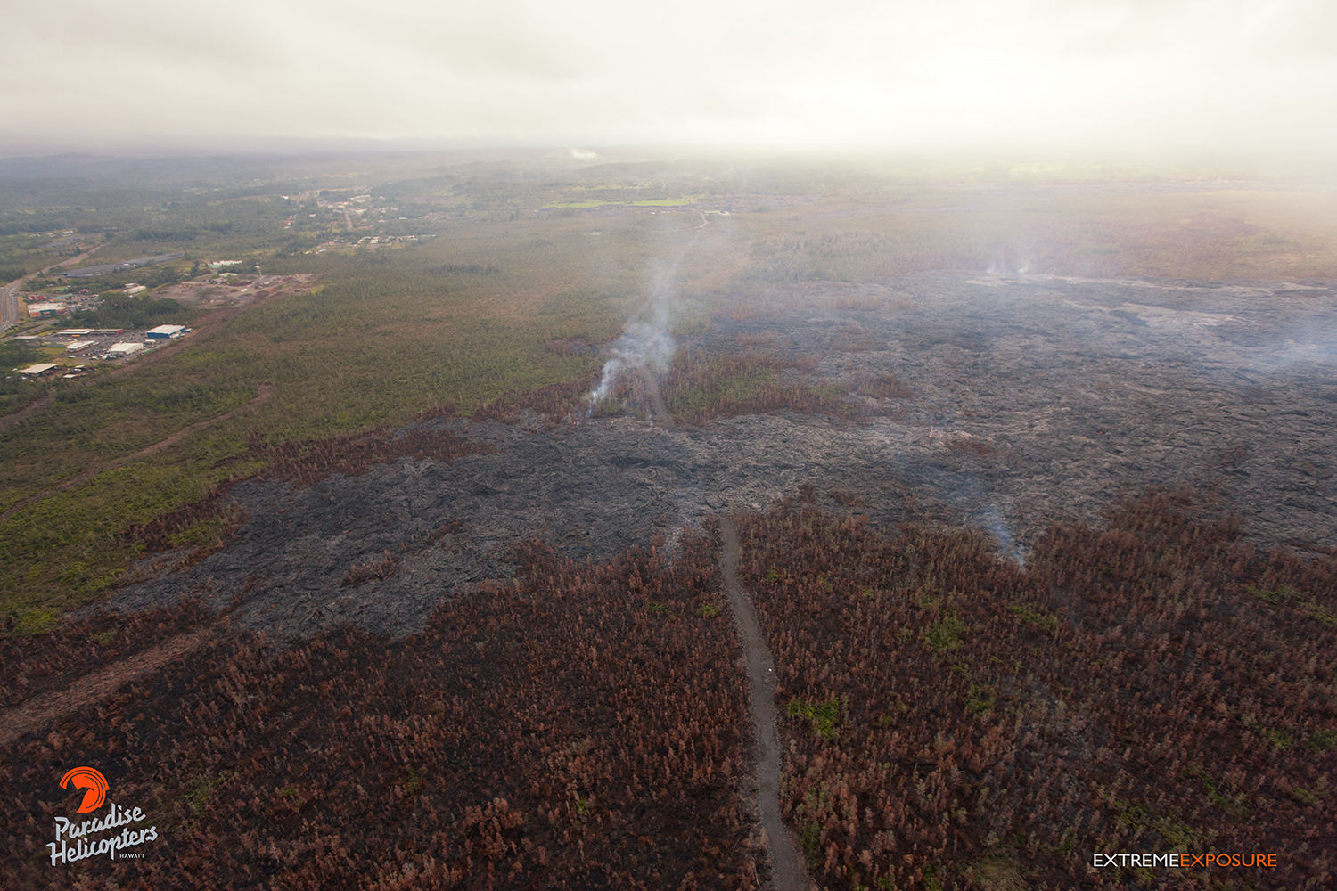
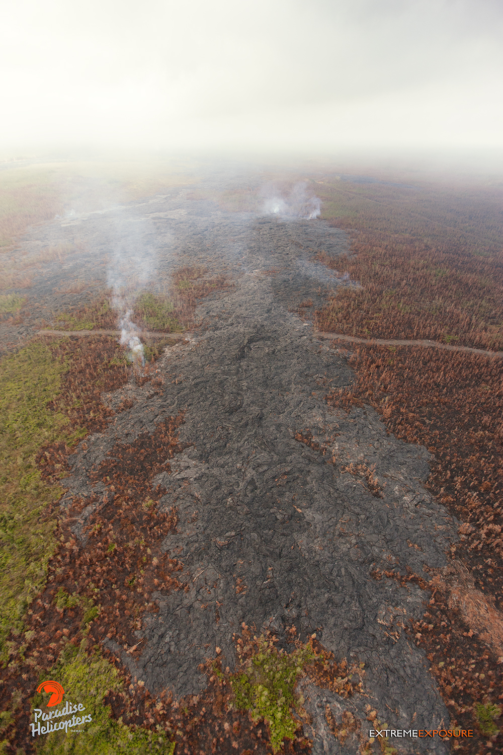
Image from Tuesday morning’s (Feb. 10) Hawai’i County Civil Defense overflight at 6:30 a.m., looking towards Highway 130 and Pahoa Marketplace. Civil Defense photo.
Hawai’i County Civil Defense lava flow map, as of Feb. 10 at 7 a.m. Civil Defense image.
Hawai’i County Civil Defense lava flow map, as of Feb. 10 at 7 a.m. Civil Defense image.
This comments section is a public community forum for the purpose of free expression. Although Big Island Now encourages respectful communication only, some content may be considered offensive. Please view at your own discretion. View Comments