

One Swell Fades as Another Builds
Alerts
A Small Craft Advisory is posted for windward and southeast Big Island waters along with the Alenuihaha channel through 6:00 p.m. Friday for southwest winds up to 25 knots and rough seas up to 14 feet. Inexperienced mariners should avoid navigating in these conditions.
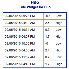
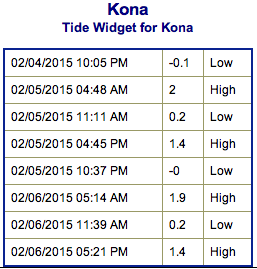
**Click directly on the images below to make them larger. Charts include: Big Island projected winds, tides, swell direction & period and expected wave heights.**
 Big Island Surf Forecast
Hilo side: Surf heights are expected knee to shoulder high early in the day. The best breaks open to the swell could see even bigger waves on the sets, especially late in the day as a new northwest moves in.
Kona side: Surf heights are forecasted to be knee to waist high. Possibly chest high on the sets.
South: Southerly spots open to the east-southeast could get ankle to waist high waves.
Our current swell is on a decreasing trend and expected to continue fading Thursday.
 Late Thursday we expect a west-northwest to start building, showing a bump in size by Friday morning. This swell is expected to show well for the Kona side. However, the surf is expected to be messy and disorganized. The peak is expected to take place late Friday.
A larger west-northwest to northwest swell is expected early next week pending development of the storm.
Nothing to get excited about out of the SPAC. Late next week we could possibly see some fun waves from a storm expected to develop near New Zealand.
Keep in mind, surf heights are measured on the face of the wave from trough to crest. Heights vary from beach to beach, and at the same beach, from break to break.
**Click here for your detailed Big Island weather report.**
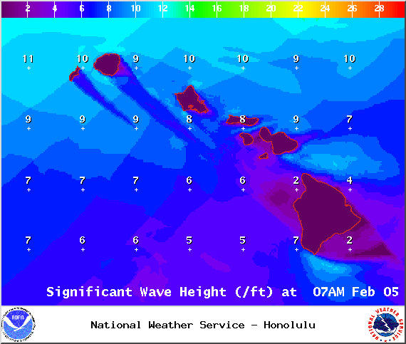
Image: NOAA / NWS

Image: NOAA / NWS
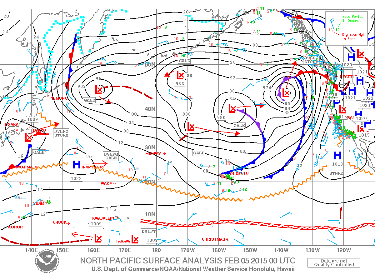
Image: NOAA / NWS
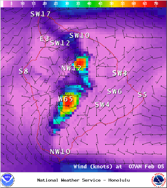
Image: NOAA / NWS
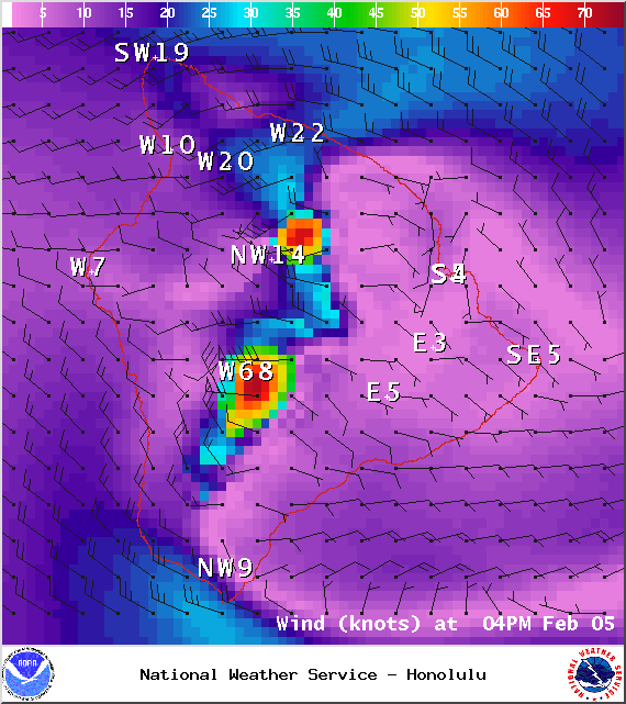
Image: NOAA / NWS


Sponsored Content

