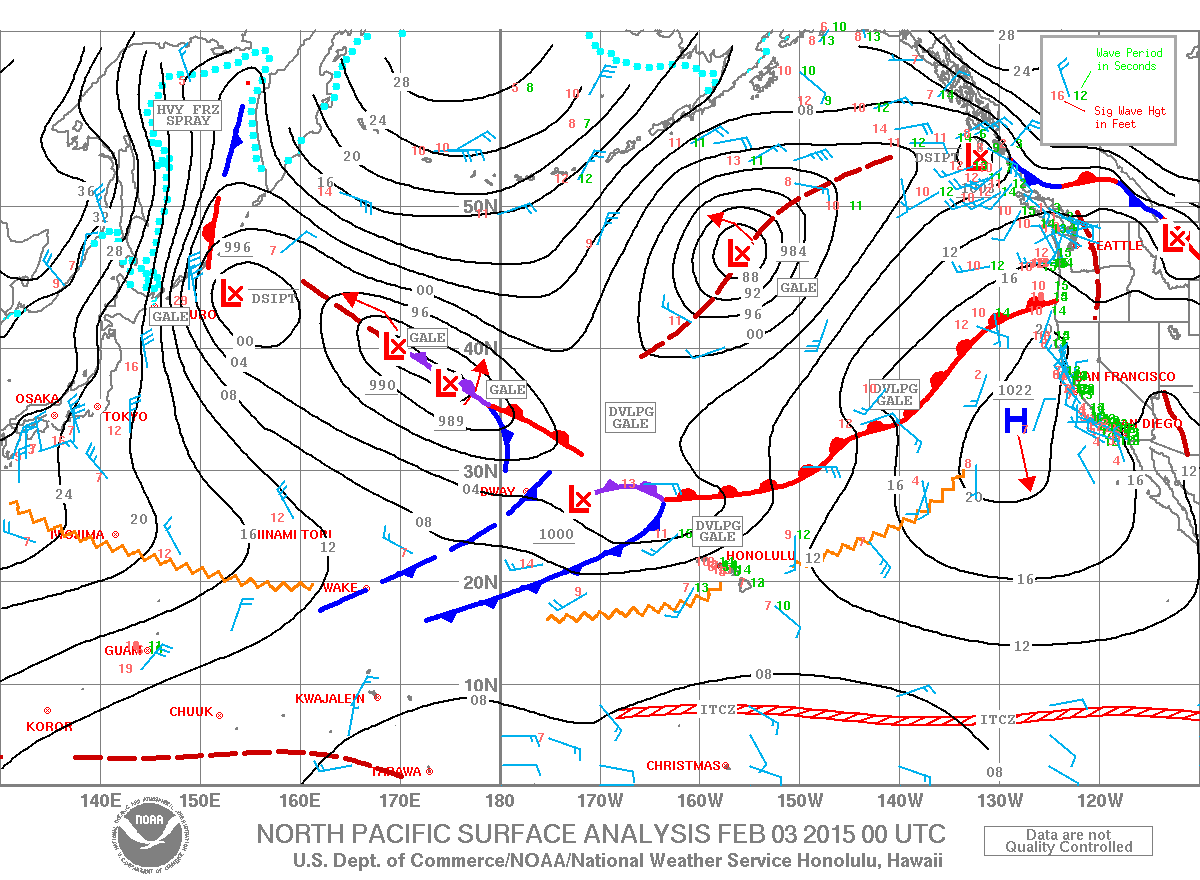
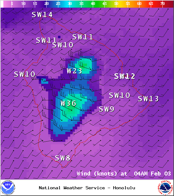
A Gale Warning has been issued by the National Weather Service for all offshore waters.
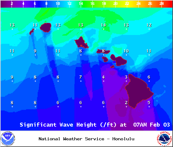
A High Surf Advisory is posted for north-facing shores of the Big Island through 6:00 a.m. Wednesday for 10 to 15 foot faces. Expect strong breaking waves, shore break and strong longshore and rip currents making swimming difficult and dangerous.
A Small Craft Advisory is posted for windward Big Island waters through 6:00 a.m. Wednesday for southwest winds up to 25 knots and rough seas of 9 to 16 feet. Inexperienced mariners should avoid navigating in these conditions.
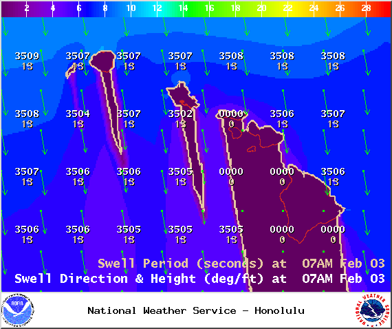
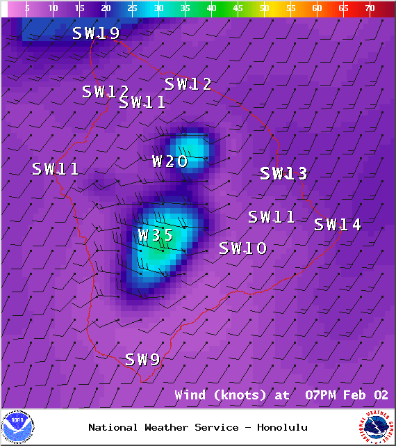
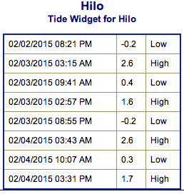
**Click directly on the images below to make them larger. Charts include: Big Island projected winds, tides, swell direction & period and expected wave heights.**
ARTICLE CONTINUES BELOW AD
ARTICLE CONTINUES BELOW AD
+
SWIPE LEFT OR RIGHT
Big Island Surf Forecast
Hilo side: Surf heights are expected overhead to well overhead early in the day. The best breaks open to the swell could see even bigger waves on the sets.
ARTICLE CONTINUES BELOW AD
Kona side: Surf heights are forecasted to be ankle to thigh high.
South: Southerly spots open to the wrap could get knee to shoulder high waves.
Our current swell peaked overnight but should hold strong Tuesday. The swell will be on a decreasing trend but solid overhead to double overhead surf is still expected. This swell should begin to fade Wednesday into Thursday. Kona side will be shut out from this swell.
A few storms are showing up on models expected to bring more waves later this week and into the next. If these storms develop as expected we could see a couple of solid swells headed our way.
ARTICLE CONTINUES BELOW AD
Nothing to get excited about out of the SPAC. Late next week we could possibly see some fun waves from a storm expected to develop near New Zealand.
Keep in mind, surf heights are measured on the face of the wave from trough to crest. Heights vary from beach to beach, and at the same beach, from break to break.
This comments section is a public community forum for the purpose of free expression. Although Big Island Now encourages respectful communication only, some content may be considered offensive. Please view at your own discretion. View Comments


 Big Island Surf Forecast
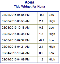 A few storms are showing up on models expected to bring more waves later this week and into the next. If these storms develop as expected we could see a couple of solid swells headed our way.