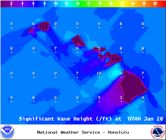
A High Surf Advisory is posted for the west side of the Big Island through 4:00 a.m. Monday. Wave heights from 8 to 12 feet. Expect strong breaking waves, shore break and strong longshore and rip currents making swimming difficult and dangerous.
A Small Craft Advisory has been issued for all island waters through 6:00 a.m. Monday for winds up to 25 knots and rough seas up to 14 feet. For the ʻAlenuihāhā channel and Big Island southeast and leeward waters, we expect 20 to 30 knot winds and rough seas up to 14 feet through 6:00 p.m. Monday.
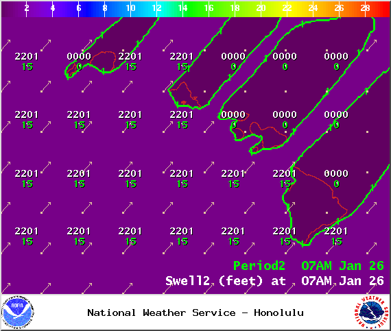
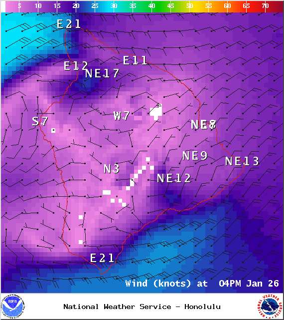
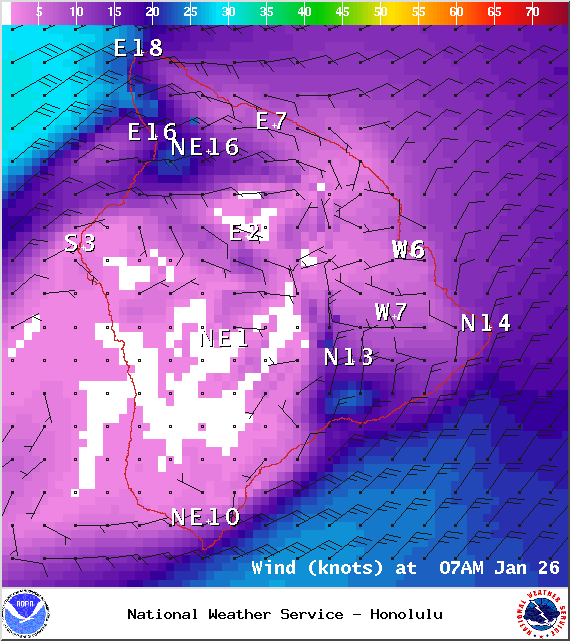
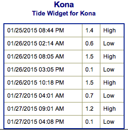
**Click directly on the images below to make them larger. Charts include: Big Island projected winds, tides, swell direction & period and expected wave heights.**
+
SWIPE LEFT OR RIGHT
ARTICLE CONTINUES BELOW AD
ARTICLE CONTINUES BELOW AD
Big Island Surf Forecast
Hilo side: Surf heights are expected waist to chest high. The best breaks open to the swell could see occasional larger waves on the sets.
Kona side: Surf heights are forecasted to be chest to head high, especially early in the day. Swell will show strongest for spots from Kona, south.
ARTICLE CONTINUES BELOW AD
South: Southerly spots open to the west-northwest swell could get waves wrapping up to shoulder high, maybe bigger on the sets. Breaks open to the trade swell could see knee to chest high waves.
Our current swell continues to fade and will drop even further by Tuesday morning.
A new storm has developed off of Japan, so we could see another solid west-northwest swell setting up for Wednesday and Thursday of next week.
Nothing to get excited about out of the SPAC.
ARTICLE CONTINUES BELOW AD
Keep in mind, surf heights are measured on the face of the wave from trough to crest. Heights vary from beach to beach, and at the same beach, from break to break.
This comments section is a public community forum for the purpose of free expression. Although Big Island Now encourages respectful communication only, some content may be considered offensive. Please view at your own discretion. View Comments


 Big Island Surf Forecast
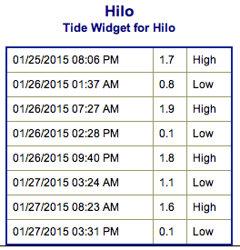 Our current swell continues to fade and will drop even further by Tuesday morning.