The National Weather Service has issued a Wind Advisory in effect from noon today through Sunday at 6 p.m. Northeast winds from 20 to 40 mph with gusts up to 50 mph are expected. The strongest winds on the Big Island are expected in leeward Kohala, the Waimea to Kawaihae corridor and near South Point and Upolu Point. Winds this strong can bring down tree branches and make driving difficult.
A Small Craft Advisory has been issued by the National Weather Service from 6 a.m. Saturday through 6 p.m. Monday for all Big Island waters and channels. Rough seas of 11 to 20 feet are forecasted along with winds of 25 to 35 knots or more. Inexperienced mariners should avoid navigating in these conditions.
The National Weather Service has issued a High Surf Advisory for west shores of the Big Island until 6 p.m. Sunday. Expect strong breaking waves, shore break and strong longshore and rip currents making swimming difficult and dangerous.
A Gale Warning is in effect for Big Island leeward waters and the Anenuihaha channel through Monday at 6 p.m. Beginning this morning, east winds of 30 to 35 knots are expected with higher gusts. Rough seas of 13 to 21 feet are also forecasted. The largest waves are expected to begin tonight after midnight. A Gale Warning means that these winds are imminent or occurring. Operating a vessel in gale conditions requires proper experience and equipment. Mariners without these things should remain in port until gale conditions end.
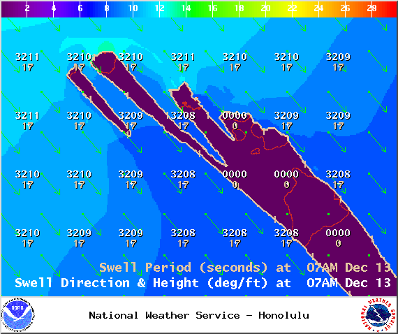
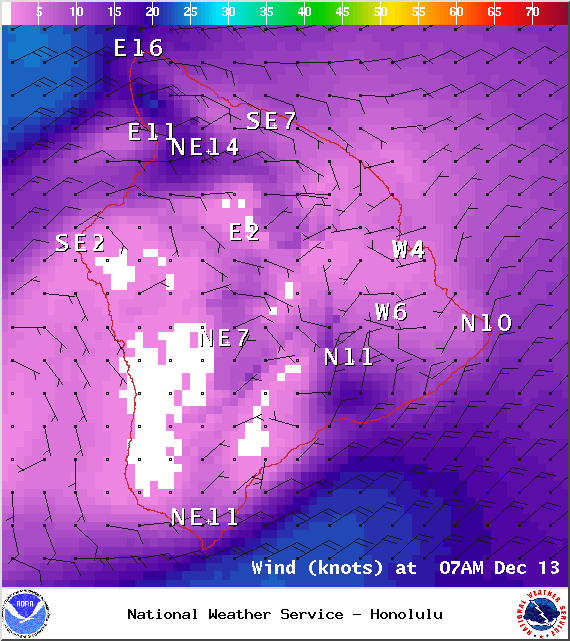
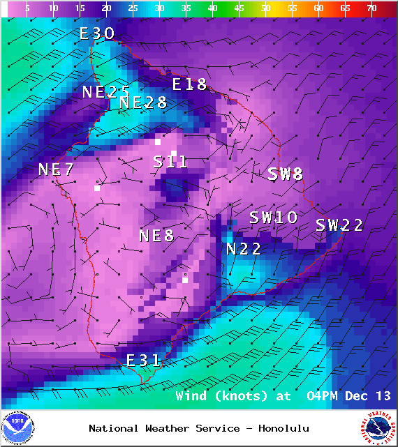
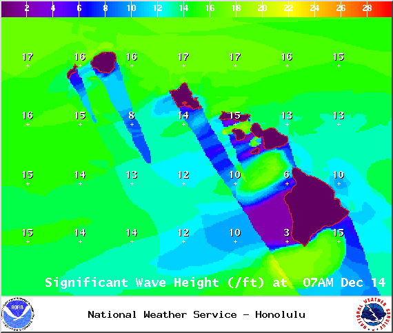
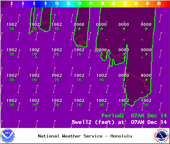
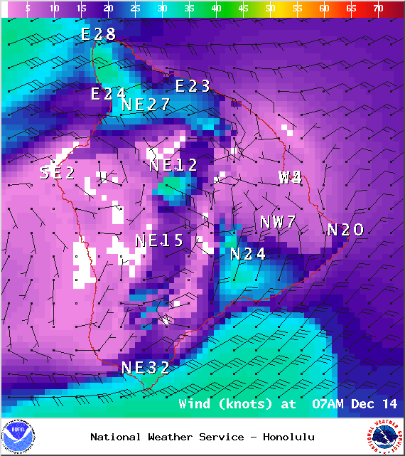
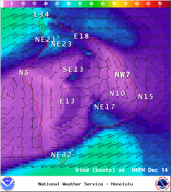
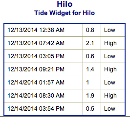
**Click directly on the images below to make them larger. Charts include: Big Island projected winds, tides, swell direction & period and expected wave heights.**
ARTICLE CONTINUES BELOW AD
ARTICLE CONTINUES BELOW AD
+
SWIPE LEFT OR RIGHT
Big Island Surf Forecast, Saturday / Sunday, December 13 – 14
Hilo side: Choppy trade wind swell expected. Late in the day a new west-northwest should bring some wrap up to about overhead at the best exposures.
ARTICLE CONTINUES BELOW AD
Kona side:Surf is expected waist to shoulder high for the best exposures in the afternoon as the WNW builds. By sunset we could see some waves reach head high or more on the sets.
South: Minimal surf out of the southern hemisphere – knee high or less. Some trade swell will trickle in to select spots as well.
A series of swells are expected over the weekend and into next week as well. Saturday a west-northwest swell is expected to build, peaking overnight Saturday into Sunday with double overhead surf on the sets. The Kona side is forecasted to get some chest to head high waves from this swell before it swings more north on Sunday and due north on Monday.
Another set of northwest swells are expected for the second half of next week with yet another large northwest swell due for next weekend. All dependent on how the storms actually end up developing. Will keep an eye on it.
ARTICLE CONTINUES BELOW AD
An out of season south swell is expected Sunday into Monday. We could see a fun little boost up to head high at the best breaks.
Keep in mind, surf heights are measured on the face of the wave from trough to crest. Heights vary from beach to beach, and at the same beach, from break to break.
This comments section is a public community forum for the purpose of free expression. Although Big Island Now encourages respectful communication only, some content may be considered offensive. Please view at your own discretion. View Comments


 Big Island Surf Forecast, Saturday / Sunday, December 13 – 14
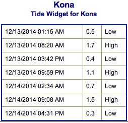 A series of swells are expected over the weekend and into next week as well. Saturday a west-northwest swell is expected to build, peaking overnight Saturday into Sunday with double overhead surf on the sets. The Kona side is forecasted to get some chest to head high waves from this swell before it swings more north on Sunday and due north on Monday.