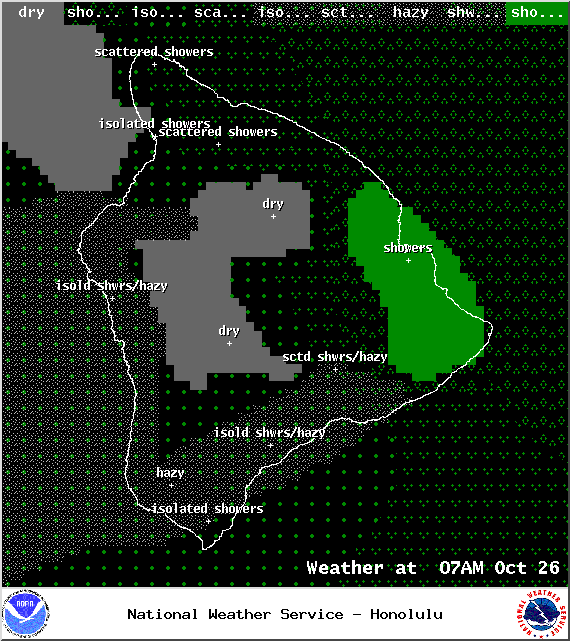
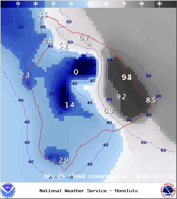
**A breakdown of expected conditions specific to the Big Island is presented below in graphical form. High and low temperatures, swell, percent chance of clouds / rain and wind conditions are each depicted. All graphics are provided by the National Weather Service in Honolulu.**
Alerts
There are no alerts posted for Hawai’i County at this time.
Today
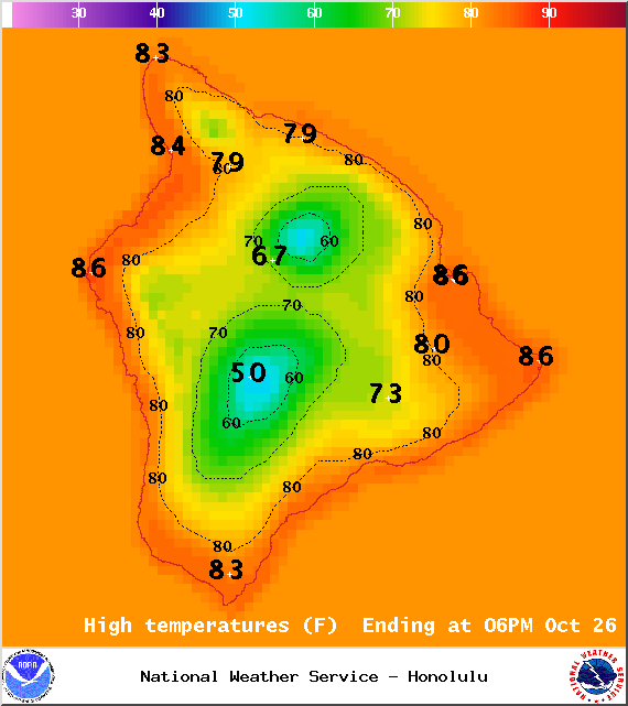
High temperatures should fall in the range of 82° to 87° with cooler temperatures at higher elevations. East winds should be around 15 mph with a sea breeze developing each afternoon for the Kona side of the island, therefore, the general weather pattern will be for scattered windward and mauka showers with mostly cloudy skies on the east side throughout the day. For the west side, especially in the lee of Hualalai, light winds and hazy skies are expected with cloud cover building in the afternoon bringing localized scattered showers. From South Point along the Hamakua Coast and all the way up to Kohala, we could see wind gusts up to 30 mph.
Sunrise: 6:18 a.m.
Sunset: 5:50 p.m.
UV index at 8 (“very high” exposure level)
ARTICLE CONTINUES BELOW AD
ARTICLE CONTINUES BELOW AD
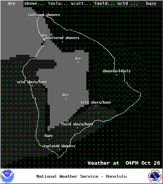
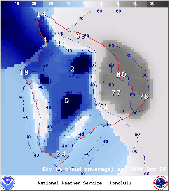
Tonight
Cloud cover on the east side will be accompanied with scattered windward and mauka showers. The leeward side may have some lingering isolated evening downpours that will clear as the land breeze takes hold and pushes those clouds and showers back out to sea. Low temperatures should fall in the range of 72° to 77° with lower temperatures expected at higher elevations. East winds around 15 mph are forecasted except for where the land breeze will bring an offshore flow.
Looking Ahead
Light to moderate trades early in the week should allow local land and sea breeze conditions to develop. Models are showing enhanced windward and mauka showers Tuesday and Wednesday. A front is also expected to enhance showers Thursday night into Friday (Halloween). I’ll keep an eye on this feature and bring you the latest if anything changes. We don’t want our trick-or-treaters to get rained out! Following the front, we expect stronger winds, cooler air, and lower humidity.
Surf and Seas Hilo: Surf is expected to be waist to possibly head high at the best breaks in the morning, fading to knee to chest high by the evening. Kona: The best exposures will see just knee high waves with trace amounts expected by the afternoon. South: Ankle-slappers are expected, possibly up to knee high in some spots. Only trace amounts are expected by sundown.
ARTICLE CONTINUES BELOW AD
Our current north swell (350-10°) has already peaked and should slowly fade through the day today with just knee to waist high waves expected by Monday. A series of small north swells is expected through Wednesday with a slightly larger north swell expected to start building late Wednesday. Larger short period easterly swells area expected late in the week as trade winds strengthen.
Our small south-southwest (200-190°) swell has dropped down to trace amounts. Another small boost is expected by mid-week, offering knee to waist high surf, possibly bigger, at the best exposures. For the second half of the week, surf goes quiet with not much on the horizon either.
If Ana continues on its current forecast track, its remnants are expected to merge with a storm to our north. If that happens we may see some swelsl generated late Wednesday into Thursday. Otherwise, Ana is not looking to be a big swell producer, maybe pushing heights up to about waist high.
ARTICLE CONTINUES BELOW AD
Keep in mind, surf heights are measured on the face of the wave from trough to crest. Heights vary from beach to beach, and at the same beach, from break to break.
Almanac for Hilo Airport Maximum Temperature for today:
Normal 82°
Record 87° / Set in 2013
Minimum Temperature for today:
Normal 68°
Record 64° / Set in 1962 and tied in both 1980 and 1998
This comments section is a public community forum for the purpose of free expression. Although Big Island Now encourages respectful communication only, some content may be considered offensive. Please view at your own discretion. View Comments


 Today
Today Tonight
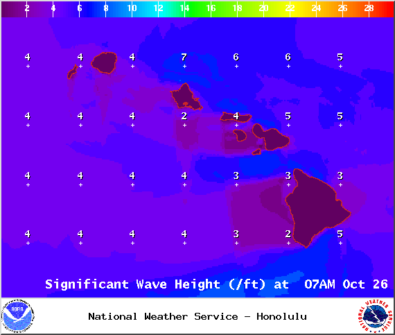 Surf and Seas
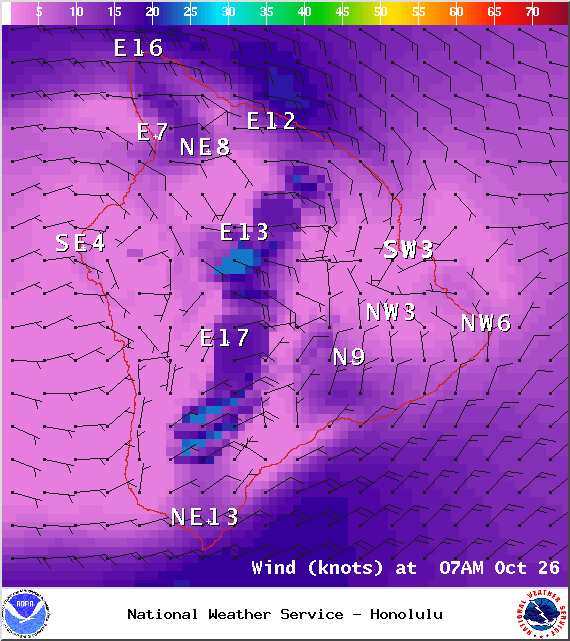 Our small south-southwest (200-190°) swell has dropped down to trace amounts. Another small boost is expected by mid-week, offering knee to waist high surf, possibly bigger, at the best exposures. For the second half of the week, surf goes quiet with not much on the horizon either.
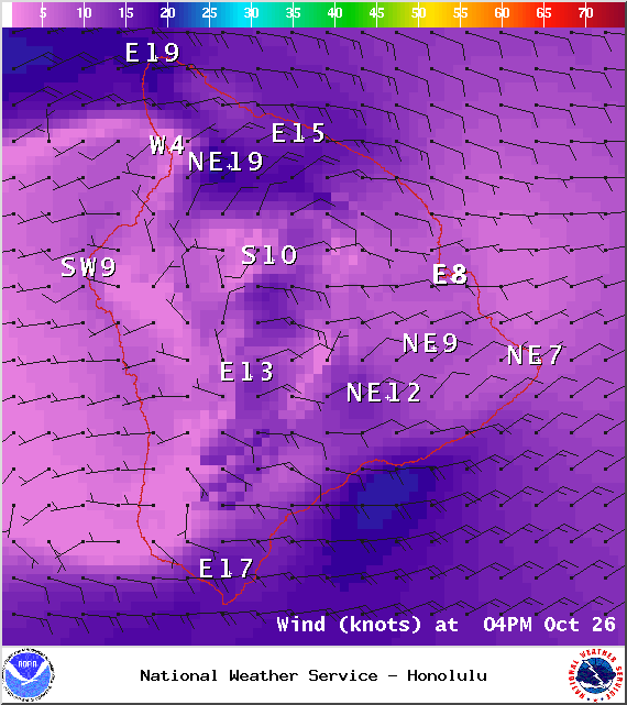 Keep in mind, surf heights are measured on the face of the wave from trough to crest. Heights vary from beach to beach, and at the same beach, from break to break.