The U.S. Geological Survey released these photos of the Lower East Rift Zone on Friday, July 20, 2018.
During their early morning overflight, USGS scientists captured this view showing three of the five volcanoes that comprise the Island of Hawai‘i: Mauna Loa, Mauna Kea, and Kīlauea, with the Fissure 8 vent and channelized lava flow on the volcano’s lower East Rift Zone.
Mauna Loa (distant upper left), Mauna Kea (distant right), and Kīlauea (foreground) on July 20. Click to enlarge. PC: USGS
An aerial view of the southernmost ocean entry lava lobe.
The ocean entry on July 20, 2018. Click to enlarge. PC: USGS
As of 6:30 a.m. on Friday, July 20, 2018, the south margin of the lava flow had not changed since yesterday, and was about .3 miles from the boat ramp at Isaac Hale Park.
ARTICLE CONTINUES BELOW AD
ARTICLE CONTINUES BELOW AD
Kīlauea summit
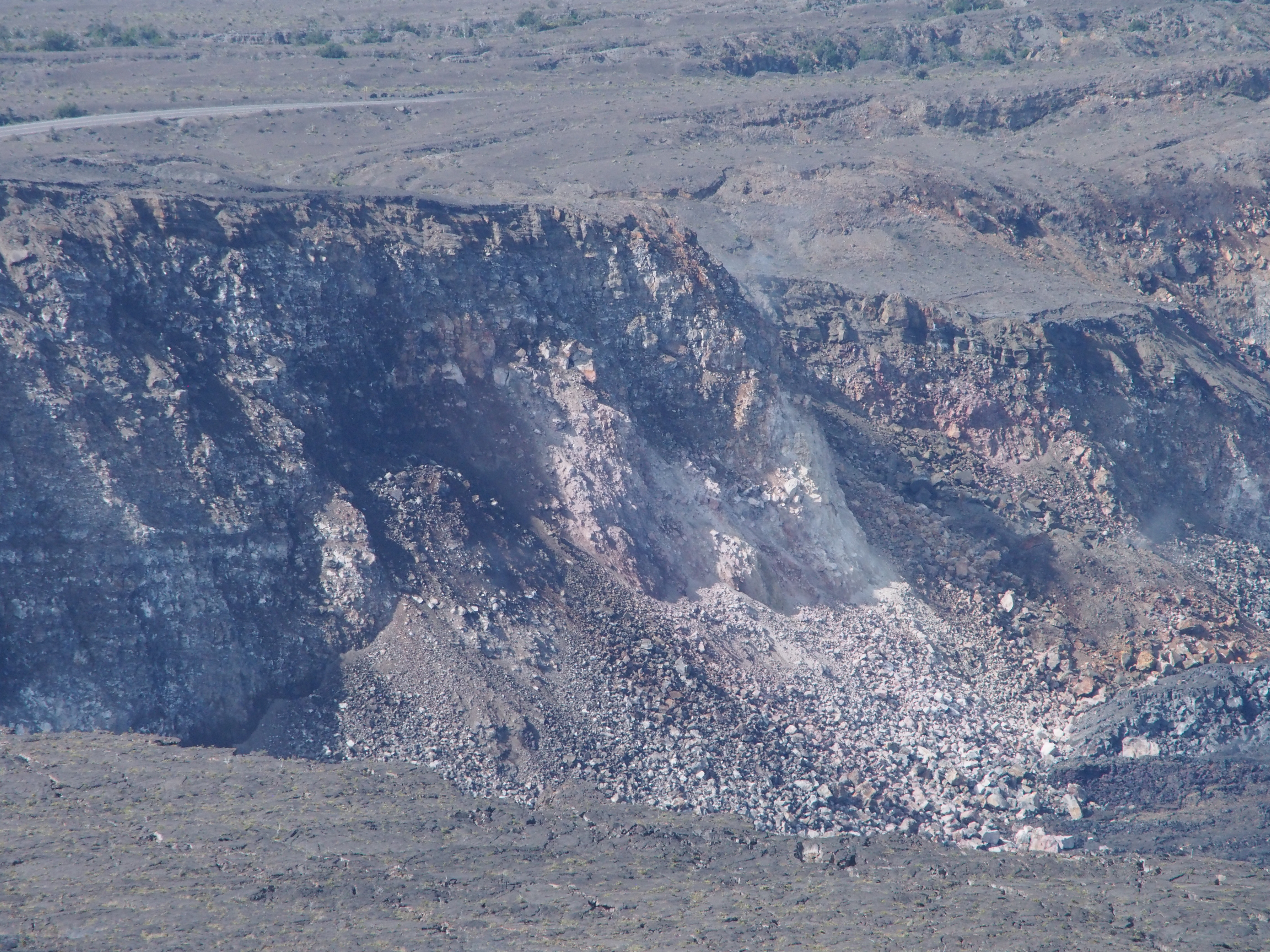
This telephoto image, looking across Kīlauea’s summit from the northeast rim of the caldera, shows rubble dislodged from a cliff just north of the South Sulphur Bank, with the 1974 gully between.
Kīlauea’s summit from the northeast rim. Click to enlarge. PC: USGS
With such rubble, it is no wonder that dust clouds were so prominent in this area after yesterday’s collapse event.
ARTICLE CONTINUES BELOW AD
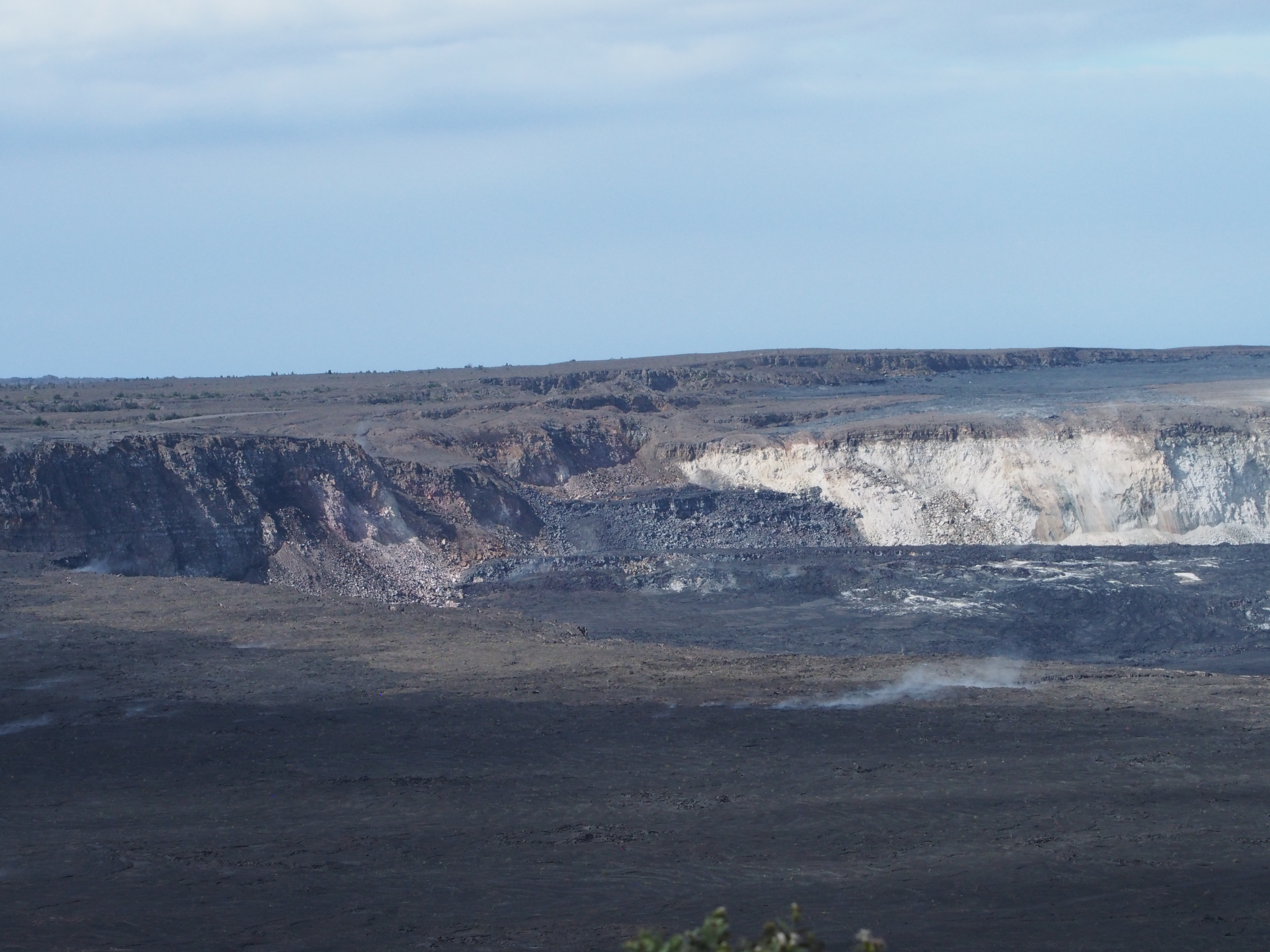
This photo provides context for the adjacent image.
Kīlauea’s summit from the northeast rim on July 20, 2018. Click to enlarge. PC: USGS
South Sulphur Bank is the light yellow area at right.
Near the center of this photo, a section of the former Crater Rim Drive on Kīlauea’s caldera floor is just barely visible.
That section of road has been chopped off by the crater just east of where it fed the former Halema‘uma‘u visitor overlook parking lot. Click to enlarge. PC: USGS
ARTICLE CONTINUES BELOW AD
Beyond the road, are cracks cutting Sand Spit, the ash-coated 1921 lava flow, and the cliff that more or less forms the boundary of the topographic caldera.
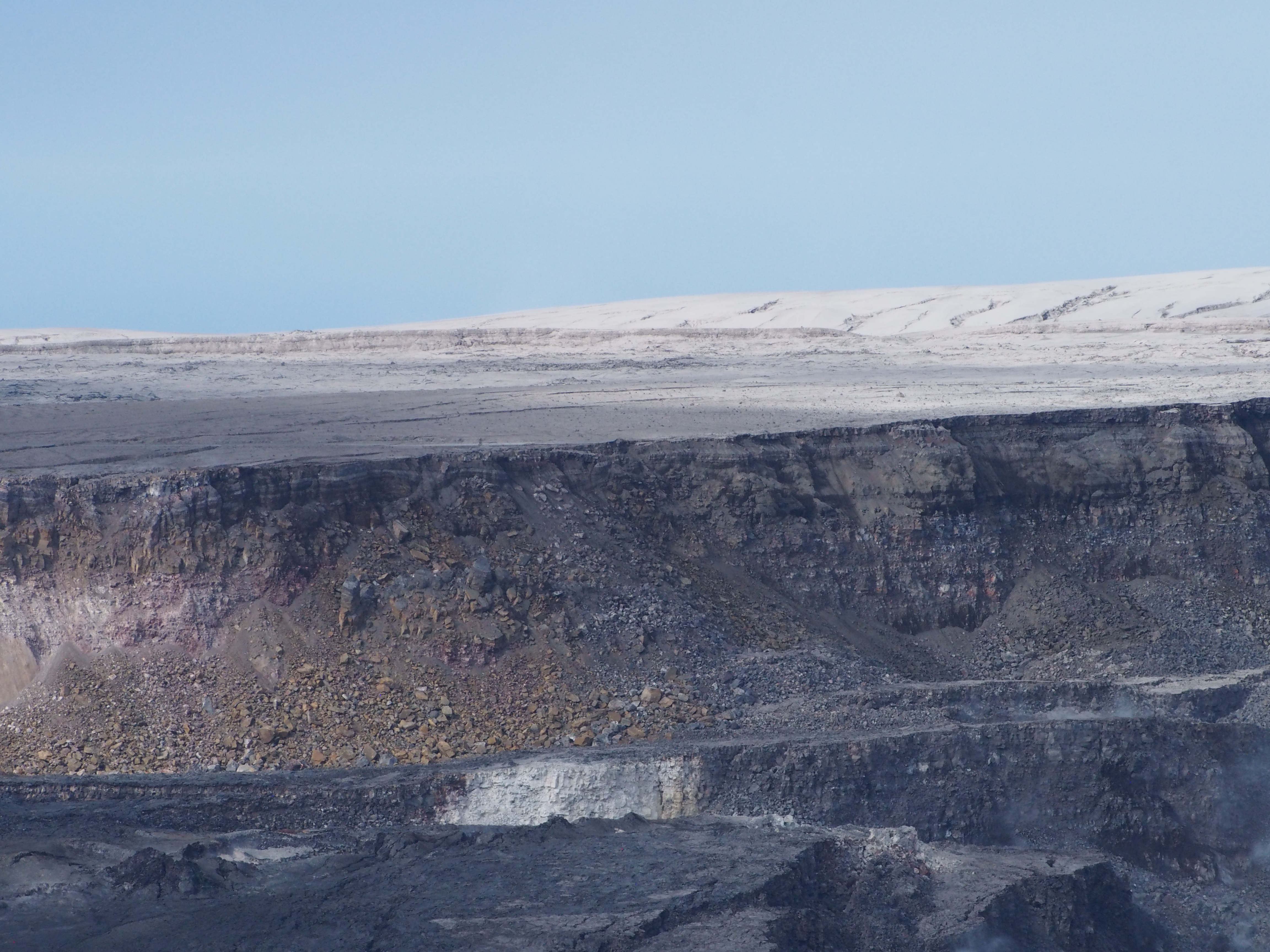
Repeat photography from the same location helps USGS scientists see subtle changes at Halema‘uma‘u and the summit caldera landscape.
This image, taken from HVO’s current observation point, will be inserted into a time series of photos that document the evolution of the growing crater. Click to enlarge. PC: USGS
This comments section is a public community forum for the purpose of free expression. Although Big Island Now encourages respectful communication only, some content may be considered offensive. Please view at your own discretion. View Comments