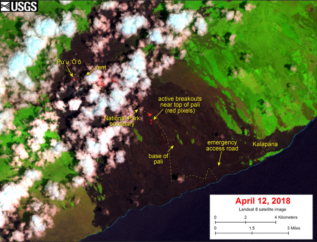
The United States Geological Survey (USGS) released this satellite image that was captured on Thursday, April 12, 2018, by the Landsat 8 satellite. Although this is a false-color image, the color map has been chosen to mimic what the human eye would expect to see. Bright red pixels depict areas of high temperatures and show active lava.
The image shows that breakouts continue in several areas on the flow field. White areas are clouds. (click to enlarge)
The largest breakout is in the upper flow field, about .6 miles east of Pu‘u ‘Ō‘ō. The closest breakouts to the coast include a few small areas that are active near the top of the pali.
This comments section is a public community forum for the purpose of free expression. Although Big Island Now encourages respectful communication only, some content may be considered offensive. Please view at your own discretion. View Comments