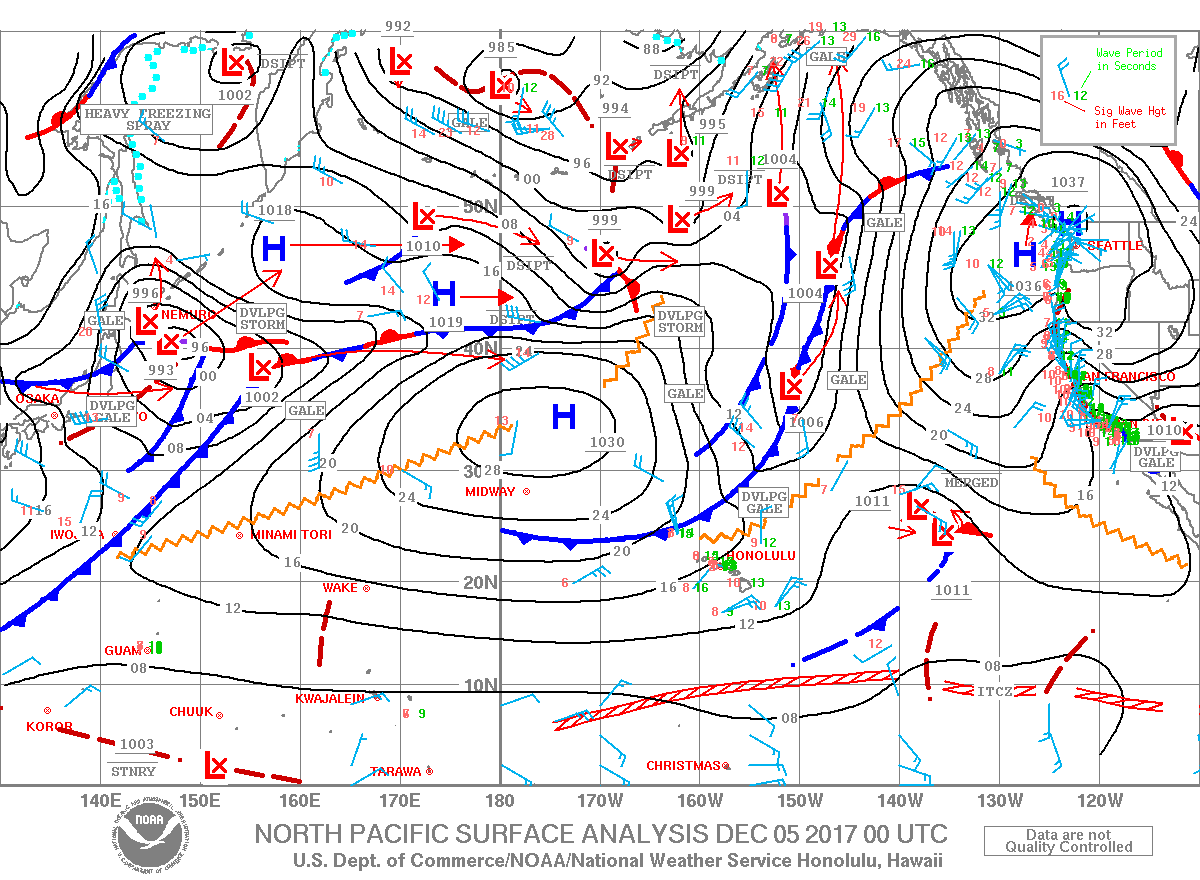
Wind Advisory: In effect through 6 p.m. Tuesday for north-northeast winds from 20 to 35 mph with gusts over 50 mph. Winds will be strongest over ridge tops and through mountain gaps as well as leeward slopes of the islands.
Gale Warning: From 6 a.m. Tuesday through 6 p.m. Tuesday for northeast winds up to 40 knots and seas from 8 to 13 feet.
High Surf Advisory: East facing shores of the Big Island through 6 p.m. Tuesday.
Small Craft Advisory: Through 6 a.m. Wednesday for northeast winds up to 35 knots and seas from 9 to 14 feet.
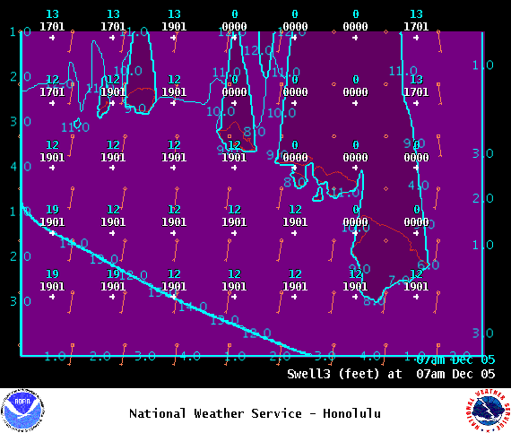
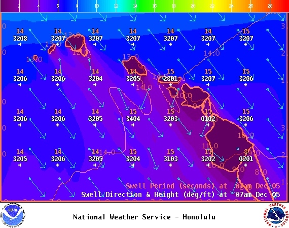
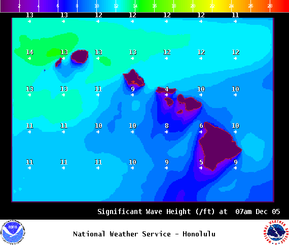
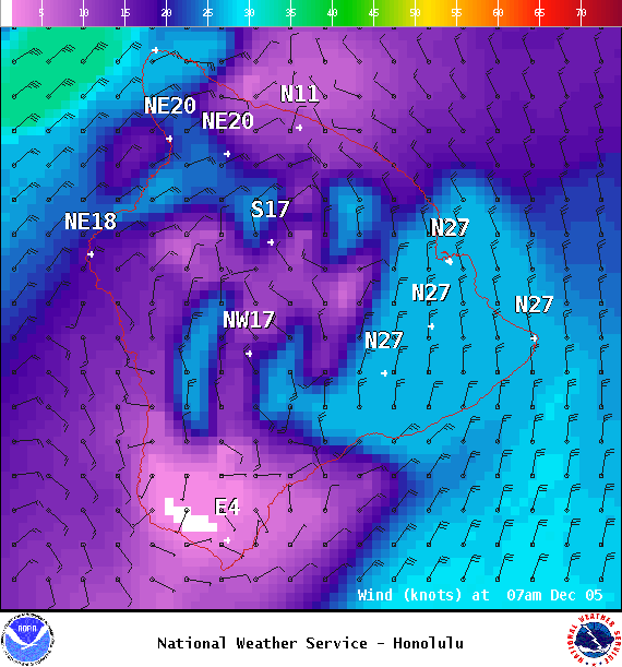
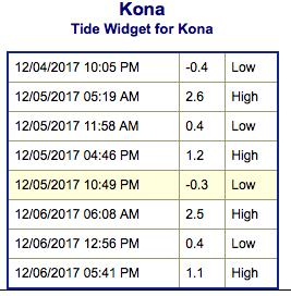
**Click directly on the images below to make them larger. Charts include: Big Island projected winds, tides, swell direction & period and expected wave heights.**
+
SWIPE LEFT OR RIGHT
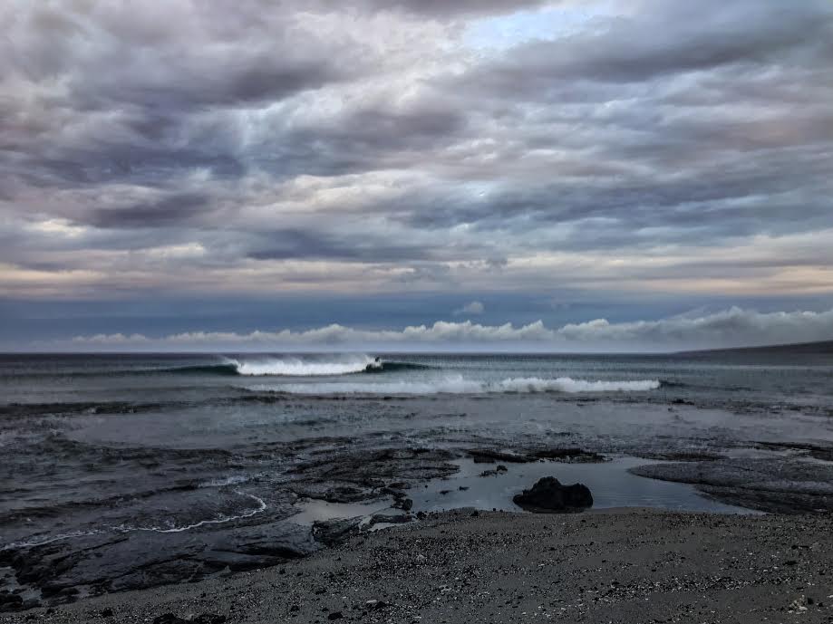
Big Island Surf Forecast
ARTICLE CONTINUES BELOW AD
Hilo: Wave heights are expected to be shoulder high to overhead.
Kona: Wave heights are expected to be around knee/thigh high and up to waist high today.
South: Wave heights are expected to be around knee/thigh high and up to waist high today.
Our new north-northwest swell is filling in and building through the work week. Advisory level surf is happening and may have to be expanded to include the west sides of some islands on Tuesday. This series of swells is forecast to trend down Thursday night and Friday.
A new north-northwest is expected to build Saturday.
ARTICLE CONTINUES BELOW AD
The combo of north swell, north winds, high tides and beach erosion could lead to coastal flooding. Keep that in mind as you plan your day.
A northeast reinforcement is forecast to keep wave heights elevated through the first part of the work week.
A small south swell is forecast to fill in midweek.
Keep in mind, surf heights are measured on the face of the wave from trough to crest. Heights vary from beach to beach, and at the same beach, from break to break.
**Click here for your detailed Big Island weather report.**
This comments section is a public community forum for the purpose of free expression. Although Big Island Now encourages respectful communication only, some content may be considered offensive. Please view at your own discretion. View Comments