Special Weather Statement: Strengthening trade winds will bring moisture over Hawaii from the east which will interact with an approaching upper level trough from the north. Windward and mauka showers will increase in coverage as the moisture arrives overnight and Thursday. The upper trough will destabilize the atmosphere over us Thursday night or Friday allowing for locally heavy passing showers at times through the weekend. The trade winds will focus more of the rain windward and mauka, but many of the showers will also reach leeward sides. Trade winds will further strengthen this weekend and result in blustery conditions. Showers will begin to taper off late Sunday as the moisture moves west of the area and the upper trough lifts to the northeast. The breezy trade winds will remain into early next week.
**Click directly on the images below to make them larger. Charts include: Big Island high/low forecasted temperatures, projected winds, chance of cloud cover, projected localized weather conditions, vog/SO2 forecast and expected wave heights.**
+
SWIPE LEFT OR RIGHT
ARTICLE CONTINUES BELOW AD
ARTICLE CONTINUES BELOW AD
Looking Ahead
Trade winds are forecast to pick up in strength Thursday and become breezy by late Friday into next week. Enhanced showers are forecast for Thursday night through the weekend as a surge of moisture moves over the islands and a disturbance passes overhead. Rain will continue to favor our usual windward and mauka spots, but many passing showers will also reach leeward areas over the next several days.
ARTICLE CONTINUES BELOW AD
Today
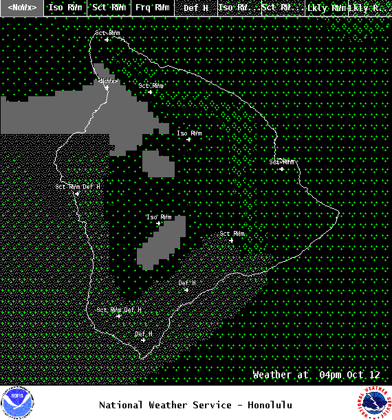
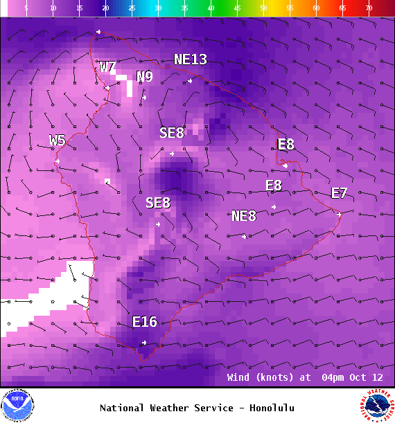
We expect east winds around 15 to 20 mph today. Partly to mostly cloudy skies are forecast with numerous windward showers and scattered leeward showers in the afternoon. Hazy skies in some spots. Temperatures up to 83° to 88°.
UV index at 9 (“very high” exposure level)
ARTICLE CONTINUES BELOW AD
Tonight
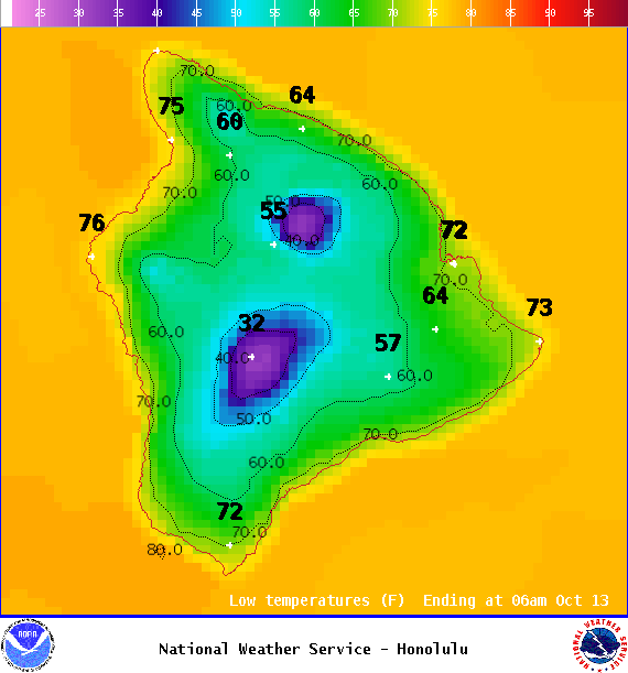
Mostly cloudy skies with numerous windward showers and scattered leeward showers. Low temperatures from 72° to 77°. Winds are expected to be out of the east around 15 to 20 mph.
This comments section is a public community forum for the purpose of free expression. Although Big Island Now encourages respectful communication only, some content may be considered offensive. Please view at your own discretion. View Comments