There was evidence of a weak tornado (F1) touchdown in Nanakuli (on O‘ahu); there were multiple reports of tornadoes touching down in Florida as Irma was approaching.
A hurricane watch was issued for Kaua‘i less than 24 hours before landfall; Floridians had days of preparation to evacuate and/or prepare for the storm as Irma’s path was more predictable.
Kaua‘i suffered nearly $3 billion in damages (including crops—initial estimates are still pending for Irma)
+
SWIPE LEFT OR RIGHT
Iniki track from National Hurricane Center.
Even the roof of this building being used by the Red Cross was not spared damage from Hurricane Iniki. FEMA News Photo Photo by FEMA News Photo
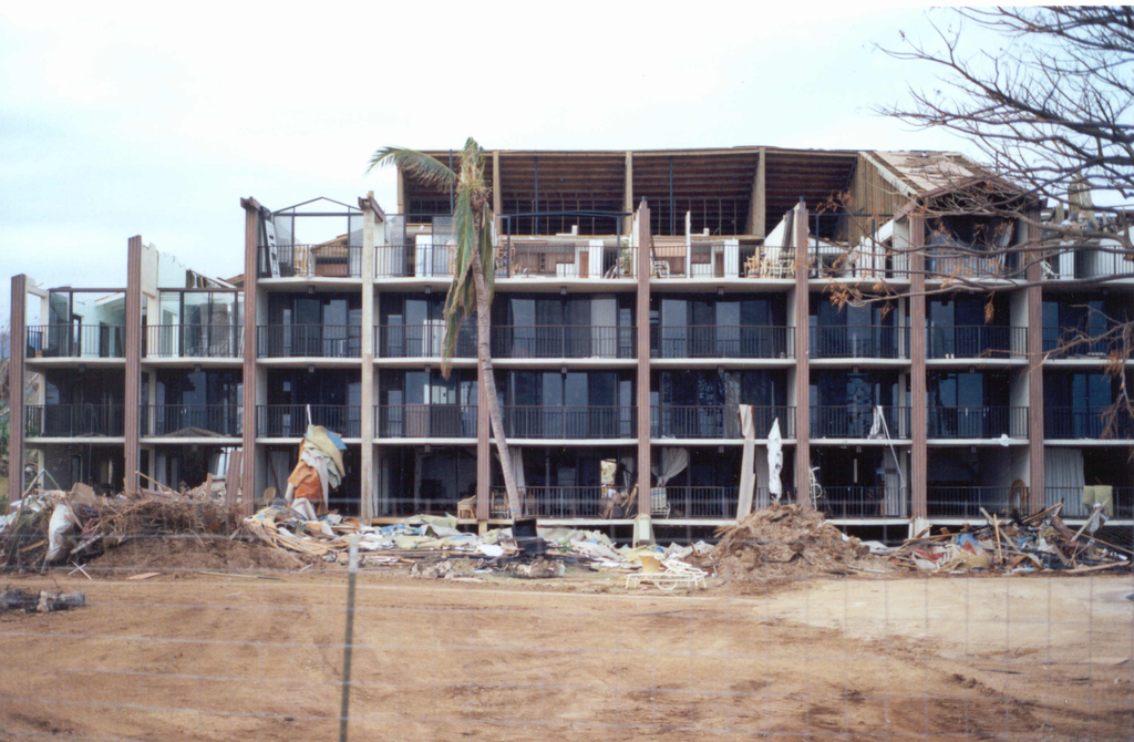
Nearly the entire roof has been blown off this multi-story apartment building during Hurricane Iniki. FEMA News Photo Photo by FEMA News Photo
This image shows downed or damaged trees at the famed “Tree Tunnel” on Kauai, Hawaii after the strong winds of Category 4 Hurricane Iniki. U.S. National Oceanic and Atmospheric Administration
According to a recent CNN article, more than 6.2 million electric customers are without power in Florida, Gov. Rick Scott’s office said Monday. FEMA chief Brock Long has said some places won’t have electricity for weeks
Kaua‘i had power fully restored after three months
According to the Red Cross, 14,350 homes on the island were affected with 1,421 destroyed and 5,152 suffering major damage. Wind damage was generally the major contributor, although a number of buildings along the coast that were subject to surf damage suffered nearly total destruction
Estimated maximum sustained winds over land were 140 mph with gusts as high as 175 mph, making Iniki the most powerful hurricane to strike the Hawaiian Islands in recent history
This comments section is a public community forum for the purpose of free expression. Although Big Island Now encourages respectful communication only, some content may be considered offensive. Please view at your own discretion. View Comments


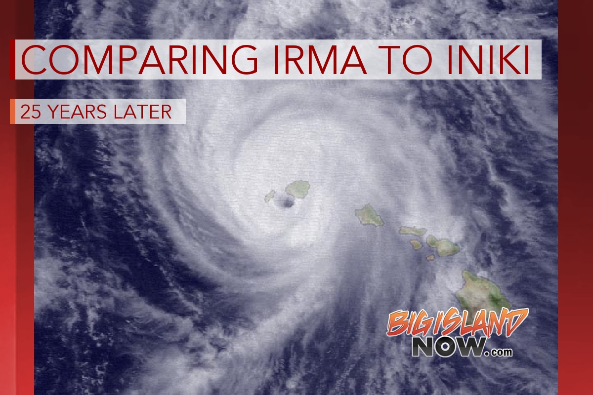 This week marks the 25th anniversary of Hurricane Iniki, which impacted the island of Kaua‘i from Sept. 5 to 13, 1992.