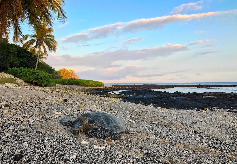
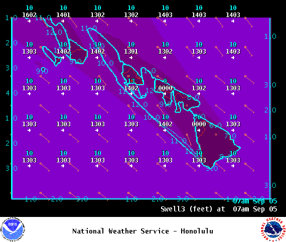
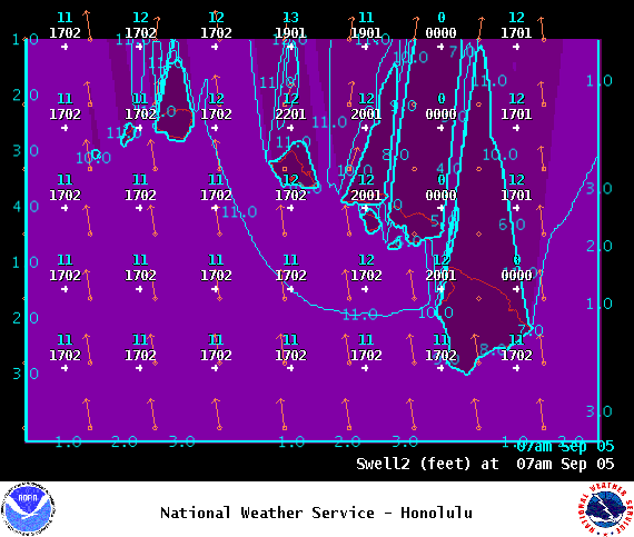
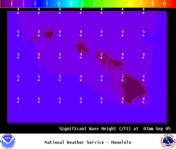
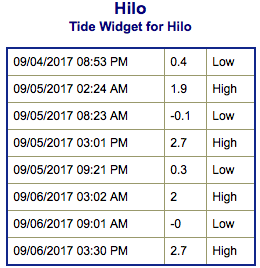
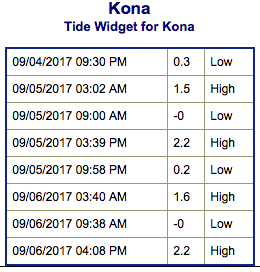
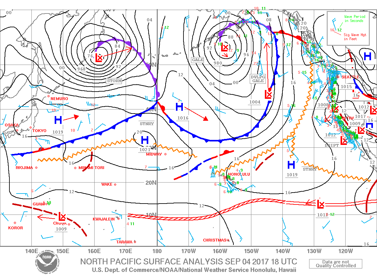
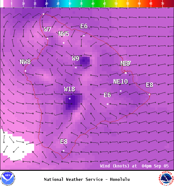
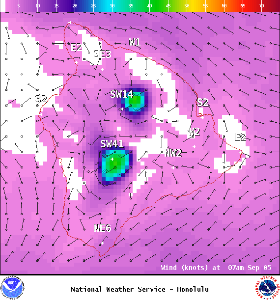
**Click directly on the images below to make them larger. Charts include: Big Island projected winds, tides, swell direction & period and expected wave heights.**
+
SWIPE LEFT OR RIGHT
ARTICLE CONTINUES BELOW AD
Big Island Surf Forecast
Hilo side: Surf heights are expected to be ankle/waist high today. By sunset, we could see some swell filling in.
Kona side: Surf heights are expected to be waist high or less today. The best breaks could get a little bigger.
ARTICLE CONTINUES BELOW AD
South: Surf heights are expected to be waist high or less today. The best breaks could get a little bigger.
Our current south swell is forecast to continue slowly trending down into Tuesday and then holding pretty steady through the end of the work week. A small southwest swell is also forecast to mix in.
A new west-northwest is forecast to start filing in Thursday and Friday. This energy is forecast to shift out of the northwest for the weekend.
Keep in mind, surf heights are measured on the face of the wave from trough to crest. Heights vary from beach to beach, and at the same beach, from break to break.
This comments section is a public community forum for the purpose of free expression. Although Big Island Now encourages respectful communication only, some content may be considered offensive. Please view at your own discretion. View Comments