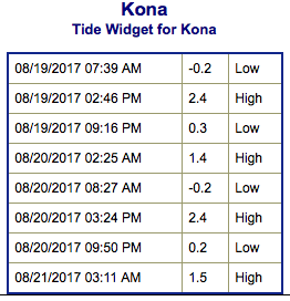
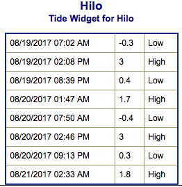
Special Weather Statement: Coastal flooding associated with spring tides (King tides) is occurring and expected through the weekend. The greatest potential for flooding is during the peak daily tide. This risk is forecast to diminish as we head into the middle of next week and the daily tide starts to drop.
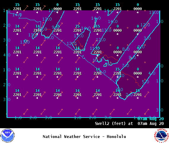
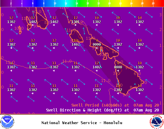
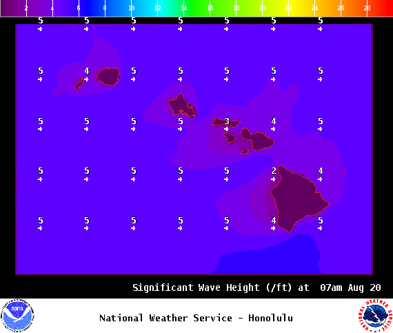
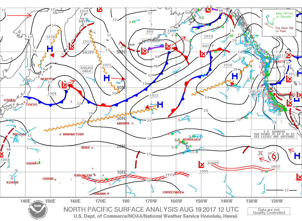
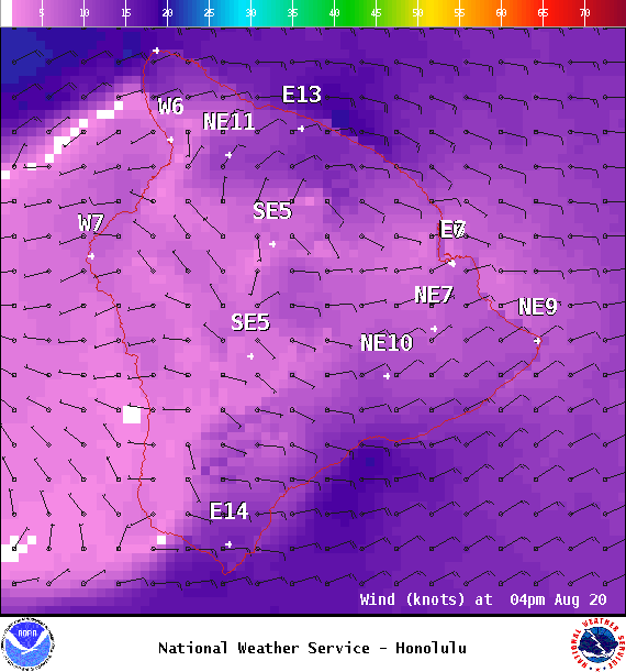
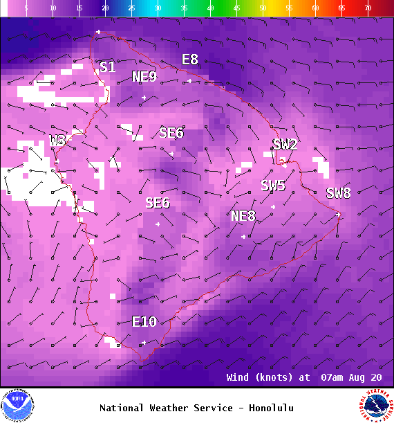
**Click directly on the images below to make them larger. Charts include: Big Island projected winds, tides, swell direction & period and expected wave heights.**
ARTICLE CONTINUES BELOW AD
ARTICLE CONTINUES BELOW AD
+
SWIPE LEFT OR RIGHT
Big Island Surf Forecast
Hilo side: Surf heights are expected to be knee/waist high today or less.
ARTICLE CONTINUES BELOW AD
Kona side: Surf heights are expected to be knee/waist high today or less.
South: Surf heights are expected to be knee/waist high today or less. Spots catching the swell could be up to tummy/chest high on the sets Saturday.
Our current south-southeast swell is forecast to slowly fade through the weekend… but still pretty small. Nothing significant is forecast out of the South Pacific at this time with just small background swell expected through next week.
Trade swell is forecast to drop a bit through the weekend as trade winds weaken. Tropical swell is possible from Kenneth for the middle to the end of next week. Will keep an eye on it.
ARTICLE CONTINUES BELOW AD
Keep in mind the spring tides are causing coastal flooding in vulnerable low-lying areas.
Keep in mind, surf heights are measured on the face of the wave from trough to crest. Heights vary from beach to beach, and at the same beach, from break to break.
This comments section is a public community forum for the purpose of free expression. Although Big Island Now encourages respectful communication only, some content may be considered offensive. Please view at your own discretion. View Comments