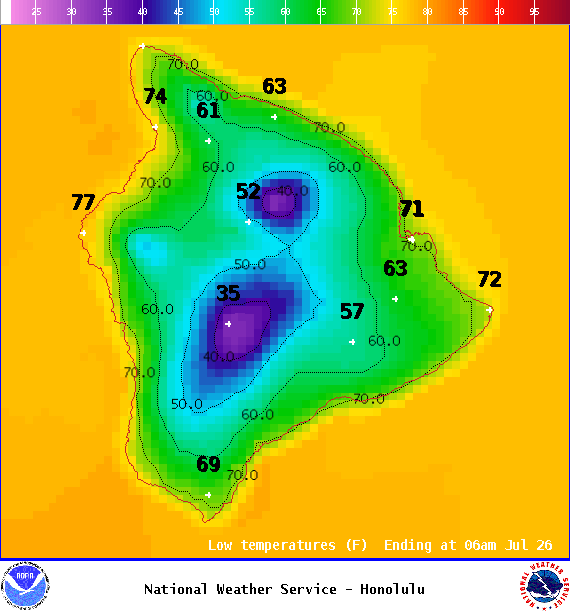
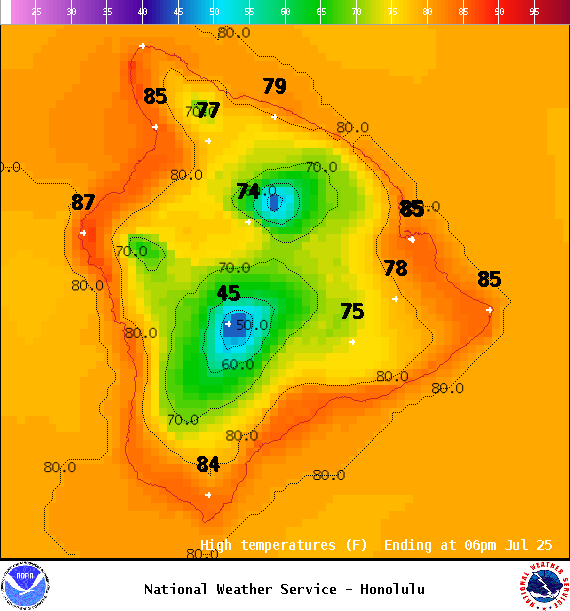
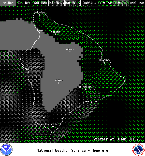
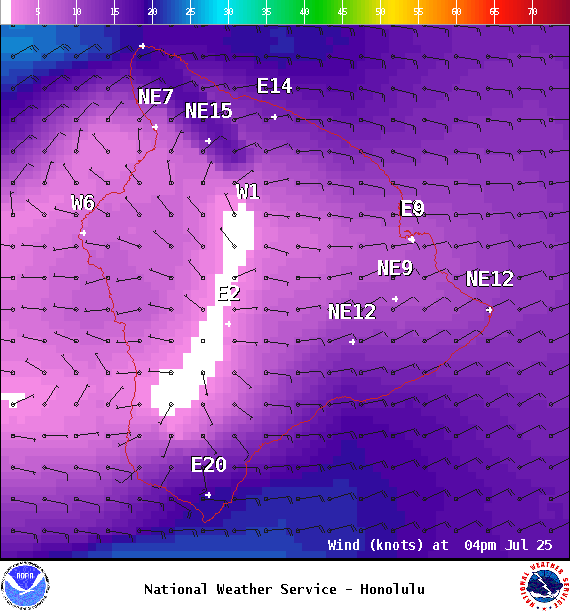
**Click directly on the images below to make them larger. Charts include: Big Island high/low forecasted temperatures, projected winds, chance of cloud cover, projected localized weather conditions, vog/SO2 forecast and expected wave heights.**
+
SWIPE LEFT OR RIGHT
ARTICLE CONTINUES BELOW AD
ARTICLE CONTINUES BELOW AD
Looking Ahead
A drier, more comfortable trade wind weather pattern is forecast to fill in Tuesday and last into the weekend. Our weather team continues to track the progress of tropical systems in the East Pacific and will bring you the latest.
ARTICLE CONTINUES BELOW AD
Today
We expect winds to transition to breezy trades, starting around 10 to 15 mph and building up to 15 to 25 mph. High temperatures are forecast from 83° to 88°. Partly cloudy skies with scattered showers for the Hilo side and isolated upslope leeward showers in the afternoon.
UV index at 12 (“extreme” exposure level)
ARTICLE CONTINUES BELOW AD
Tonight
Trade winds are forecast up to 25 mph. Mostly cloudy skies with scattered windward showers and isolated leeward showers. Low temperatures from 71° to 76°.
This comments section is a public community forum for the purpose of free expression. Although Big Island Now encourages respectful communication only, some content may be considered offensive. Please view at your own discretion. View Comments