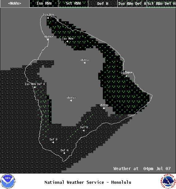
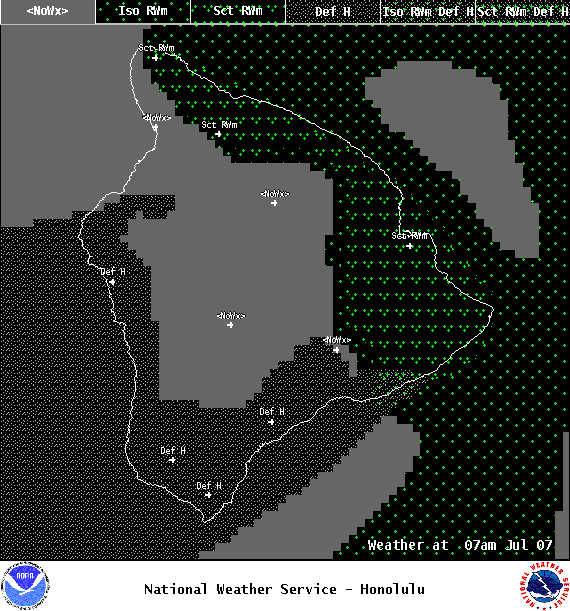
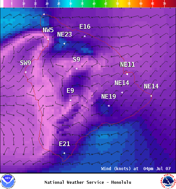
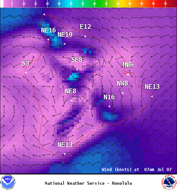
**Click directly on the images below to make them larger. Charts include: Big Island high/low forecasted temperatures, projected winds, chance of cloud cover, projected localized weather conditions, vog/SO2 forecast and expected wave heights.**
+
SWIPE LEFT OR RIGHT
ARTICLE CONTINUES BELOW AD
ARTICLE CONTINUES BELOW AD
Looking Ahead
Breezy trade winds are forecast to continue through Monday with a few passing showers for our usual windward and mauka areas over the next several days. An increase in windward showers is expected to begin Monday night.
ARTICLE CONTINUES BELOW AD
Today
We expect northeast winds around 15 to 20 mph with gusts up to 35 mph. High temperatures are forecast from 82° to 88°. Mostly cloudy skies with scattered morning windward showers for the Hilo side and isolated afternoon showers for the Kona side.
UV index at 13 (“extreme” exposure level)
ARTICLE CONTINUES BELOW AD
Tonight
Northeast winds are forecast around 15 to 20 mph with higher gusts. Mostly cloudy skies with scattered windward showers. Low temperatures from 71° to 76°.
This comments section is a public community forum for the purpose of free expression. Although Big Island Now encourages respectful communication only, some content may be considered offensive. Please view at your own discretion. View Comments