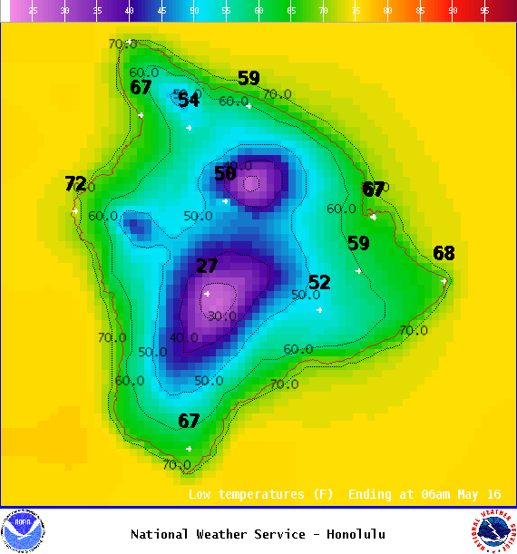
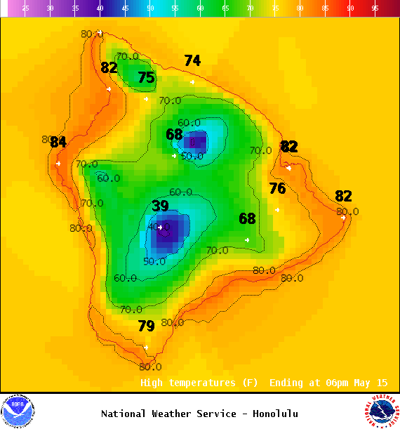
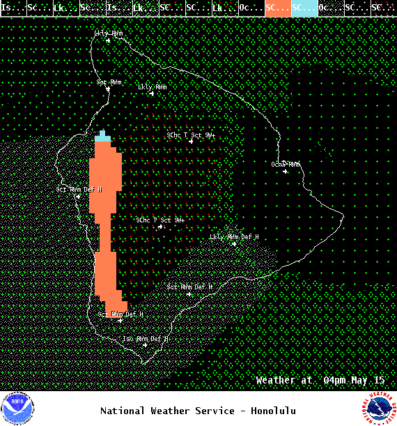
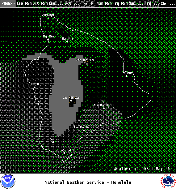
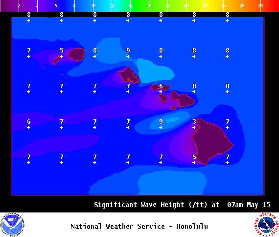
**Click directly on the images below to make them larger. Charts include: Big Island high/low forecasted temperatures, projected winds, chance of cloud cover, projected localized weather conditions, vog/SO2 forecast and expected wave heights.**
+
SWIPE LEFT OR RIGHT
Looking Ahead
ARTICLE CONTINUES BELOW AD
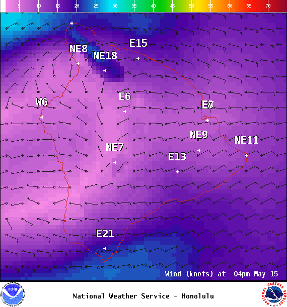
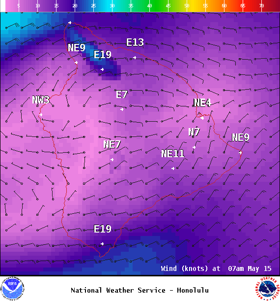
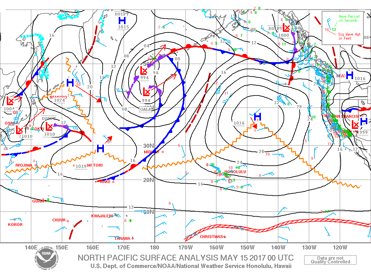
Breezy trade winds will continue over the islands through Tuesday before weakening for the second half of the work week. A disturbance high in the atmosphere is forecast to move south through Monday evening, then stall near the Big Island through Tuesday evening. Enhanced showers are expected during that time, especially for windward spots across the state. The disturbance is then expected to move slowly northeast during the second half of the week with a drier weather pattern expected across the state.
Today
We expect east winds around 15 to 20 mph. High temperatures are forecast from 79° to 84°. Partly to mostly cloudy skies with frequent showers for windward spots. For the Kona side, sunshine in the morning with building clouds in the afternoon and scattered showers during that time. There is also a slight chance for thunderstorms.
ARTICLE CONTINUES BELOW AD
UV index at 10 (“very high” exposure level)
Tonight
East winds are forecast around 15 to 20 mph. Mostly cloudy skies with frequent showers for windward spots and clearing for the Kona side as the night goes on. Low temperatures from 67° to 72°.
This comments section is a public community forum for the purpose of free expression. Although Big Island Now encourages respectful communication only, some content may be considered offensive. Please view at your own discretion. View Comments