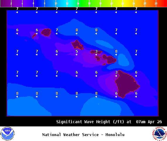
**Click directly on the images below to make them larger. Charts include: Big Island high/low forecasted temperatures, projected winds, chance of cloud cover, projected localized weather conditions, vog/SO2 forecast and expected wave heights.**
+
SWIPE LEFT OR RIGHT
ARTICLE CONTINUES BELOW AD
ARTICLE CONTINUES BELOW AD
Looking Ahead
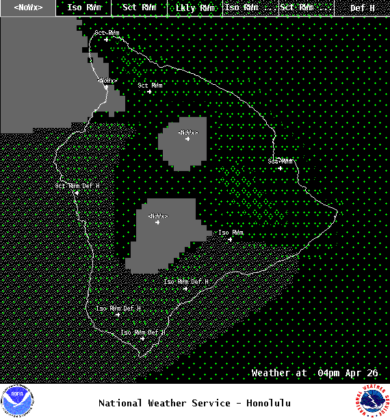
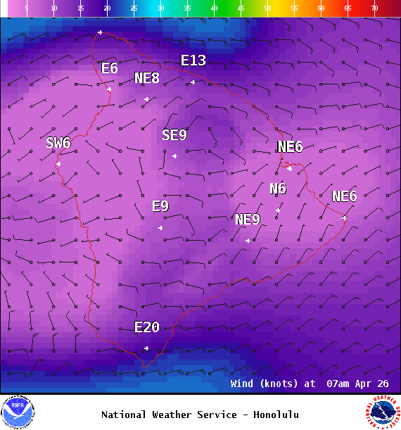
Moderate east winds are expected through Wednesday with limited windward showers and stable conditions. Winds are forecast to ease and shift out of the southeast Thursday as a front approaches. We could see spotty afternoon showers during that time. On Friday, the front is expected to bring showers to Kauai and possibly Oahu, with prefrontal showers forecast for the rest of the state. Wet and unstable conditions are expected for some spots through the weekend. Will keep an eye on it and bring you the latest.
ARTICLE CONTINUES BELOW AD
Today
We expect east winds today around 15 mph. High temperatures are forecast from 81° to 86°. Partly sunny skies with scattered windward showers and isolated showers for leeward areas in the afternoon.
UV index at 12 (“extreme” exposure level)
ARTICLE CONTINUES BELOW AD
Tonight
East winds are forecast around 15 mph. Mostly cloudy skies with windward scattered showers and isolated showers for the Kona side. Low temperatures from 69° to 74°.
This comments section is a public community forum for the purpose of free expression. Although Big Island Now encourages respectful communication only, some content may be considered offensive. Please view at your own discretion. View Comments