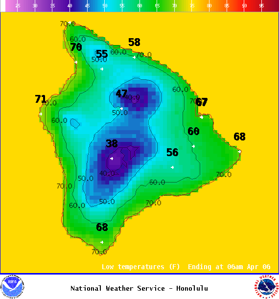
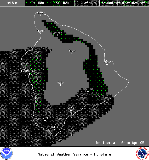
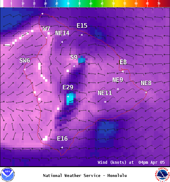
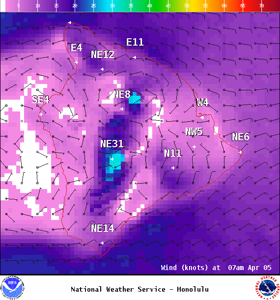
**Click directly on the images below to make them larger. Charts include: Big Island high/low forecasted temperatures, projected winds, chance of cloud cover, projected localized weather conditions, vog/SO2 forecast and expected wave heights.**
+
SWIPE LEFT OR RIGHT
ARTICLE CONTINUES BELOW AD
ARTICLE CONTINUES BELOW AD
Looking Ahead
Moderate trade wind speeds are forecast through most of the work week with dry, pleasant weather on tap. Brief morning showers for windward and mauka spots are possible. Friday, our winds are expected to pick up in speed but over the weekend winds will weaken and turn southeasterly which could increase the coverage of volcanic haze on the Big Island.
ARTICLE CONTINUES BELOW AD
Today
We have northeast winds today around 15 to 20 mph. High temperatures are forecast from 81° to 86°. Partly cloudy skies with scattered windward showers in the morning. The Kona side will be mostly sunny to start with mostly cloudy skies and isolated showers in the afternoon.
UV index at 12 (“extreme” exposure level)
ARTICLE CONTINUES BELOW AD
Tonight
Northeast winds are forecast around 15 mph. Partly cloudy skies are expected for Hawaii County with scattered windward showers and isolated showers in leeward spots. Low temperatures from 68° to 73°.
This comments section is a public community forum for the purpose of free expression. Although Big Island Now encourages respectful communication only, some content may be considered offensive. Please view at your own discretion. View Comments