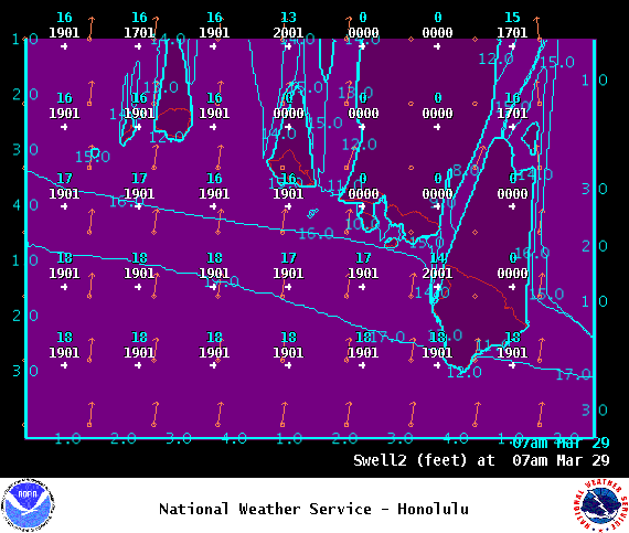
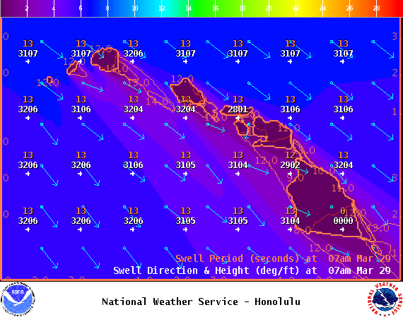
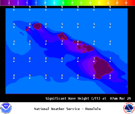
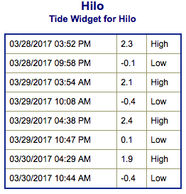
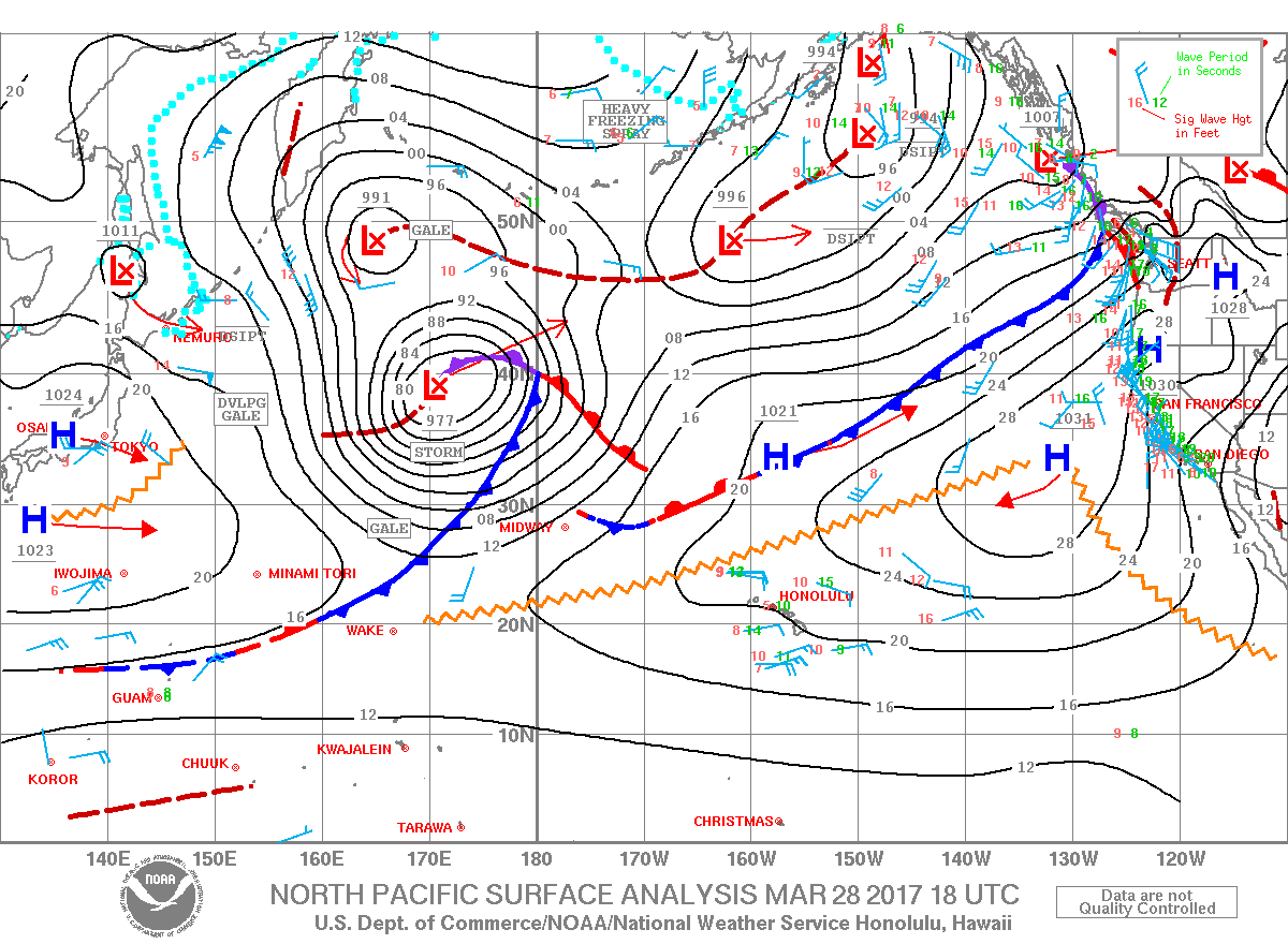
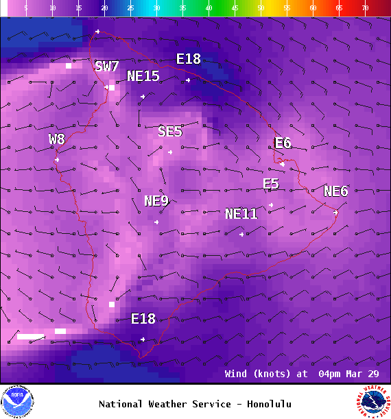
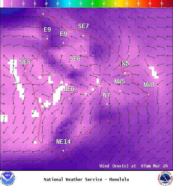
**Click directly on the images below to make them larger. Charts include: Big Island projected winds, tides, swell direction & period and expected wave heights.**
+
SWIPE LEFT OR RIGHT
ARTICLE CONTINUES BELOW AD
Big Island Surf Forecast
Hilo side: Wave heights are forecast to be shoulder high to a couple feet overhead today.
Kona side: Wave heights are expected to be waist/chest high today out of the west-northwest and knee/waist high today out of the south-southwest with occasional chest high sets.
ARTICLE CONTINUES BELOW AD
South: Wave heights are expected to be waist/chest high today out of the west-northwest and knee/waist high today out of the south-southwest with occasional chest high sets.
Old west-northwest swell gets a boost from northwest reinforcement today but fading thereafter. A solid west-northwest is expected for the end of the week, building Friday, peaking that night and holding through Saturday morning before slowly easing late Saturday into Sunday.
Modest south-southwest swell continues Wednesday with a new south-southwest filling in Thursday.
Keep in mind, surf heights are measured on the face of the wave from trough to crest. Heights vary from beach to beach, and at the same beach, from break to break.
This comments section is a public community forum for the purpose of free expression. Although Big Island Now encourages respectful communication only, some content may be considered offensive. Please view at your own discretion. View Comments