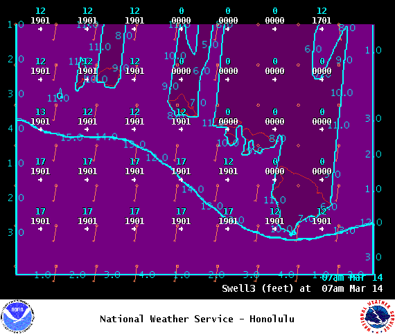
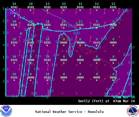
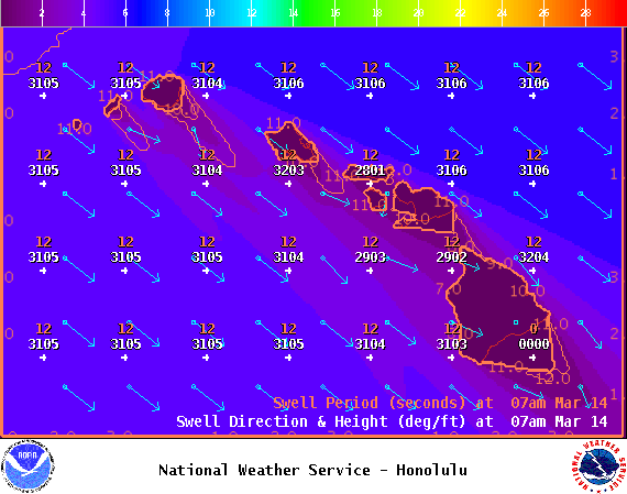
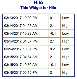
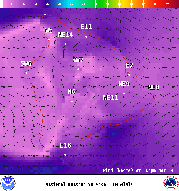
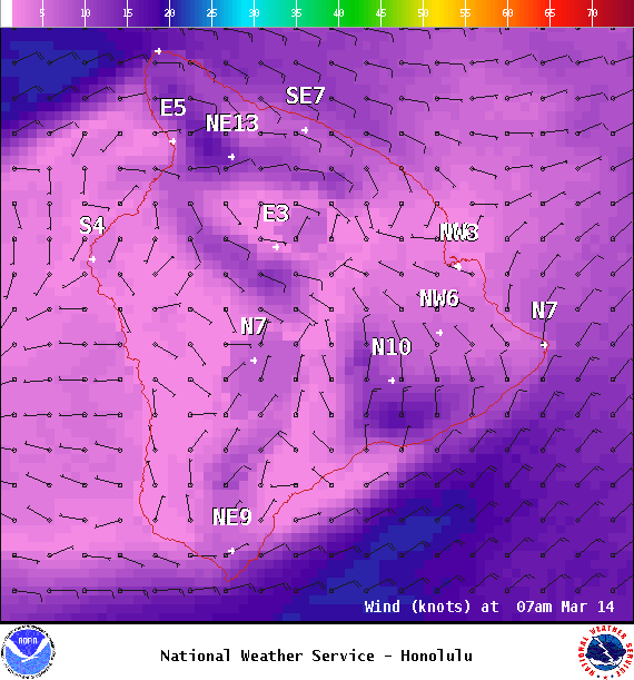
**Click directly on the images below to make them larger. Charts include: Big Island projected winds, tides, swell direction & period and expected wave heights.**
+
SWIPE LEFT OR RIGHT
ARTICLE CONTINUES BELOW AD
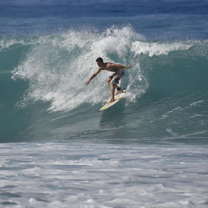
Big Island Surf Forecast
Hilo side: Wave heights are forecast to be ankle/waist high today.
Kona side: Wave heights are expected to be knee/thigh high today with waist high sets at the best breaks.
ARTICLE CONTINUES BELOW AD
South: Wave heights are expected to be knee/thigh high today.
Small south-southwest is forecast to continue fading Tuesday with just leftovers by Wednesday.
A west-northwest swell is expected to peak Tuesday and fade through mid week. A larger west-northwest is lining up for the 20th but still pending development of the storm.
Keep in mind, surf heights are measured on the face of the wave from trough to crest. Heights vary from beach to beach, and at the same beach, from break to break.
This comments section is a public community forum for the purpose of free expression. Although Big Island Now encourages respectful communication only, some content may be considered offensive. Please view at your own discretion. View Comments