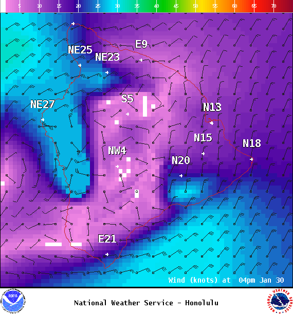
Small Craft Advisory: All waters and channels through 6 p.m. Monday.
Wind Advisory: Posted through 6 p.m. Monday for north to northeast winds from 20 to 35 mph, gusting to 55 mph. The strongest winds will be in the leeward Kohala area, the Waimea to Kawaihae corridor, in the North Kona district and southeast of volcano within the National Park.
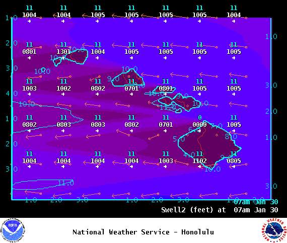
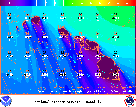
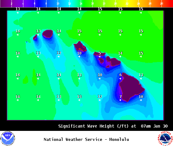
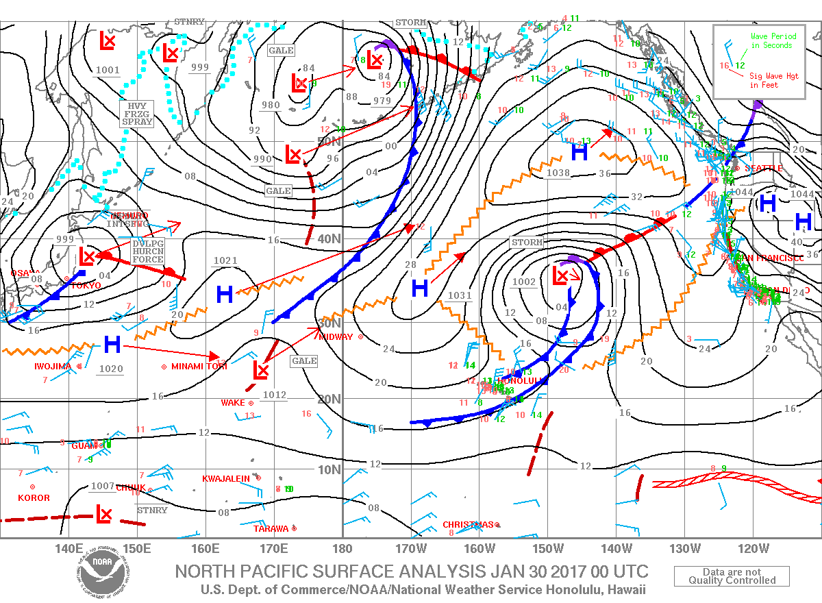
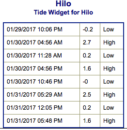
**Click directly on the images below to make them larger. Charts include: Big Island projected winds, tides, swell direction & period and expected wave heights.**
+
SWIPE LEFT OR RIGHT
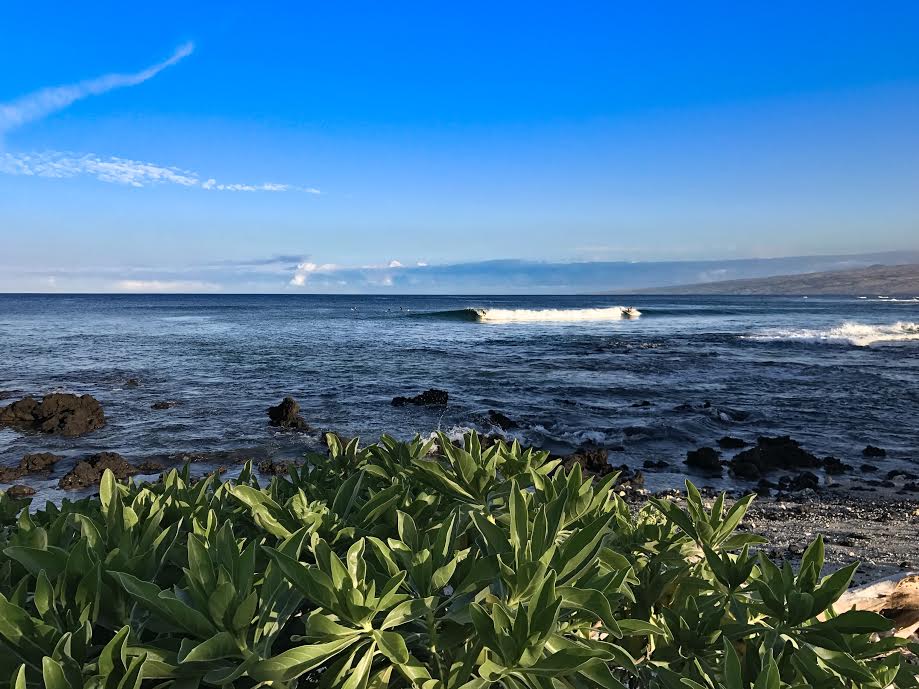
Big Island Surf Forecast
ARTICLE CONTINUES BELOW AD
Hilo side: Wave heights are forecast to be overhead to double overhead in some spots today for the best exposures.
Kona side: Wave heights are expected to be waist/chest high today with shoulder/head high sets possible.
South: Wave heights are expected to be waist/chest high today with shoulder/head high sets possible.
Our current swell is slowly easing but still keeping wave heights elevated. A new northwest pulse is expected Monday and easing Tuesday. That same storm which generated the northwest pulse then re-intensifies to bring us a large north-northeast swell filling in Tuesday and peaking Wednesday before fading through the second half of the work week.
ARTICLE CONTINUES BELOW AD
The North Pacific is looking to remain quite active further out with another swell forecast for the 2nd and more pulses right on the heels of that.
Nothing significant expected out of the South Pacific any time soon.
Keep in mind, surf heights are measured on the face of the wave from trough to crest. Heights vary from beach to beach, and at the same beach, from break to break.
This comments section is a public community forum for the purpose of free expression. Although Big Island Now encourages respectful communication only, some content may be considered offensive. Please view at your own discretion. View Comments


 Big Island Surf Forecast
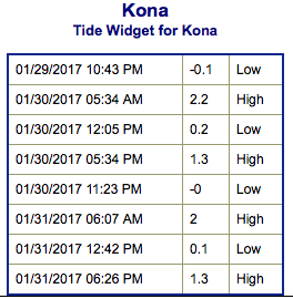 Our current swell is slowly easing but still keeping wave heights elevated. A new northwest pulse is expected Monday and easing Tuesday. That same storm which generated the northwest pulse then re-intensifies to bring us a large north-northeast swell filling in Tuesday and peaking Wednesday before fading through the second half of the work week.