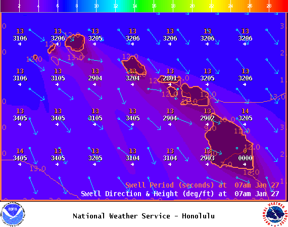
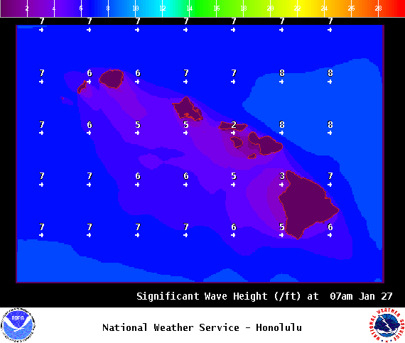
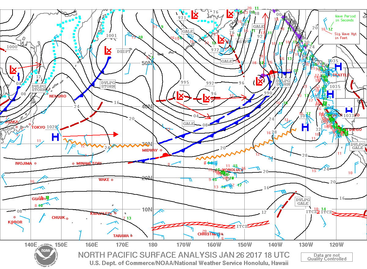
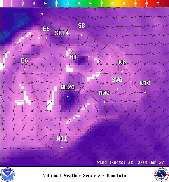
**Click directly on the images below to make them larger. Charts include: Big Island projected winds, tides, swell direction & period and expected wave heights.**
ARTICLE CONTINUES BELOW AD
ARTICLE CONTINUES BELOW AD
+
SWIPE LEFT OR RIGHT
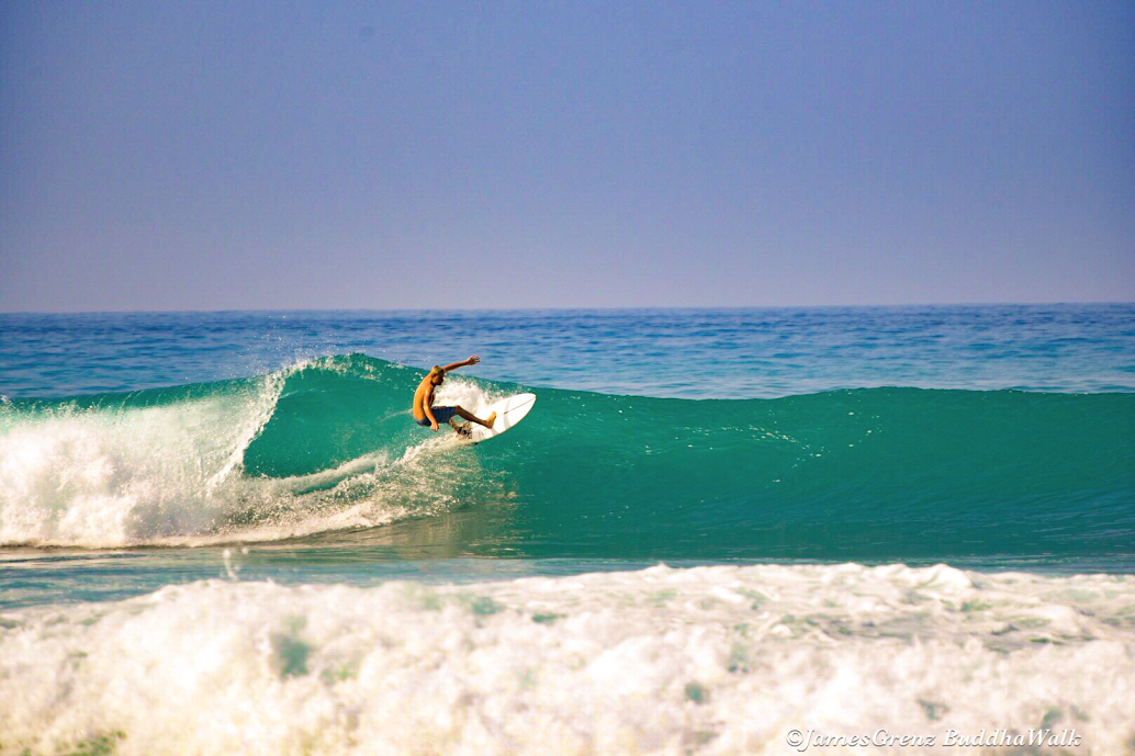
Big Island Surf Forecast
Hilo side: Wave heights are forecast to be head high to overhead today for the best exposures.
ARTICLE CONTINUES BELOW AD
Kona side: Wave heights are expected to be waist/chest high today with shoulder high sets possible.
South: Wave heights are expected to be waist/chest high today with shoulder high sets possible.
Our current northwest swell is forecast to continue easing but it won’t be long before another swell builds back in. Over the weekend, back-to-back large swells are expected with the first filling in Saturday and peaking Saturday night at advisory levels. The second swell is expected to be much larger, filling in late Sunday and peaking Sunday night into Monday at warning levels.
The front that is going to push down the island chain should create a northeast trade swell that could coincide with the peak of the second west-northwest swell.
ARTICLE CONTINUES BELOW AD
Nothing significant expected out of the South Pacific any time soon.
Keep in mind, surf heights are measured on the face of the wave from trough to crest. Heights vary from beach to beach, and at the same beach, from break to break.
This comments section is a public community forum for the purpose of free expression. Although Big Island Now encourages respectful communication only, some content may be considered offensive. Please view at your own discretion. View Comments


 Big Island Surf Forecast
 Our current northwest swell is forecast to continue easing but it won’t be long before another swell builds back in. Over the weekend, back-to-back large swells are expected with the first filling in Saturday and peaking Saturday night at advisory levels. The second swell is expected to be much larger, filling in late Sunday and peaking Sunday night into Monday at warning levels.