A Flash Flood Watch is posted for the Big Island through Sunday afternoon.
A Winter Storm Warning is posted for Mauna Kea and Mauna Loa above 8000 feet. Thursday afternoon through Friday afternoon we could see heavy snow accumulations of 6 to 12 inches.
A High Surf Advisory is posted for east facing shores until 6 p.m. Friday.
A Gale Warning is posted through 6 a.m. Friday for our windiest channels and waters.
ARTICLE CONTINUES BELOW AD
ARTICLE CONTINUES BELOW AD
A Small Craft Advisory is posted for all remaining Hawaii County waters through 6 p.m. Saturday.
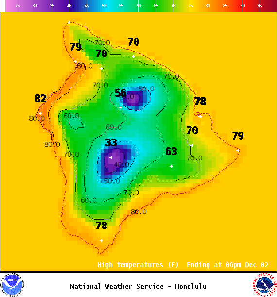
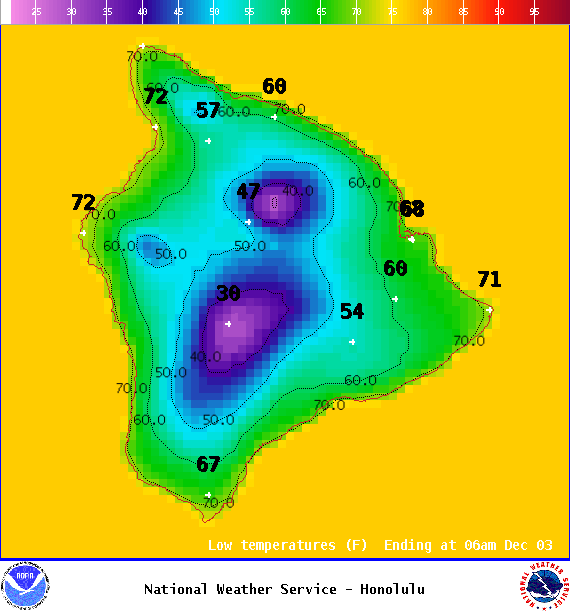
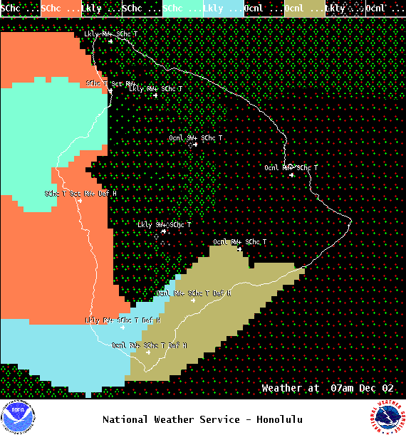
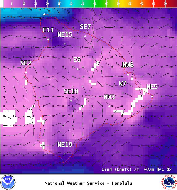
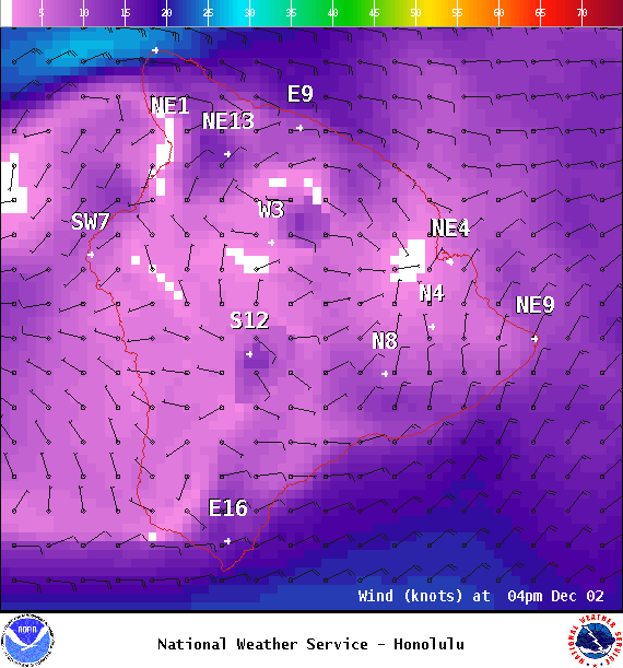
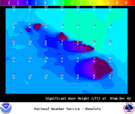
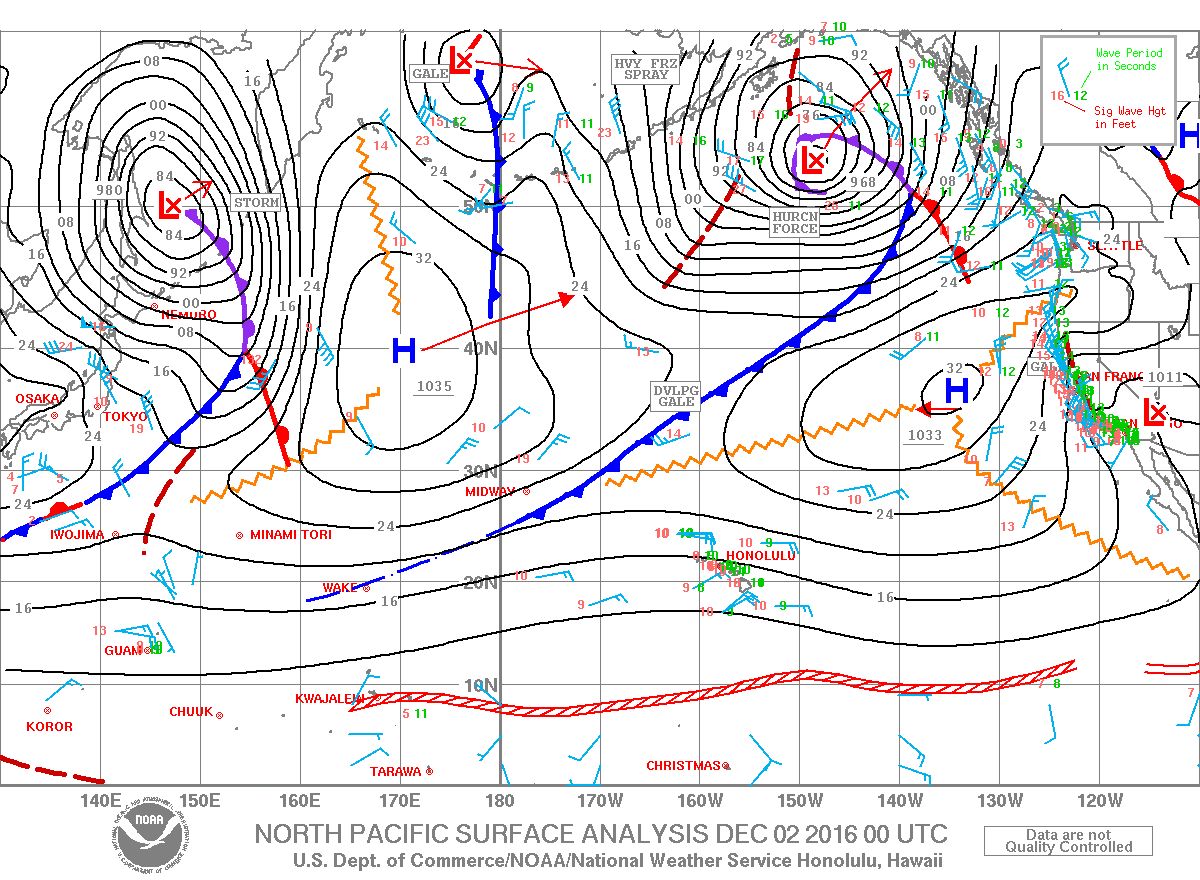
**Click directly on the images below to make them larger. Charts include: Big Island high/low forecasted temperatures, projected winds, chance of cloud cover, projected localized weather conditions, vog/SO2 forecast and expected wave heights.**
+
SWIPE LEFT OR RIGHT
Looking Ahead
ARTICLE CONTINUES BELOW AD
A disturbance high in the atmosphere has created instability that led to snowfall on our Big Island summits yesterday. This feature will remain just south of the islands through Friday. Breezy trade winds will give way to increasingly moist southerly flow over the state. The combination of these two features will cause pockets of heavy rain and even a few thunderstorms over and near the state for the next few days. The disturbance is forecast to move away from the islands on Monday with the airmass drying out somewhat at that time.
Today
Mostly cloudy for windward spots with frequent showers. Hazy for the Kona side with scattered showers. Locally heavy rainfall possible with a slight chance of thunderstorms. High temperatures from 78° to 83°. Winds will be out of the northeast around 15 mph.
UV index at 6 (“high” exposure level)
ARTICLE CONTINUES BELOW AD
Tonight
Winds will be variable around 15 mph. Mostly cloudy with likely showers in windward spots. Scattered showers for leeward areas. Chance of thunderstorms and locally heavy rainfall possible. Low temperatures from 68° to 73°.
This comments section is a public community forum for the purpose of free expression. Although Big Island Now encourages respectful communication only, some content may be considered offensive. Please view at your own discretion. View Comments